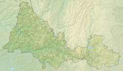
The key is a river in Russia , flowing in the Orenburg region. The mouth of the river is 7 km on the right bank of the Net . The river is 11 km long.
| Key | |
|---|---|
| Characteristic | |
| Length | 11 km |
| Watercourse | |
| Source | |
| • Coordinates | |
| Mouth | Net |
| • Location | 7 km on the right bank of the river |
| • Coordinates | |
| Location | |
| Water system | Net → Salmysh → Sakmara → Ural → Caspian Sea |
| A country |
|
| Region | Orenburg region |
| HWR code | |
Water registry data
According to the state water register of Russia, it belongs to the Ural Basin District , the water sector of the Sakmara River from the confluence of the Bolshoy Ik River to the mouth, the river sub-basin - the Sub-basin. The river basin is the Urals (the Russian part of the basin) [2] .
According to the geographic information system of water management zoning of the territory of the Russian Federation, prepared by the Federal Agency for Water Resources [2] :
- The code of the water body in the state water registry is 12010000712112200006695
- The code for hydrological knowledge (GI) is 112200669
- Pool code - 12.01.00.007
- GI Volume Number - 12
- GI Issue - 2
Notes
- ↑ Surface Water Resources of the USSR: Hydrological Understanding. T. 12. Lower Volga and Western Kazakhstan. Vol. 2. Ural-Emba region / ed. Z. G. Markova. - L .: Gidrometeoizdat, 1966 .-- 152 p.
- ↑ 1 2 State Water Register of the Russian Federation: Key . Archived on August 20, 2012.
Links
- The article used information provided by the Federal Agency for Water Resources from the list of water bodies registered in the state water register as of March 29, 2009. List (rar-archive, 3.21 Mb).