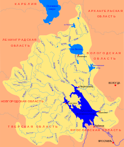
Renya is a river in the Tver region in the north-west of the European part of the Russian Federation . It falls into the Vesyegonsky reach of the Rybinsk reservoir on the Volga . The river is 80 km long [2] .
| Renya | |
|---|---|
 Basin of the Rybinsk Reservoir and White Lake Basin of the Rybinsk Reservoir and White Lake | |
| Characteristic | |
| Length | 80 km |
| Pool | 1400 km² |
| Watercourse | |
| Source | |
| • Location | Sandovsky district |
| • Coordinates | |
| Mouth | Rybinsk reservoir |
| • Location | Vesyogonsky reach |
| • Coordinates | |
| Location | |
| Water system | Rybinsk Reservoir → Volga → Caspian Sea |
| A country |
|
| Region | Tver region |
| HWR code | |

Tributaries: Zvana , Rainbow - left; The rump is right.
Water registry data
According to the state water register of Russia, it belongs to the Upper Volga Basin District , the water sector of the river is the Rybinsk Reservoir to the Rybinsk Hydroelectric Complex and the rivers flowing into it, without the Mologa , Suda and Sheksna Rivers from the source to the Sheksninsky Hydroelectric Complex , the river sub-basin is the Rivers of the Rybinsk Reservoir Basin. The river basin - (Upper) Volga to the Kuibyshev reservoir (without the Oka basin) [2] .
The code of the object in the state water registry is 08010200412110000005085 [2] .
Reni Basin River List
A systematic list of basin rivers. The list was formed according to the principle: river - tributary of the river - tributary of the tributary and so on. The order of the tributaries is measured from source to mouth . All tributaries named on topographic maps of scale 1: 100000 are included, map sheets on which rivers are shown are indicated
- ← Kochinets O-37-50
- → Nameless O-37-50
- → Butterdish O-37-50
- ← Kuzminov O-37-50
- ← Black O-37-50
- → Oiler O-37-50
- ← Rotnya O-37-50
- → Kamenka O-37-50
- ← Loshitsky O-37-50
- → Rainbow O-37-50
- → Lubach O-37-50
- → Nivinsky O-37-50
- → Nesterovsky O-37-50
- → Tukovka O-37-50
- → Bow O-37-50
- → Haddock O-37-50
- → Zvana O-37-49, O-37-50, O-37-38, O-37-39
- ← Denisovka O-37-49
- ← Berezhok O-37-49
- ← Senna O-37-50
- → Chelonka O-37-49, O-37-50
- ← Lyubovka O-37-50
- ← Undrosa O-37-50
- → Gversnya O-37-50
- ← Zheltun O-37-50
- ← Strashinsky O-37-50
- ← Borkovsky O-37-38
- Bolotovsky O-37-38, O-37-50
- → Cool O-37-38
- ← Ivanovsky O-37-38
- → Veenka O-37-49, O-37-50, O-37-38
- ← Crayon O-37-50
- → Black O-37-38
- ← Holmenka O-37-38
- → Tresna O-37-38
- → Yezinets O-37-37
- ← Talis O-37-38
- ← Live O-37-38
- ← Yurashevsky O-37-38
- ← Bear O-37-50, O-37-38, O-37-39
- → Chudinovsky O-37-50
- ← Spit O-37-50, O-37-38, O-37-39
- ← Iron O-37-51 O-37-39
- ← Deep O-37-51
Notes
- ↑ Surface water resources of the USSR: Hydrological knowledge. T. 10. Upper Volga region / ed. V.P. Shaban. - L .: Gidrometeoizdat, 1966 .-- 528 p.
- ↑ 1 2 3 State Water Register of the Russian Federation: Renia . Date of treatment August 7, 2011. Archived on August 20, 2012.