Vaya - a river in Russia , flows in the Yaroslavl region. The source of the river is located on the watershed of Chesnava and Volga, east of the village of Vaninskoe. The length of the river is 18 [2] km. The catchment area is 84.2 [2] km².
| Wai | |
|---|---|
| Characteristic | |
| Length | 18 km |
| Pool | 84.2 km² |
| Watercourse | |
| Mouth | Chesnava |
| • Location | 4.1 km on the right bank |
| • Coordinates | |
| Location | |
| Water system | Chesnava → Rybinsk Reservoir → Volga → Caspian Sea |
| A country |
|
| Region | Yaroslavskaya oblast |
| HWR Code | |
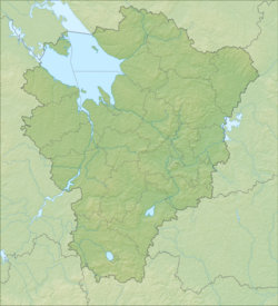
The river flows to the north, bypassing the tracts of Chausovo and Yermakovo, there are almost no settlements along the river. The right tributary, the Krekov stream, flowing from the marshes of the Krasnoe tract, flows in front of the only village on the river - Chayanovo. The mouth of the river is 4.1 km along the right bank of the Chesnava River, in the bay of the Rybinsk reservoir, opposite the village of Gorelovo.
Water Registry Data
According to the state water register of Russia, it belongs to the Upper Volga basin district , the water management section of the river is the Rybinsk reservoir to the Rybinsk hydroelectric complex and the rivers that flow into it, without the Mologa , Suda and Sheksna rivers from the source to the Sheksna hydroelectric complex , the river sub basin of the Rybinsk reservoir. The river basin is the (Upper) Volga to the Kuibyshev reservoir (without the Oka basin) [2] .
The object code in the state water register is 08010200412110000004774 [2] .
Notes
- ↑ Surface water resources of the USSR: Hydrological knowledge. T. 10. Verkhne-Volzhsky district / ed. V.P. Shaban. - L .: Gidrometeoizdat, 1966. - 528 p.
- ↑ 1 2 3 4 State Water Register of the Russian Federation: Vai . Archived August 20, 2012.