Labaheito is a freshwater lake in the Nenets Autonomous District of the Arkhangelsk Region of Russia . Height above sea level - 127 [1] m.
| Lake | |
| Labaheito | |
|---|---|
| Morphometry | |
| Absolute height | 127 m |
| Hydrology | |
| Type of mineralization | fresh |
| Pool | |
| Flowing river | nameless streams |
| Flowing river | Labaheisho |
| Location | |
| A country |
|
| The subject of the Russian Federation | Arkhangelsk region |
| Area | Nenets Autonomous Okrug |
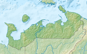
The lake is located in the Bolshezemelskaya tundra and has a circular shape. Two nameless streams flowing more than a kilometer long flow into Labaheito: the first in the southwest and the second in the northwest. One river flows out - Labaheisho (a tributary of the Colva ) [1] .
A shrub grows along the shores of the lake [1] . A kilometer west of Labaheito passes a winter road to the village of Khorey-Ver (about 90 km) [1] .
Notes
- ↑ 1 2 3 4 Map sheet R-40-XXXV, XXXVI hut Hanaway . Scale: 1: 200 000. Indicate the date of issue / condition of the area .