Jiulong on the administrative map of Hong Kong

Residential Skyscrapers of Jiulong
- See also Jiulong (peninsula) .
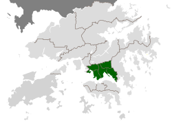
Jiulong [1] [2] ( Jer. Trad.九龍, ex.九龙, English Kowloon , cant. Kau-lun ?, Put. Jiulong ? Territory ). Consists of the Jiulong Peninsula and New Jiulong . Does the eastern border of Jiulong pass through the Leyyumun Strait ? , western - through Meifusanchun ? and the island of Stonkutters , the north through the Tate Pyramid and the Lion Stone , and the south through Victoria Bay . The population of Jiulong (2006 data) is 2 019 533 people. The population density is 43 thousand people / km². The peninsula is about 47 km². Together with Hong Kong Island, its population is 47% of the population of the Hong Kong Special Administrative Region .
Administrative Division
Parishes located on the island:
- Yauchimmon (Yau Tsim Mong, 油尖旺 區) - population - 281 thousand people, area - 6.99 km².
- Samsoypo (Sham Shui Po, 深水埗 區) - population - 366 thousand people, area - 9.35 km².
- Kowloon City (ow 城區) - population - 363 thousand people, area - 10.02 km².
- Wontaisin (Wong Tai Sin, 黃大仙 區) - population - 424 thousand people, area - 9.3 km².
- Kunton (Kwun Tong, 觀塘 區) - population - 588 thousand people, area - 11.27 km².
Notes
- ↑ China and the states of East Asia // Atlas of the world / comp. and preparation. to the ed. PKO "Cartography" in 2009; ch. ed. G.V. Pozdnyak . - M .: PKO "Cartography": Onyx, 2010. - S. 126-126. - ISBN 978-5-85120-295-7 (Cartography). - ISBN 978-5-488-02609-4 (Onyx).
- ↑ Jiulong // Dictionary of geographical names of foreign countries / resp. ed. A.M. Komkov . - 3rd ed., Revised. and add. - M .: Nedra , 1986.- S. 419.
See also
- Kowloon (walled city)