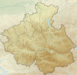
Ulalushka is a river in the north of the Altai Republic . The mouth of the river is 10 km along the right bank of the Maima River. The river is 19 km long.
| Ululushka | |
|---|---|
| Characteristic | |
| Length | 19 km |
| Watercourse | |
| Mouth | Mayma |
| • Location | 10 km from the mouth on the right bank |
| • Coordinates | |
| Location | |
| Water system | Maima → Katun → Ob → Kara Sea |
| A country |
|
| Region | Altai Republic |
| Areas | Maiminsky district , Gorno-Altaysk |
| HWR code | |

The river originates on the eastern slope of Mount Sugul (995 m), then flows westward through the territory of the Mayminsky District and flows into the Mayma River in the city of Gorno-Altaysk , at the foot of the Komsomolskaya Mountain. On the bank of the Ulalushki River, the village of the same name is located, not far from Gorno-Altaysk - the village. Alferovo . Most of the banks of the river are covered with mixed forests. Tributaries - Kayancha and Malaya Ulushka.
As a result of excavations in the city on the banks of the Ulalushki River, an ancient man’s site was discovered, whose age, according to experts, is 200-250 thousand years [2] . The object is open for access, organized tours are possible.
Water registry data
According to the state water register of Russia, it belongs to the Verkhneobsky Basin District , the water sector of the river is Katun , the river sub-basin of the river is Biya and Katun. River basin - (Upper) Ob until the confluence of the Irtysh [3] .
Notes
- ↑ Surface Water Resources of the USSR: Hydrological Understanding. T. 15. Altai and Western Siberia. Vol. 1. Gorny Altai and Upper Irtysh / ed. V.V. Seeberg. - L .: Gidrometeoizdat, 1966 .-- 216 p.
- ↑ Official website of the city of Gorno-Altaysk (Inaccessible link - history ) .
- ↑ State Water Register . Ulala . textual.ru . Ministry of Natural Resources of Russia (March 29, 2009). Date of treatment December 20, 2018. Archived March 29, 2009.