Kamenka is a river in Russia , flows mainly in the south-west of the Uglich district of the Yaroslavl region , the source is in the Pereslavl region . Merging to the left with the Yakovlevskaya River forms the Moshnitsa River. [1] The State Water Register considers Kamenka as the beginning of Moshnitsa, the length with it is 16 km. [2]
| Kamenka | |
|---|---|
| Characteristic | |
| Watercourse | |
| Source | |
| • Location | southwest of the village of Krivtsovo |
| • Coordinates | |
| Mouth | Scammer |
| • Height | 144.8 m |
| • Coordinates | |
| Location | |
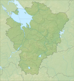
| Water system | Moshnitsa → Kisma → Saber → Nerl → Uglich Reservoir → Volga → Caspian Sea |
| A country |
|
| Region | Yaroslavskaya oblast |
| Areas | Pereslavl district , Uglich district |
The largest tributary is the Moshenka (on the left). [one]
Rural settlements near the river: Krivtsovo , Vasiltsovo . [one]
According to the state water register of Russia, it belongs to the Upper Volga basin district , the Volga river water sector from the Ivankovo hydroelectric complex to the Uglich hydroelectric complex ( Uglich reservoir ), the river sub-basin - the tributaries of the (Upper) Volga to the Rybinsk reservoir. The river basin of the river is the (Upper) Volga to the Kuibyshev reservoir (without the Oka basin). [2]
Notes
- ↑ 1 2 3 Map sheet O-37-101 Zaozerye . Scale: 1: 100,000. Status of the terrain for 1972. 1978 edition
- ↑ 1 2 State Water Register . Moshnitsa (Kamenka) . textual.ru . Ministry of Natural Resources of Russia (March 29, 2009). Date of treatment December 20, 2018. Archived March 29, 2009.