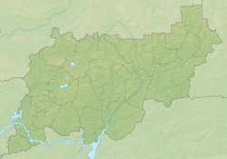
Mesa is a river in Kostroma and insignificantly in Ivanovo (only the source and first meters of the current) regions of Russia . It falls into the Kostroma Gulf of the Gorky reservoir on the Volga . The length of the river is 125 km, the catchment area is 901 km².
| Mesa | |
|---|---|
| Characteristic | |
| Length | 125 km |
| Pool | 901 km² |
| Watercourse | |
| Source | |
| • Coordinates | |
| Mouth | Kostroma Bay |
| • Location | Gorky reservoir |
| • Coordinates | |
| Location | |
| Water system | Volga → Caspian Sea |
| A country |
|
| Regions | Kostroma region , Ivanovo region |
| Areas | Zavolzhsky District , Sudislavsky District , Kostroma District |
| HWR code | |
Content
Water registry data
According to the state water register of Russia, it belongs to the Upper Volga Basin District , the Kostroma water sector from the source to the water gauge near the village of Isady , the river sub-basin is the Volga below the Rybinsk Reservoir until the Oka River flows into it. The river basin - (Upper) Volga to the Kuibyshev reservoir (without the Oka basin) [2] .
Tributaries (km from the mouth)
- 35 km: Myshka river (ave.)
- 46 km: Orsha river (ave.)
- 56 km: river Shacha (lv)
- 89 km: Puga river (pr)
- 99 km: Kokhtalka river (pr)
Notes
- ↑ Surface Water Resources of the USSR: Hydrological Understanding. T. 10. Upper Volga region / ed. V.P. Shaban. - L .: Gidrometeoizdat, 1966 .-- 528 p.
- ↑ State Water Register of the Russian Federation: Mesa . Date of treatment February 23, 2011. Archived July 20, 2012.
Links
- Mesa // Brockhaus and Efron Encyclopedic Dictionary : in 86 volumes (82 volumes and 4 additional). - SPb. , 1890-1907.
- The article used information provided by the Federal Agency for Water Resources from the list of water bodies registered in the state water register as of March 29, 2009. List (rar-archive, 3.21 Mb).