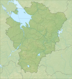
Vymchuk - a river in Russia , flows in the Lyubimsky district of the Yaroslavl region . The mouth of the river is located 8 km along the right bank of the Sharn River from its mouth. The river is 14 km long. [2] Rural settlements by the river: Pletenevo , Martyanovo , Petrovo ; the mouth is located opposite the village of Fedotovo . [3] [4]
| Vymchuk | |
|---|---|
| Characteristic | |
| Length | 14 km |
| Watercourse | |
| Source | |
| • Location | east of the village of Pletenevo |
| • Coordinates | |
| Mouth | Sharn |
| • Location | 8 km from the mouth on the right bank |
| • Coordinates | |
| Location | |
| Water system | Sharna → Obnora → Kostroma → Volga → Caspian Sea |
| A country |
|
| Region | Yaroslavskaya oblast |
| Area | Lyubimsky district |
| HWR code | |
Water registry data
According to the state water register of Russia, it belongs to the Upper Volga Basin District , the Kostroma water sector from the source to the water gauge near the village of Isady , the river sub-basin is the Volga below the Rybinsk Reservoir until the Oka River flows into it. The river basin of the river is the (Upper) Volga to the Kuibyshev reservoir (without the Oka basin). [2]
According to the geographic information system of water management zoning of the territory of the Russian Federation, prepared by the Federal Agency for Water Resources [2] :
- The code of the water body in the state water registry is 08010300112110000012946
- The code for hydrological knowledge (GI) is 110001294
- Pool code - 01/08/03.001
- GI Volume Number - 10
- GI Issue - 0
Notes
- ↑ Surface Water Resources of the USSR: Hydrological Understanding. T. 10. Upper Volga region / ed. V.P. Shaban. - L .: Gidrometeoizdat, 1966 .-- 528 p.
- ↑ 1 2 3 Vymchuk River Neopr . The list of water bodies registered in the state water register (as of March 29, 2009) . Archived July 20, 2012.
- ↑ Sheet 12. Love . Topographic Atlas. Yaroslavskaya oblast. 1: 200 000.
- ↑ Map sheet O-37-58 Love . Scale: 1: 100,000. State of the terrain for 1985. 1990 edition