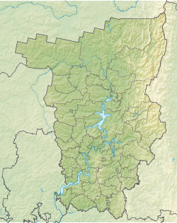
Anyl is a river in Russia , it flows in the Perm Territory and the Komi Republic . The mouth of the river is located 269 km on the right bank of the Colva River . The length of the river is 25 km [2] .
| Anyl | |
|---|---|
| Characteristic | |
| Length | 25 km |
| Watercourse | |
| Source | |
| • Coordinates | |
| Mouth | Colva |
| • Location | 269 km on the right bank |
| • Coordinates | |
| Location | |
| Water system | Colva → Vishera → Kama Reservoir → Kama → Volga → Caspian Sea |
| A country |
|
| Regions | Komi Republic , Perm Region |
| Areas | Troitsko-Pechora District , Cherdyn District |
| HWR Code | |
Content
Description
It originates in the territory of the Republic of Komi, near the border with the Perm region. The source is located on the watershed of the Kama and Pechora , near the beginning of the river Lelim . It then flows through the territory of the Cherdynsky district of the Perm Territory, mainly in the southern and southeast directions. Falls into Kolvu just below the village Nuzym .
Tributaries
(km from the mouth)
- 3.6 km: Izcaraush River (lv)
- 6.6 km: Bolshoi Rodnik stream (pr)
- 12 km: the river Payvozh ( PR )
Water Registry Data
According to the state water register of Russia, it belongs to the Kama basin district , the water management section of the river - Kama from the water measuring station near the village of Bondyug to the city of Berezniki , the river sub-basin of the river - the tributaries of the Kama to the confluence of the White River. River basin - Kama [2] .
The object code in the state water register is 10010100212111100005713 [2] .
Notes
- ↑ Surface water resources of the USSR: Hydrological knowledge. T. 11. Middle Ural and Urals. Issue 1. Kama / ed. V.V. Nikolaenko. - L .: Gidrometeoizdat, 1966. - 324 p.
- ↑ 1 2 3 State Water Register . Anyl . textual.ru . Ministry of Environment of Russia (March 29, 2009). The appeal date was December 20, 2018. Archived March 29, 2009.