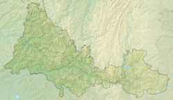
Baktak - a river in Russia , flows in the Orenburg region. The mouth of the river is 12 km along the right bank of the Tiris River. The length of the river is 11 km, the catchment area is 50.1 km².
| Bactac | |
|---|---|
| Characteristic | |
| Length | 11 km |
| Pool | 50.1 km² |
| Watercourse | |
| Source | |
| • Coordinates | |
| Mouth | Tiris |
| • Location | 12 km on the right bank |
| • Coordinates | |
| Location | |
| Water system | Tiris → Ik → Kama → Volga → Caspian Sea |
| A country |
|
| Region | Orenburg region |
| HWR code | |
Water registry data
According to the state water register of Russia, it belongs to the Kama basin district , the water sector of the river is Ik from the source to the mouth, the river sub-basin is the basins of the Kama tributaries until the confluence of the White. The river basin of the river is Kama [2] .
According to the geographic information system of water management zoning of the territory of the Russian Federation, prepared by the Federal Agency for Water Resources [2] :
- The code of the water body in the state water registry is 10010101312111100027773
- The code for hydrological knowledge (GI) is 111102777
- Pool code - 01/10/01/013
- GI Volume Number - 11
- GI Issue - 1
Notes
- ↑ Surface Water Resources of the USSR: Hydrological Understanding. T. 11. The Middle Urals and the Urals. Vol. 1. Kama / ed. V.V. Nikolaenko. - L .: Gidrometeoizdat, 1966 .-- 324 p.
- ↑ 1 2 State Water Register of the Russian Federation: Bactak Neopr . Archived July 18, 2012.
Links
- The article used information provided by the Federal Agency for Water Resources from the list of water bodies registered in the state water register as of March 29, 2009. List (rar-archive, 3.21 Mb).