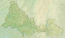
Uslu - a river in Russia , flows Bizhbulyaksky and Ponomarevsky , Bashkortostan and the Orenburg region, respectively [2] [3] . The mouth of the river is 8.7 km on the left bank of the Uazy river. The length of the river is 43 km [4] .
| Services | |
|---|---|
| Characteristic | |
| Length | 43 km |
| Watercourse | |
| Source(T) (B) | |
| • Coordinates | |
| Mouth | Uazy |
| • Location | 8.7 km on the left bank |
| • Coordinates | |
| Location | |
| Water system | Uyazy → Dema → White → Kama → Volga → Caspian Sea |
| A country |
|
| Regions | Bashkortostan , Orenburg Region |
| HWR Code | |
Tributaries
- 17 km: Tribushinka
- 25 km: Degotlja
Water Registry Data
According to the state water register of Russia, it belongs to the Kama basin district , the water management section of the river is Dema from its source to the gauging post near the village of Bochkareva , the river sub-basin of Belaya. River basin - Kama [4] .
The object code in the state water register is 10010201312111100024564 [4] .
Notes
- ↑ Surface water resources of the USSR: Hydrological knowledge. T. 11. Middle Ural and Urals. Issue 1. Kama / ed. V.V. Nikolaenko. - L .: Gidrometeoizdat, 1966. - 324 p.
- ↑ Map sheet N-40-85 Aitovo . Scale: 1: 100,000. State of the area in 1982. 1989 edition
- ↑ Map sheet N-40-86 Kirgiz-Miyaki . Scale: 1: 100,000. The state of the terrain in 1991. 1994 edition
- ↑ 1 2 3 State Water Register . Usla . textual.ru . Ministry of Environment of Russia (March 29, 2009). The appeal date was December 20, 2018. Archived March 29, 2009.