Karkala - a river in Russia , flows through the territory of the Miyakinsky and Sterlibashevsky districts of Bashkortostan .
| Karkala | |
|---|---|
| Characteristic | |
| Length | 10 km |
| Watercourse | |
| Mouth | Elm |
| • Location | in the village of Small Karkaly |
| • Coordinates | |
| Location | |
| Water system | Elms → Dema → Belaya → Nizhnekamsk reservoir → Kama → Volga → Caspian Sea |
| A country |
|
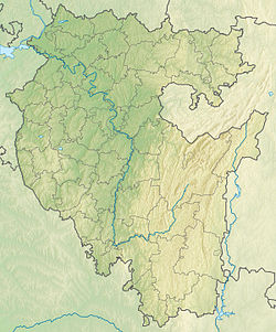
| Region | Bashkortostan |
| Areas | Miyakinsky district , Sterlibashevsky district |
| HWR code | |
Geography and Hydrology
The mouth of the river is 67 km along the left bank of the Uyaz River . The length of the river is 10 km [2] . Karkala takes the left tributary of the Cold Key.
From the source to the mouth on the river are three settlements - Kamyshly , Big Karkaly , Small Karkaly [3] .
Water registry data
According to the state water register of Russia, it belongs to the Kama Basin District , the water sector of the river is Dema from the source to the water gauge near the village of Bochkareva , the river sub-basin of the river is Belaya. The river basin of the river is Kama [2] .
The code of the object in the state water registry is 10010201312111100024496 [2] .
Notes
- ↑ Surface Water Resources of the USSR: Hydrological Understanding. T. 11. The Middle Urals and the Urals. Vol. 1. Kama / ed. V.V. Nikolaenko. - L .: Gidrometeoizdat, 1966 .-- 324 p.
- ↑ 1 2 3 State Water Register . Karkala . textual.ru . Ministry of Natural Resources of Russia (March 29, 2009). Date of treatment December 20, 2018. Archived March 29, 2009.
- ↑ Map sheet N-40-86 of Kyrgyzstan-Miyaki . Scale: 1: 100,000. Status of the terrain in 1991. 1994 edition