Magura is the peak in the Skole Beskydy Mountains , on the border of the Skole District of Lviv Region and the Dolinsky District of Ivano-Frankivsk Region. Height - 1362.7 m [1] . The top and slopes of the mountain are covered with forest. Magura is the second highest peak in the Lviv region (after Pikuy ). To the west of the mountain is the village of Libohor .
| Magura | |
|---|---|
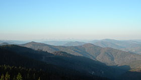 Magura; view from the top | |
| Highest point | |
| Absolute height | 1362.7 m |
| Location | |
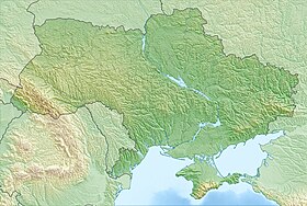
| A country |
|
| Mountain system | Carpathians |
Notes
- ↑ Map sheet M-34-120 Benefit . Scale: 1: 100,000. Status of the area in 1990. 1991 edition