Sweetwater County is a county located in Wyoming ( USA ) with a population of 37,613 according to 2000 census statistics.
| district | |||
| Sweetwater County | |||
|---|---|---|---|
| Sweetwater county | |||
| |||
| A country | USA | ||
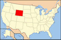
| Included in | wyoming | ||
| Adm. Centre | Green river | ||
| History and Geography | |||
| Date of formation | 1867 | ||
| Square | 27 172 km² | ||
| The largest city | Rock springs | ||
| Population | |||
| Population | 37 613 people ( 2000 ) | ||
| Density | 1 pax / km² | ||
| Official language | English | ||
| Official site | |||
 | |||
 | |||
The county capital is Green River .
Content
History
Sweetwater County was formed in 1867.
Geography
According to the US Census Bureau, Sweetwater County has a total area of 27,172 square kilometers, of which 27,001 square meters. a kilometer takes land and 171 square meters kilometer - water. The area of water resources of the district is 0.63% of its total area.
Largest in Wyoming, Sweetwater County is the eighth largest area in the United States, with the exception of the baro in Alaska .
Neighboring Counties
- Fremont North
- Carbon East
- Moffat ( Colorado ) - South
- Winta - Southwest
- Summit ( Utah ) - Southwest
- Daggett ( Utah ) - Southwest
- Lincoln West
- Sablett - Northwest
Protected Areas
- Ashley National Forest (part)
- Flaming Gorge National Wildlife Refuge “Flaming Gorge” (part)
- Sidskadi National Reserve
Demographics
| Population census | |||
|---|---|---|---|
| Census year | Us. | % ± | |
| 1870 | 1916 | ||
| 1880 | 2561 | 33.7% | |
| 1890 | 4941 | 92.9% | |
| 1900 | 8455 | 71.1% | |
| 1910 | 11 575 | 36.9% | |
| 1920 | 13,640 | 17.8% | |
| 1930 | 18 165 | 33.2% | |
| 1940 | 19 407 | 6.8% | |
| 1950 | 22 017 | 13.4% | |
| 1960 | 17 920 | -18.6% | |
| 1970 | 18 391 | 2.6% | |
| 1980 | 41,723 | 126.9% | |
| 1990 | 38 823 | -7% | |
| 2000 | 37,613 | -3.1% | |
| Current 2009 | 41,226 | ||
According to the 2000 census [1], 37,613 people, 10,099 families lived in Sweetwater County , there were 14,105 households and 15,921 residential buildings. The average population density was 1 person per square kilometer. According to the census, the racial makeup of the county was as follows: 91.62% White , 0.73% Black or African American , 1.01% Native American , 0.64% Asian , 0.04% Pacific Islander , 2.37% - representatives of mixed races, 3.59% - of other nationalities. Hispanic and Latino Americans accounted for 9.42% of all residents in the county.
Of the 14 105 households, 38.20% raised children under the age of 18, 57.80% were married couples living together, in 9.20% of the families women lived without husbands, 28.40% did not have families. 23.60% of the total number of families at the time of the census lived independently, while 6.90% were single elderly people aged 65 years and older. The average household size was 2.62 people and the average family size was 3.11 people.
According to the 2000 census, the population of the district according to the age range was as follows: 28.90% - residents under 18 years old, 10.10% - between 18 and 24 years old, 29.30% - from 25 to 44 years old, 23.70% - from 45 to 64 years old and 8.00% - at the age of 65 years and older. The average age of the district residents was 34 years. For every 100 women in the county, there are 102.40 men, while for every 100 women 18 years of age and over, 101.10 men are also over 18 years old.
The average household income in the district was $ 46,537, and the average household income in the district was $ 54,173. At the same time, men had an average income of $ 45,678 a year, compared to $ 22,440 of the average annual income for women. The per capita income for the district was $ 19,575 a year. 5.40% of the total number of families in the district and 7.80% of the total population were below the poverty line at the time of the census, with 9.20% of those under the age of 18 and 7.00% at the age of 65 and older.
Main Highways
Settlements
Cities
- Green river
- Rock springs
- Baroil
- Granger
- Superior
- Womsatter
Statistically Separate Locations
|
|
|
|
Others
- Blairtown
Notes
- ↑ U.S. Census Bureau website