Oirase ( お い ら せ 町 Oirase-cho:) is a village in Japan located in Kamikita County in Aomori Prefecture . The area of the village is 71.88 km² [1] , the population is 25,064 people (August 1, 2014) [2] , the population density is 348.69 people / km².
| Village | |||||
| Oirase | |||||
|---|---|---|---|---|---|
| jap. お い ら せ 町 | |||||
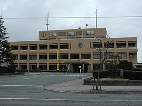 City Hall of Oirase | |||||
| |||||
| A country | |||||
| Prefecture | Aomori | ||||
| County | Kamikita | ||||
| History and Geography | |||||
| Square | 71.88 km² | ||||
| Timezone | UTC + 9 | ||||
| Population | |||||
| Population | 25,064 people ( 2014 ) | ||||
| Density | 348.69 people / km² | ||||
| Digital identifiers | |||||
| Postcode | 〒 039-2192 | ||||
| Code | 02412-1 | ||||
| Other | |||||
| Isle | Honshu | ||||
| Region | Tohoku | ||||
| Symbolism | Flower : Sakura Tree : Ginkgo Bird : Swan | ||||
| town.oirase.aomori.jp (Japanese) | |||||


Content
Geographical position
The village is located on the island of Honshu in Aomori Prefecture of the Tohoku region . The cities of Misawa , Hatinohe and the villages of Rokunohe and Gonokha border it [3] .
Population
The population of the village is 25,064 people (August 1, 2014), and the density is 348.69 people / km². The change in population from 1980 to 2005 [4] :
|
Symbols
The tree of the village is considered to be ginkgo , the flower is the sakura flower, the bird is the swan [5] .
Notes
- ↑ The area is indicated according to the Geospatial Information Authority of Japan (Japanese) , subject to changes published on October 1, 2011.
- ↑ 統計 情報 の ご 案 内 (Japanese) . Aomori Prefecture Administration (August 18, 2014). - The population of Aomori Prefecture. Date of treatment August 29, 2014.
- ↑ 国土 数 値 情報 行政 区域 デ ー タ の 詳細 (Japanese) (inaccessible link) . Counsellor, National and Regional Planning Bureau. - Digital maps with the administrative division of Japan. Date of treatment July 23, 2010. Archived April 30, 2012.
- ↑ The number is indicated by the censuses of Japan 1980, 1985, 1990, 1995, 2000 and 2005.
- ↑ 花 ・ 木 ・ 鳥 (Japanese) . Administration of the village of Oirase. Date of treatment August 3, 2010. Archived on May 5, 2012.
Links
- Wikimedia Commons has media related to Oirase
- Official site (Japanese)
- 青森 県 (Japanese) . Geospatial Information Authority of Japan. - The geographical coordinates of the settlements of Aomori Prefecture. Date of treatment July 23, 2010.
- 青森 県 内 市町村 (Japanese) . Local Authorities Systems Development Center. - Identification codes, names, postal addresses and phone numbers of administrations of settlements of Aomori Prefecture. Date of treatment July 23, 2010.