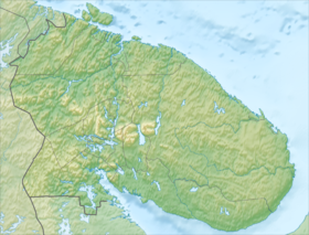
Upper Volchye is a fresh lake in the Murmansk region in the northern part of the Kola Peninsula .
| Lake | |
| Upper Wolf | |
|---|---|
| Morphometry | |
| Absolute height | 164.8 m |
| Dimensions | 9.3 × 4.8 km |
| Area | 18 km² |
| Coastline | about 35 km |
| Deepest | 50.7 [1] m |
| Hydrology | |
| Type of mineralization | Fresh |
| Location | |
| A country |
|
| The subject of the Russian Federation | Murmansk region |
| Identifiers | |
| HWR : | |

Content
- 1 Geography
- 2 Description
- 3 Infrastructure
- 4 See also
- 5 notes
- 6 Sources
- 7 Literature
Geography
The lake is located 20 kilometers northwest of Monchegorsk and 28 kilometers west of Olenegorsk , adjacent almost right to the Wolf Tundra ridge, which is the northern extension of the Chunatundra and Monchetundra massifs. Included in the lake-river system is the Upper Volchye-Sukhaya Lambina [3] . Located at an altitude of 164.8 meters above sea level.
The Upper Volchye belongs to the basin of the White Sea ; it is connected with it through the Volchyu River - a tributary of the Kutskol River flowing into Imandra . Lies in dry mountainous terrain, small areas of marshes are found only on the east coast of the central part. From the east, steep slopes of hills up to 500 meters high descend to the lake: Mount Tuybola (499.6 meters), elevations of 466.5 meters, 452.4 meters and 431.5 meters. The slopes of the Wolf Tundra Uplands to the west and south of Upper Voronya ( Yukspor Mountains - 957 meters, Sainbasterternchorr - 910.1 meters, Alnjunichorr - 858 meters, Kivayvynchr - 805.1 meters, Mochechnyunachorr - 861.6 meters, and Mount Volchya Tundra 932.8) are more gentle and covered with sections of pine , pine- spruce and spruce - birch forests with trees up to 12-15 meters high. The ascent ( winter road ) begins from the southern part of the lake to the pass popular between extreme tourists between Mochisnunachorr and Kivayvinch [4] .
Description
| External Images | |
|---|---|
| Photos of the Upper Wolf | |
| View of the lake from the Wolf Tundra Range | |
| Lake Superior Wolf, winter, 1993 | |
| Lake surroundings | |
The area of the Upper Volchiy is 18 km², it is the 38th largest lake in the Murmansk region [5] . The coastline is about 35 kilometers [6] . Depth reaches 50.7 meters.
The lake has an elongated shape extending from south to north, along the Wolf Tundra ridge, extending to the south. The lake is about 9.3 kilometers long and 0.2-1.4 kilometers wide in the narrow northern part and up to 4.8 kilometers in the wide northern part. The banks are uneven, with many capes and bays. Off the east coast are small sections of sandbanks. A large rocky peninsula 2 kilometers long and up to 700 meters wide protrudes into the lake from the south, dividing its southern part into two parts of approximately the same size. Another relatively large forested and partially marshy peninsula, a little less than a kilometer long and no more than 600 meters wide, is located in the extreme northeastern part of the lake.
Across the entire territory of the Upper Wolf, small gently sloping nameless islands are scattered, located mainly along the shores of the lake and having up to 250 meters in length and up to 4 meters from the height of the lake.
From the northern end of the lake flows the Volchya River, connecting the Upper Volchye with the Lower Volchye Lake lying in the north and a group of Korezheny lakes. From the surrounding hills, many nameless rapids flow into the lake. Around the Upper Wolf, there are several other lakes of the system, most of which are nameless and very small. The largest of the adjacent lakes: Lower Volchye - 1.1 kilometers to the north, Kashkozero - 7 kilometers to the north-east, Incis - 5 kilometers to the east, Smelling - 0.9 kilometers to the east (connected to the Upper Volch channel ), Rechye (on some maps - Lebyazhye [7] ) - 0.8 kilometers to the southeast (connected to the Upper Wolf Channel) and Krasnaya Lambina (2.7 kilometers to the southeast).
Infrastructure
There are no settlements on the Upper Wolf. The nearest settlements are Monchegorsk (20 kilometers to the south-east), Olenegorsk (28 kilometers to the east) and the village Kutskol left in the early 90s (17 kilometers to the north-west, currently only ruins from single and two-story buildings). Several non-residential huts standing 700 meters along the winter road to the west were destroyed (burned) in the late 90s. Another winter road starts from the southeastern part of the lake and, bifurcating at the Krasnaya Lambina lake, leads southeast to Monchegorsk and to the south along the Wolf Tundra ridge.
See also
- Lakes of the Murmansk region
Notes
- ↑ Wolf // Kola Encyclopedia . In 5 t. T. 1. A - D / Ch. ed. A.A. Kiselev . - SPb. : IP; Apatity: KSC RAS, 2008 .-- S. 423.
- ↑ Surface Water Resources of the USSR: Hydrological Understanding. T. 1. Kola Peninsula / ed. Yu.A. Yelshin. - L .: Gidrometeoizdat, 1969 .-- 134 p.
- ↑ Materials of the Monchezers Limnological Expedition of 1933
- ↑ Wolf Tundra on the site "Wanderer"
- ↑ The largest lakes and reservoirs of the Murmansk region
- ↑ Part of the approximate dimensions and distances in the article were calculated using Google Earth
- ↑ Map sheet R-36-138-B, G. Scale: 1: 50,000 .
Sources
- Map sheet R-36-XXXIII, XXXIV Olenegorsk . Scale: 1: 200,000.
- Map sheet R-36-137,138 x Wolf Wolf Tundra . Scale: 1: 100 000. Indicate the date of issue / condition of the area .
- Map sheet R-36-138-A, B. Scale: 1: 50,000 .
- Map sheet R-36-138-B, G. Scale: 1: 50,000 .
- Map sheet R-36-137-A, B. Scale: 1: 50,000 .
- Map sheet R-36-137-B, G. Scale: 1: 50,000 .
Literature
- Wolf // Kola Encyclopedia . In 5 t. T. 1. A - D / Ch. ed. A.A. Kiselev . - SPb. : IP; Apatity: KSC RAS, 2008 .-- S. 423.
- Upper Wolf // Geographical Dictionary of the Murmansk Region / ed. V. G. Muzhikov. - Murmansk: Murman. reg. Institute of Development Region. education, continuing education ped. Personnel, 1996. - S. 29. - ISBN 5-86975-023-7 .