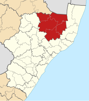
Zululand ( Eng. Zululand , “Land of the Zulu”) is a district of KwaZulu-Natal province ( South Africa ). The administrative center is Ulundi . Other large cities are Mondlo , Ntsocane , Nongoma .
| Area | |
| Zululand | |
|---|---|
| English Zululand | |
| A country | South Africa |
| Included in | Kwazulu Natal |
| Includes | 5 local municipalities |
| Adm. center | Ulundi |
| History and Geography | |
| Area | 15.305.79 km² |
| Height | |
| Timezone | UTC + 2: 00 |
| Population | |
| Population | 902.890 people people ( 2001 ) |
| Density | 58.99 people / km² |
| Nationalities | Colored 0.19% Blacks {{{Blacks}}}% White 1.71% Asians 0.08% |
| Official site | |
 | |
Content
- 1 History
- 2 Current status
- 2.1 Administrative divisions
- 3 notes
History
Initially, the European Boer colonists used the name “Zululand” to denote all the lands north of the Tugela River that were inhabited by the Zulu [1] .
In January 1879, British troops crossed the border river and invaded the territory of the Zulu kingdom , the Anglo-Zulu war began , which lasted until August 28, 1879. After the war ended, the Zulus country was divided between 13 leaders who were subordinate to the British "residents", but internecine clashes between the leaders caused a new reform - in 1883 the territory of the Zulus kingdom was divided into three parts [2] .
In 1887, the territory of the former Zulus kingdom was annexed by the British Empire, as a result a new administrative-territorial entity was created - Zululand County, which was incorporated into the province of Natal [3] .
The territory of Zululand was the space between the Tugela river and the Umzimkulu river with a total area of 27 thousand square kilometers [4] .
As of the early 1960s, the population of Zululand was 400 thousand people, most of them were Zulus. The main occupation of the population was agriculture and work in the Transvaal mines. There were also several sugar plantations on the territory of the okrug, several sugar refineries (owned by the British) and logging operations [5] .
Current status
Administrative Division
Currently, the territory of Zululand is 15 306 sq. Km. The Zululand district consists of five local municipalities :
- Ulundi (local municipality)
- Nongoma (local municipality)
- Abakulusi (local municipality)
- Uphongolo (local municipality)
- Edumbe (local municipality)
According to the 2001 census, the majority of the district's population speaks the Zulu language.
Notes
- ↑ C. T. Binns. Dinuzulu. The end of the Chucky Dynasty. M., "Science", 1978. p. 4
- ↑ C. T. Binns. Dinuzulu. The end of the Chucky Dynasty. M., "Science", 1978. p. 10
- ↑ Anglo-Zulu War // Africa: Encyclopedic Reference (in 2 vols.). / redkoll., ch. ed. A.A. Gromyko. volume 1. M., "Soviet Encyclopedia", 1986. p. 256
- ↑ Zululand // Great Soviet Encyclopedia. / redkoll., ch. ed. B. A. Vvedensky. 2nd ed. T.17. M., State Scientific Publishing House "Great Soviet Encyclopedia", 1952. p. 242
- ↑ Zululand // Brief geographical encyclopedia. / redkoll., ch. ed. A.A. Grigoriev. t.2, M., "Soviet Encyclopedia", 1961