Kaliningrad Bay - a bay located in the southern part of the Baltic Sea , also called Wislinsky (in Poland ), the German name is Frisches Haff Fresh Bay . Received the Russian name from the city of Kaliningrad located on the bay.
| Kaliningrad Bay | |
|---|---|
| polish Zalew Wiślany | |
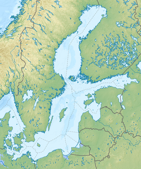
 Satellite image of the bay | |
| Characteristics | |
| Bay Type | lagoon |
| Area | 838 km² |
| Coastline | 270 km |
| Deepest | 5,2 m |
| Average depth | 2.7 m |
| Flowing rivers | Nogat , Pregolya , Cool |
| Location | |
| Upstream waters | Baltic Sea , Atlantic Ocean |
| Countries |
|
| Regions | Kaliningrad Region , Warmian-Masurian Voivodeship , Pomeranian Voivodeship |
Content
- 1 Geography and hydrology
- 2 fauna
- 3 History
- 4 notes
- 5 Links
Geography and Hydrology
In fact, the Kaliningrad Bay is a lagoon - an almost enclosed body of water, separated from the sea by a sandy Baltic (Vistula) spit . Water exchange occurs through the narrow Baltic Strait , located in the eastern part near the city of Baltiysk . The water level in the bay is slightly higher than sea level , so there is a current in the strait connecting the bay with the sea. The Nogat River (the right arm of the Vistula ), Pregolya , Prokhladnaya and others flow into the bay, so the water in the bay is quite fresh.
The length of the bay is 91 km, the width varies from 2 to 11 km, the area is 838 km². The total coastline stretches for 270 km, of which 159 km belong to Russia and 111 km to Poland. The average depth is 2.7 m, the maximum (with the exception of the artificial channel - the Kaliningrad Sea Canal ) is 5.2 m. There are bulk islands along the channel (Zeleny and others). The largest island of Nasypnoy is located on Russian territory. The name speaks of its origin. It was artificially created on a natural shallow in the 30s of the XX century. During the war, there was a battery of searchlight installations on it. Now there are two navigation signs (Nasypnaya-Severny and Nasypnaya-Yuzhny), which are valid from April 10 to December 5 [1] [2] .
The water area of the gulf is divided between Russia and Poland , while 56.2% of its area belongs to Russia and the rest to Poland [1] [2] . The border of the Kaliningrad region passes through the water area . The shores are low, marshy, with coniferous forest. In winter it is covered with ice. Ports: Baltiysk (on the banks of the strait), Kaliningrad [3] .
Fauna
The bay is home to 57 species of cyclostomes and fish belonging to 22 families (of which 20 species are cyprinids ). The main commercial fish are herring , bream , pikeperch , eel , roach , perch and sabrefish ( Pelecus cultratus ). To a lesser extent, burbot , pike , asp , silver bream , river flounder ( Platichthys flesus ) and ruff are of commercial importance [4] .
History
The first mention refers to the journey of Wulfstan from the Jutland Peninsula to Truso . Anglo-Saxon version of the name Estmere . Perhaps this is a scoring from the Old Russian Aīstinmari .
In 1246, in the documents of the Teutonic Order in Latin, recens mare . Records 1251 speak of mare recens and Neriam , record 1288 speaks of recenti mari hab .
In the documents of the crusaders in the middle of the XIV century, the name Vrychschen Mere was also used.
The Polish name for the bay was Zatoka Świeża. In 1903, Sigmund Gloger used the name Fryszchaf , which included the German version.
On the 1934 map of the Polish Military Geographical Institute, the bay is named zalew Fryski .
Notes
- ↑ 1 2 N.N. Lazarenko, A. Mayevsky (ed.). Hydrometeorological regime of the Vistula Gulf. - Leningrad: Gidrometeoizdat, 1971. - 279 p.
- ↑ 1 2 Ulrich Schiewer (ed.). Ecology of Baltic Coastal Waters . - Springer, 2008 .-- 428 p. - ISBN 3540735232 .
- ↑ Kaliningrad Bay - an article from the Great Soviet Encyclopedia .
- ↑ Yu. K. Ruigite. Morphological and ecological characteristics and possibilities of commercial use of the breeding grounds (Blicca bjoerkna L.) of the Vistula Gulf of the Baltic Sea. Abstract of dissertation for the degree of candidate of biological sciences. Kaliningrad - 2009. online (inaccessible link) . www.klgtu.ru . Date of treatment January 19, 2019. Archived March 8, 2016.
Links
- Monitoring the quality of the waters of the Vistula Gulf based on satellite sounding . web.archive.org . Date of treatment January 19, 2019.
- Fishing on the Kaliningrad Bay (inaccessible link) . www.pohodvles.ru . Archived on June 7, 2013.