Razdolnaya (until 1972, Suifun , Chinese Exercise 绥芬河 , Pall .: Suifen-He ) is a river in the south of the Primorsky Territory of Russia , originating in Manchuria (in the territory of the PRC ) from the confluence of the rivers [2] Xiaosufynhe (169 km) and Dasuyfynhe (148 km).
| Split | |
|---|---|
| Kit. 绥芬河 | |
 Razdolnaya River in the village of Baranovsky , a bridge to the Khasansky District Razdolnaya River in the village of Baranovsky , a bridge to the Khasansky District | |
| Characteristic | |
| Length | 245 km |
| Pool | 16 830 km² |
| Watercourse | |
| Source | River confluence: Xiaosuifnhe and Dasuifinhe |
| • Height | 880 m |
| • Coordinates | |
| Mouth | Amur Bay |
| • Height | 0 m |
| • Coordinates | |
| Location | |
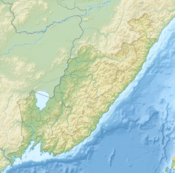
| Water system | Japanese Sea |
| China | Heilongjiang |
| Russia | Primorsky Krai |
| HWR Code | |
In XII-XIII centuries, the river was called Suiping. On the map J.-B. 1734 d'Anville is named Suifong. The former name of the river is “Suifun”, translated from the Manchu language as “awl” (the self-name of one of the Manchurian peoples settled on this river [3] ). Renamed in 1972 after the armed conflict over the island of Damanskii , during a massive campaign to replace the Chinese toponyms of Primorye with newly invented Russians [4] .
The total length of the river is 245 km (it is 414 km from the source of the Xiaosuif'nhe river), it flows through the territory of Primorsky Krai for a length of 191 km. The basin area is 16 830 km² (6,820 km² within the Primorsky Krai).
Tributaries: Granitnaya (99 km), Krestyanka (46 km), Slavyanka (67 km), Borisovka (86 km), Komarovka (with Rakovka flowing into the mouth), Second River (41 km).
- In the literature there are conflicting data, which river flows into Razdolnaya, Komarovka or Rakovka . According to one geographical map, Rakovka flows into Komarovka in Ussuriysk , slightly above the road bridge connecting ul. Red Banner and Vladivostok highway , road signs "The Komarovka River" are installed in front of the bridge, respectively Komarovka flows into Razdolnaya.
- Other cards, such as the Ussuriisk map, were compiled in 2013 by Primorsky Information and Analytical Center, printed in Vladivostok, IPK Dalpress, 3000 copies, order number 2028 , the Komarovka River flows into Rakovka (at the same bridge ), and Rakovka in Razdolnaya.
- On most geographic maps, a short section about 2 km in length after the confluence of two rivers is usually not indicated.
- Other cards, such as the Ussuriisk map, were compiled in 2013 by Primorsky Information and Analytical Center, printed in Vladivostok, IPK Dalpress, 3000 copies, order number 2028 , the Komarovka River flows into Rakovka (at the same bridge ), and Rakovka in Razdolnaya.
The Razdolnaya River is a mountain river within Manchuria , gradually losing these features, and in Russia it is already a river of the plain type. The riverbed in the upper course is moderately sinuous, in the lower course it becomes strongly tortuous. In the lower reaches, the channel is comparatively branched, it is 100–200 m wide, replete with assaults , streamers and shallows .
The prevailing depth of the river is from 0.5 to 5 m. The current velocities vary from very insignificant to 1.5 m / s (the highest speeds up to 3 m / s - on shallows). The prevailing width of the river is 100–150 m. The bottom of the river bed is pebbly and sandy. Its shores are mostly steep and steep, from 0.5 to 5 m in height.
At the confluence of the Amur Bay forms a shallow Tavrichsky estuary . At the turn of the Pliocene — early Pleistocene, the Paleo-Razdolnaya belonged to the Paleo- Amur system. During one of the mid-Pleistocene cold spells, when the sea level was significantly lower than the modern one, one of the watercourses that flowed directly into the Sea of Japan became the “aggressor river”, which sawed through the basalt bridge as a result of regressive erosion and decapitated the Paleo-Razdolnaya, as a result which, much of its catchment area was reoriented to the south [5] .
In the past, it was a rich spawning river of salmon.
Content
Russian settlements in the valley of the Razdolnaya River
Top down stream:
- October district
On the right bank:
- Poltavka
- Konstantinovka
- Sinelnikovo-2
- Pomegranate
- Zaprotochny
- Zarechnoye
On the left coast:
- Fadeevka
- Novogeorgiyevka
- Chernyatino
- Sinelnikovo-1
- District center Pokrovka
- Starorechenskoye
On the right bank:
| On the left coast:
|
- Nadezhda district
On the right bank:
- Terehovka
- Reindeer herder
- Quiet
- Barracks 25th km
- Nezhino
- Vinevitino
On the left coast:
- Baranovsky
- Gorodechnoye
- 9208th km
- Razdolnoye
- Cypress
- Cypress-2
- Tavrichanka
- Selected major settlements.
Gallery
Razdolnaya River near the village of Ulyosnoe . Flooding .
Away - Henina Sopka ( Ussuriysk )Razdolnaya river near Banevurovo station
Razdolnaya river in winter, the view from the train window
Razdolnaya River in the vicinity of the village of Baranovsky
Baranovsky volcano , view of the stone scree from the left bank of the river Razdolnaya, the photo was taken in 1983.
View of the Baranovsky volcano in winter from the train window
Railway bridge over Razdolnaya (to Hasan and the DPRK)
Attractions
- With a. Zarechnoye over the river rises the town of Senkin Cap, which is a natural and archaeological monument.
- In the vicinity of the village. Baranovsky towers over the river Baranovsky , an extinct volcano in the Primorsky Territory. It is visible from the trains passing through Transsib .
- In the Razdolnaya river basin, there is a rare mollusk - Middendorf's perch Dulkeit , listed in the Red Book of Russia .
- Below Baranovsky station, a railway bridge was built over Razdolnaya, trains go to Hassan station and further to North Korea , to Tumangan station .
- On bridges at with. Utyosnoe , pos. Baranovsky and pos. Razdolnoye is carried out by road communication with the Khasansky district and the southern coast of the Peter the Great Bay .
Notes
- ↑ Surface water resources of the USSR: Hydrological knowledge. T. 18. Far East. Issue 2. Lower Amur (from v. Pompeevki to the mouth) / ed. A.P. Muranova. - L .: Gidrometeoizdat, 1970. - 592 p.
- ↑ Map sheet L-52-XXXV Moulin . Scale: 1: 200,000.
- ↑ Vladimir Arsenyev “Across the Ussuri Territory (Dersu-Uzala)”
- ↑ Since the original name of the river is not Chinese, but Manchu, this renaming cannot be considered fair and historically justified.
- ↑ N. I. Belyanin , P. S. Belyanin , E. V. Mityureva . Reorientation of runoff r. Split in the Pleistocene, Southern Primorye