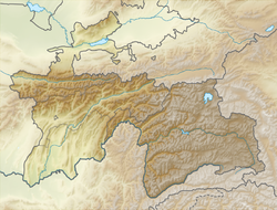
Kyzylsu (in the middle of the course - Shurobdarya [1] , in the upper Mullokoni [1] ) - the right tributary of the Pyanj river in the Khatlon region of Tajikistan . The border with Afghanistan runs along a small estuarine site. Length 230 [2] km, basin area 8630 [2] km².
| Kyzylsu | |
|---|---|
| Characteristic | |
| Length | 230 km |
| Pool | 8630 km² |
| Water consumption | 75 m³ / s (58 km from the mouth) |
| Watercourse | |
| Source | |
| • Coordinates | |
| Mouth | Panj |
| • Coordinates | |
| Location | |
| Tajikistan | Khatlon region |
| Afghanistan | Tahar |
It originates in the southern spurs of the Vakhsh ridge. The average water discharge at 58 km from the mouth is 75 [2] m³ / s, suspended sediment 480 kg / s.
The food is snowy, flood from February to June, the maximum flow in April. Mineralization of water 500-800 mg / l in flood and 800-1000 mg / l in low water, the composition of sulfate-calcium. Used for irrigation. 14 intake channels.
Notes
- ↑ 1 2 Map sheet J-42-XVI . Scale: 1: 200 000. Indicate the date of issue / condition of the area .
- ↑ 1 2 3 Kyzylsu (river in the Tajik SSR) - an article from the Great Soviet Encyclopedia .