Blue Mountains - a wooded mountain range in the western part of the Prigorodny District of the Sverdlovsk Region , west of Nizhny Tagil . Near the ridge are the village. Baranchinsky , Sinegorsky , Serebryanka and Upper Oslyanka villages.
| Blue mountains | |
|---|---|
| Highest point | |
| Highest peak | Blue |
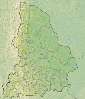
| Location | |
| A country |
|
| The subject of the Russian Federation | Sverdlovsk region |
| Mountain system | Ural mountains |

Content
- 1 Geographical location
- 2 Description
- 3 History
- 4 notes
- 5 Links
Geographical position
The Sinegorye ridge is located on the territory of the municipalities “ Kushvinsky urban district ” and “ Gornouralsky urban district ”, runs from north to south from the Kokuy river valley to the north to the Selivanovskoye swamp in the valley of the Mezhevaya Utka river to the south parallel to the Ural ridge , 5-6 kilometers west of it. The length of the ridge is 28 kilometers, and the height reaches 500-600 meters. The highest peak of the ridge is Mount Sinaya with a height of 600.1 meters in the central part. Other peaks are Mount Sedlo with a height of 482.5 meters 11 kilometers north-northwest, Mount Boltun with a height of 544.3 meters 7 kilometers to the north, Mount Klyktan with a height of 576.2 meters, 2 kilometers to the south, Mount Pozharishche with a height of 506.1 meters, 13 kilometers to the southeast. The ridge is covered mainly by forest, and on the peaks there are stone placers, rock outcrops up to 30 meters high. In the southern part, on the Sinaya Gora pass (height 507.0 meters), the Nizhny Tagil - Serebryanka highway passes. In the vicinity is the village of Sinegorsky , 3 kilometers east of the pass [1] .
Description
The highest peaks: the mountains of the same name Sinaya (near the village of Baranchinsky ) and Sinaya (near the village of Sinegorsky ).
A blue mountain 552 meters high near the village of Baranchinsky is a geomorphological, geological, archaeological and botanical natural monument of the Sverdlovsk region. There are rare plants listed in the Red Book of the Middle Urals, and at the top is a relay television tower [2] .
Blue Mountain 600.1 meters high near the village of Sinegorsky - a mountain with picturesque rocky outcrops, near which the border between Europe and Asia passes. At the Sinjaya Gora pass (on the old Serebryansky tract, which continues the main Sinegorsky street), there are the Stolb and Kamennye Vorota rocks , and somewhat to the south, the Korablik rocks [3] .
History
The toponym Blue Mountain may have arisen due to the fact that the mountain has a bluish tinge of local quartzites in some places or it seems blue from afar [3] .
Notes
- ↑ Rundqvist N., Zadorina O. Sverdlovsk Region. From A to Z: Illustrated Local History Encyclopedia . - Yekaterinburg: Quist, 2009 .-- 456 p. - ISBN 978-5-85383-392-0 .
- ↑ Pavel Raspopov. Mount Sinaya near Baranchinsky // UraloVed.ru. - 03/27/2017.
- ↑ 1 2 Pavel Raspopov. Blue Mountains and the Ship near the village of Sinegorsky // UraloVed.ru. - 03/05/2015.