Rukva is a closed lake located in the south-west of Tanzania between the lakes of Tanganyika and Nyasa . This shallow salt lake with a basin area of about 80,000 km² is part of the Rukva ecosystem around Katavi National Park [1] .
| Lake | |
| Rukva | |
|---|---|
| Swahili Rukwa | |
 Rukva Lake, NASA image | |
| Morphometry | |
| Absolute height | 792 m |
| Dimensions | 150 × 25-30 km |
| Square | 2600 km² |
| Average depth | 3m |
| Location | |
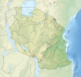
| A country |
|
Physico-geographical characteristics
The lake is located in the Albertin rift valley at an altitude of 792 meters. In the southeast, it is bounded by the Mbeya ridge, in the west by the slopes of the escarpment of Ufipa and Mbizi , which reach 2664 meters in height, rocky cliffs reaching 1707 meters on Mount Sange are located in the northeast [2] . According to TSB, the lake can reach 150 km in length and 25-30 km in width; in dry seasons, the lake almost completely dries out [3] . In 1929, the length of the lake was about 50 km, and in 1939 reached 130 km with a width of 40 km [4] . Studies of 1996 provide the following data: the length of the lake is 165 km, the width in the northern part is 37 km, and the maximum width is 48 km [2] .

The lake has several large tributaries. The rivers Lupa, Chambua, and Songwe Rivers flow from the Mbeya mountains and flow into the lake in the south, the Rungwa river feeds the lake from the north, and Momba from the west. In addition, during the rainy season there are a number of temporary rivers. During floods, the lake is a single pool, but when it dries, it is divided into two parts of different sizes and levels. The maximum depth of the southern basin is reached in its eastern part and is 10-15 meters. The northern basin is smaller and sometimes dries completely. The depth of the swamp located between these two basins usually does not exceed one meter. The lake has a high concentration of sodium , alkaline water ( pH from 8.0 to 9.0) [2] .
The region is characterized by a humid tropical climate with the rainy season from October to April. The amount of annual precipitation varies from 650 mm in the south to 900 mm in the north and about 2500 mm in the Ufip mountains, in which precipitation can occur from May to October. In the southern part of the system, the temperature ranges from 12.7 ° C to 28 ° C, with an average annual temperature of 21C. The surface temperature of the lake ranges from 20 ° C to 35 ° C [2] .
Flora and Fauna
Papyrus ( Cyperus papyrus ) and reeds ( Phragmites mauritianus ) grow in the lake and the marshes around it. Around the lake, floodplain meadows dominate with low salt resistant grasses such as Diplachne fusca, Sporobolus spicata and Sporobolus robustus ( cereals ). Acacias predominate along the tributaries of the lake [2] .
There are more than 60 species of fish in the ecosystem of the lake: pecilia ( Aplocheilichthys ) and cichlids ( Haplochromis genera ), young barbs , and African sabrefish ( Chelaethiops rukwaensis ) are widespread in the coastal strip, wetland deltas of a number of rivers are the habitat of oreochromis and tilapia , important elements of commercial fishing on the lake, the rocky eastern part of the lake is less populated than the rest, but there is a labeo ( Labeo cylindricus ). Typical river fish, such as Amphilius jacksonii , Leptoglanis rotundiceps, and Chiloglanis trilobatus (all from the catfish order) are found in the Pitia River [2] .
On the shores of the lake, pink pelican ( Pelecanus onocrotalus ), loaf ( Plegadis falcinellus ), Spurgeon goose ( Plectropterus gambensis ), white-winged swamp tern ( Chlidonias leucopterus ) and African water-cutter ( Rynchops flavirostris ) are found on the shores of the lake. In 1995, large colonies of large white pelicans and white-winged swamp terns were recorded [2] . The main studies of the bird population date back to the 1950s, while more than 350 species of birds lived on the lake, of which eight were specially protected [5] . Other representatives of the fauna of the region are water mongooses ( Atilax paludinosus ), otters ( Lutra maculicollis and Aonyx capensis ) and hippos ( Hippopotamus amphibius ) [2] .
Discovery History
Scottish explorer Joseph Thomson, who explored the area between the Nyasa and Tanganyika lakes and saw the outlines of the lake in 1880, is considered to be his discoverer [4] [6] . Here is how he describes what he saw [7] :
We had the pleasure of being the first to see a curious lake, called differently both Rukva, Likva, and Hikva, and which had many outlines in the imagination of travelers and geographers, and which now has the freedom to be called Lake Leopold. We observed it from 8,000 feet above sea level, its surface lay more than half this height below us, and the mountains were so perfect precipices around it that it seemed like stone could be thrown at them.
Original textWe had the pleasure of being the first to see that curios lake, named variously Rukwa, Likwa, and Hikwa, which had assumed so manys in the fancy of different travelers and geographers, and which have now taken the liberty to call Lake Leopold. We saw it from an altitude of about 8000 feet above the sea, its surface lying more than half that height beneath us, and the mountains in such perfect precipices all round that it seemed as if we could throw a stone into it.
Notes
- ↑ Lake Rukva . utalii.com. Date of treatment May 3, 2010. Archived April 24, 2012.
- ↑ 1 2 3 4 5 6 7 8 Lake Rukva (English) (unavailable link) . Freshwater Ecoregions of the World. Date of treatment May 3, 2010. Archived April 24, 2012.
- ↑ Lake Rukva // Great Soviet Encyclopedia : [in 30 vol.] / Ch. ed. A.M. Prokhorov . - 3rd ed. - M .: Soviet Encyclopedia, 1969-1978.
- ↑ 1 2 Lake Rukva . Encyclopedia Britannica . Date of treatment May 3, 2010. Archived April 24, 2012.
- ↑ Rukva Lake at Birdlife International
- ↑ Joseph Thomson // Great Soviet Encyclopedia : [in 30 vol.] / Ch. ed. A.M. Prokhorov . - 3rd ed. - M .: Soviet Encyclopedia, 1969-1978.
- ↑ The Lake Rukwa Expedition, 1938 (Eng.) // Geographical Journal. - 1939. - Vol. 94 , no. 5 . - P. 368-387 .