Misima is an island in the Pacific Ocean . It is the territory of the state of Papua New Guinea . It is administratively part of the Milne Bay province of the Papua region.
| Mishima | |
|---|---|
| English Misima | |
 | |
| Characteristics | |
| Area | 202.5 km² |
| Highest point | 1036 m |
| Population | 5,000 people |
| Population density | 24.69 people / km² |
| Location | |
| Archipelago | Louisiana Islands |
| Water area | Pacific Ocean |
| A country |
|
| Region | Papua |
| Area | Milne Bay |
Content
- 1 Geography
- 2 History
- 3 population
- 4 Economics
- 5 notes
Geography
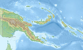
Mishima is a large island that is part of the Louisiana Archipelago and washed by the waters of the Pacific Ocean . The nearest mainland, Australia , is approximately 1050 km away. Mishima is located at the northwestern tip of the Vanatinai Barrier Reef, approximately 200 km southeast of the island of New Guinea [1] . Like most islands in the archipelago has a mountainous topography and is covered with dense vegetation [2] .
From the point of view of geology, has a volcanic origin [3] . Mishima Square is 202.5 km², and the highest point, Mount Koya Tau, reaches 1036 m [3] . The island is about 40 km long and 10 km wide [1] .
The climate on the island is humid tropical [3] .
History
The European explorer of the island was the French traveler Joseph Bruni D'Antrkasto , who discovered the island in 1793 [4] .
In 1888, the formal annexation of the Louisiana Islands, as well as the Mishima Islands, by the British Empire followed, which became part of British New Guinea (since 1904 - Papua Territory under the control of Australia ). [5]
In the late 1890s, gold deposits were discovered on Misima. Their active development began already at the beginning of the 20th century , and from 1990 to 2001 gold was mined by the open pit [1] .
Since 1975, Mishima has been part of the independent state of Papua New Guinea . [5]
Population
About 5000 people live in Misima. The largest settlement is Bwagaoia.
Economics
The main occupation of local residents is agriculture ( copra production) [1] . There is a runway [3] .
Notes
- ↑ 1 2 3 4 Misima Island Encyclopædia Britannica. 2010. Date of treatment May 2, 2010. Archived April 24, 2012.
- ↑ Misima . Oceandots.com. Date of treatment May 2, 2010.
- ↑ 1 2 3 4 Island Directory. Islands of Papua New Guinea . UN SYSTEM-WIDE EARTHWATCH Web Site. Date of treatment May 2, 2010. Archived April 22, 2012.
- ↑ Max Quanchi; John Robson Historical Dictionary of the Discovery and Exploration of the Pacific Islands. - Lanham, Maryland; Toronto; Oxford: The Scarecrow Press, Inc., 2005 .-- P. xv. - ISBN 0810853957 .
- ↑ 1 2 Stanley J. Ulijaszek. Population, Reproduction and Fertility in Melanesia. - Berghahn Books, 2008 .-- P. 92. - 256 p. - ISBN 1845452690 .