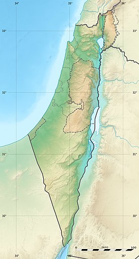
Dolina Timna is a depression located in the south of the Arava desert , 25 km north of Eilat . This depression, shaped like a horseshoe , covers an area of approximately 60 km² [1] and is surrounded on three sides by sheer cliffs. From the north, its border is the drying stream of Timna, and from the south - Nekhushtan, flowing from the side of the Arava desert in the east. In the center is Mount Timna, 453 meters high. The climate here corresponds to the harsh desert climate.
| Timna Valley | |
|---|---|
| Heb. בקעת תמנע | |
 Solomon's Pillars | |
| Specifications | |
| Absolute height | 453 m |
| Square | 60 km² |
| Location | |
| A country |
|
| Region | Arava |
A man appeared in the Timna Valley as early as the Neolithic , since there are reserves of copper .
It is in Timna that there are copper mines , called the “ Mine of King Solomon .” All other copper mines mentioned in the literature under this name, as it turned out, are fictitious, and only copper mines in the Timna Valley really existed.
Content
History
Geology
The Timna Valley originated millions of years ago as a result of the formation of the Syrian-African Fault . As a result, rocks and numerous minerals , such as copper , iron , manganese , etc. were exposed. The rocks here are composed of a wide variety of rocks - volcanic, igneous , sedimentary and sandstones of various colors .
Timna Valley is located in the northern part of the Arab-Nubian tectonic plateau , formed at the end of the Precambrian era [2] . The crystallization processes of magma in Timna led to the formation of hard rocks, including varieties of granite . The gradual elevation of the region, occurring about 550 million years ago, was accompanied by intense erosion , which led to the exposure of even more ancient igneous layers. In the upper layers of the exposed rocks, the soil was washed away by river flows flowing from east to west. The sand formations remaining on the surface as a result of the movement of water flows almost completely disappeared at the beginning of the Cambrian period , which led to the exposure of dolomites and sand shales , which are currently found in the upper part of Mount Timna and in the channel of the Timna River. These rocks were stratified as a result of the influx of ocean waters to the Eilat region during the Lower Cambrian . In addition to the formation of other rocks, layering of copper occurred precisely in the Cambrian era [3] .
Then a long period of weathering and erosion began, and about 320 million years ago ( Carboniferous ), the process of layering of white sandstone and numerous minerals resumed, the deep penetration of which into sandstone and other rocks led to the formation of various colors on the surface.
Very thick sedimentary layers, including up to 800 meters thick, and a large number of marine minerals in the rocks, including ammonites , indicate that the region was in the past under the waters of the Tethys Sea . The sea, approaching from the northwest, reached Timna about 100 million years ago ( Cretaceous period ) and covered the surface of the region until the Paleogene era (40 million years ago). During this period, massive layering of chalk , dolomites , limestone , clay , phosphorites , etc., the process of elevation of the entire region led to the gradual retreat of Tethys , which occurred at the end of the Paleogene - Paleocene . Sedimentary rocks were exposed to the surface and a long erosion process began, which covered most of the continental rocks located at the top of the underwater layers. Most of the cliffs and slopes formed in Timna are the most extreme formations located on the edge of the Syrian-African fault , which began to form 20 million years ago ( Neogene ) and continues to change until now [4] . The raising and splitting of plates and rocks led to the formation of massive Slopes east of Timna [5] . It is believed that the fault process began only 5 million years ago at the time of the end of the Neogene . The constant "subsidence" of the Syrian-African fault and the Arava Valley led to the exposure of sedimentary layers on the banks of the Timna and Nekhushtan rivers. The geology and topology of the area, as well as climatic conditions, are a continuous source of changes in the surface of the valley, erosion of river channels and changes in the topography of the area [6] .
Copper Mining
Copper was the first metal on earth that man began to process and use for the manufacture of tools , weapons , household utensils, jewelry and religious supplies. In Timna, traces of copper mining and processing were found at all stages of these processes.
Although copper mining in the Timna Valley was known in ancient centuries from studies conducted at the end of the 19th century , scientific attention and great public interest were attracted in the 30s of the 20th century by the works of Nelson Gluck , who connected copper mining here with King Solomon ( X century BC ) named this place the Mines of King Solomon. A later study showed that this site was not used during the X century BC. e., that is, during the time of King Solomon, copper was not mined here. [7] However, the expression “ Mines of King Solomon ” is associated with this place.
Archaeological studies show that copper mining began in the late Neolithic period [8] and continued almost without a break into the Middle Ages [9] . Copper mining in the Timna Valley peaked during the reign of the Pharaohs of the 18th and 19th Egyptian dynasties, spanning the XIV-XII centuries BC, when the Egyptians conducted mining and copper mining in collaboration with the Midianites and local Amalekites , turning the Timna Valley into a large copper mining center [10] . Bringing with them deep knowledge about the ore business, the Egyptians used metal chisels and hoes, and cut through them the tubular shafts of the correct form, on the walls of which they knocked out leg supports. Going down into these mines, the Egyptians mined copper, lying at a depth of about 30 meters.
The first aerial photographs of the region, as well as surveys of the area in the 20th century, showed the presence of thousands of white dots with a diameter of about 80 centimeters, later called "plates", filling the entire Timna Valley. The purpose of these "plates" remained unclear until the start of archaeological excavations, when it was discovered that the "plates" are nothing more than round mines, eventually covered with sands and going deep to 35 meters. The initial opinion of scientists was that these mines are water wells, but over time it became clear that these vertical mines were the way the ancient Egyptians looked for accumulations of copper ore deposits in the region. A similar method of prospecting for copper and other ores is known from many other regions of the world, but all of them belong to later periods. Thus, it became known that the copper mines in Timna are the first evidence of the extraction and search for copper ores in this way, if not the first evidence of the extraction of copper by man on earth.
Copper mining after the establishment of the state
The copper mining process resumed after the creation of the State of Israel , and in 1951 new mines were founded, the task of which was the extraction of copper for commercial purposes. In 1954, the enterprise was founded as a subsidiary of the state structure for the development of mineral resources, and in 1959 it began mining copper in ten open pits and closed mines using modern heavy equipment. The mines were wide enough to accommodate and pass special equipment. About 50 kilometers of underground tunnels were laid in these mines, at several levels branching from open pits. The southern branch of the mines was connected to a vertical elevator system with which copper ore was extracted to the surface.
Currently, after the cessation of mines and stopping the pumping of groundwater , most of the underground mines are filled with groundwater.
In the mines, during their years of operation, about 1.1 million tons of copper ore were mined per year. In the 60s and 70s of the 20th century , about 1000 people worked in the Timna mines, who served as a source of income for this production, and this was an important production facility in the southern region of Israel, which also gave a serious impetus to the development of Eilat as the residence of most mine workers and quarries.
In 1976, Timna’s copper mines were first closed due to financial losses of the mining company due to a strong drop in world copper prices. In 1980, an attempt was made to resume the extraction of copper in Timna, as well as expand the area of activity in the direction of the extraction of manganese ores . This attempt was unsuccessful, and the mines were finally closed in 1983 .
Copper mining was carried out in several stages: development and extraction of ore to the surface, its delivery to grinding equipment, mixing and dissolution of copper in sulfuric acid . As a result, copper sulfate (CuSO 4 ) was formed, and the remainder of ore slag was deposited in seven special sedimentary basins, after which it was exported as waste in the Arava region. Copper sulfate was then transferred to special baths, in which scrap metal , which bound sulfur, was placed. Copper was disconnected from sulfur and deposited at the bottom of the pool in the form of cement , the content of pure copper in which was up to 83%. After draining the pools in the sun, copper remained at the bottom, which was collected and sent abroad for separation by the electrolytic method . Copper production reached 16,000 tons per year.
In recent years, renewed attempts to use the natural resources of Timna. In 1997, on the basis of the existing production, a small copper processing plant was founded with the aim of producing copper sulfates for use as agricultural fertilizer and an ingredient in agricultural feed [11] . Also, aluminum is processed at this enterprise and various compounds are produced with its use [12] .
Timna Park Attractions
In the valley is Timna Park; Due to the unique natural data of the area, this is a famous tourist attraction in Israel. Tourism is promoted by many attractions of natural origin and ancient history - ancient copper mines , cave paintings, unique stone compositions, as well as objects erected in the park in recent years.
Given Timna’s proximity to Eilat , numerous travel agencies offer, among other things, excursions to Timna Park. For travel operators and agencies, Timna is, of course, a “ brand ” that is actively cultivated among visitors to Eilat and the Dead Sea . The park has planned various routes for visiting attractions, as well as entertainment programs for adults and children, such as pedaling boats on the lake or filling bottles with colored sand.
Solomon Poles
Solomon's pillars are one of the most significant attractions of Timna Park. Solomon's pillars are part of a stone rock. They were formed naturally as a result of erosion of hard red sandstone . They got their name in honor of King Solomon . King Solomon, who built the First Temple according to the command of God given Moshe , gave names to two bronze columns at the entrance to the Temple - Boaz and Yakhin [13] . Yakhin was the son of Simeon and grandson of Jacob , and Boaz was the great-grandfather of King David , the nephew of Elimelech . It is these columns (pillars) that are called the Solomon Pillars, and the colossal rocks in Timna - embody and personify the power of these most important elements of the Temple .
Temple of the Goddess Hathor
Temple of the Goddess Hathor , built at the end of the XIV century BC. er during the reign of the Egyptian pharaoh Seti I , is located near the Solomon pillars. The temple is built in a low stone wall, which closes the room adjacent to the rock, made of white sandstone and granite, in the form of an open courtyard and has dimensions of about 15 x 15 meters. The steps of the temple lead to a rock engraving depicting Ramesses III presenting gifts to the goddess Hathor. In Egyptian mythology, Hathor is the goddess of heaven, love, femininity and beauty, as well as the wife of Horus . Originally considered the daughter of Ra . Hathor - “Goddess of Mines”, “Woman Hawk”, “Goddess of Love”, “Turquoise” Goddess, keeping from the evil eye . [14] . Among other patrons, Hathor was considered the patroness of miners and treasure seekers, this is one of the main reasons why the Hathor temple was erected in Timna [15] .
The temple was seriously destroyed by an earthquake and rebuilt during the reign of Ramses II with a larger yard and a white stone floor. The walls were built of sandstone and granite available at the site, and the facade was built of white sandstone brought from the mine zone. The temple, with its two square columns bearing the heads of Hathor, was to be a spectacular sight in the light of the rising sun. In the courtyard of the temple there was a small workshop for casting copper figures and products that served as part of the rites of sacrifice . Among the finds in the temple were hieroglyphic inscriptions, including cartouches (seals) of most of the pharaohs who reigned in the XII-XIV centuries BC. Numerous elements of acts of sacrifice made by the Egyptians were also discovered, including various copper products, vessels made of alabaster , figurines of cats and leopards made of faience , seals , beads and scarabs made of stone and copper, as well as statuettes, tablets and sculptures of Hathor. In total, several thousand artifacts were discovered in the Egyptian temple [16] .
With the fall of Egyptian rule over the region in the middle of the 12th century BC, the Hathor temple was abandoned along with the mines of Timna. However, religious activities in the temple were restored by the Medes , who remained in Timna for a short period after the departure of the Egyptians. They destroyed the traces of the Egyptian cult and erased the images of Hathor and the Egyptian hieroglyphic inscriptions on the steles. Other changes were also made: a number of steles were installed and “benches of proposals” were built on both sides of the entrance. The remnants of wool found along the walls of the courtyard provide evidence that the Medes turned the Egyptian temple into a campground in the desert. Among the finds in this Mussel temple there were a large number of household items and religious attributes delivered directly from Media , including beautiful jewelry made of ceramics and metal. The finding of a copper snake with a gilded head is of particular importance. This recalls the brass serpent described in the Book of Numbers :
| And the Lord said to Moses: Make yourself a serpent and set it on a banner, and stinged, looking at it, it will remain alive. And Moses made a copper serpent and set it on the banner, and when the serpent stung a man, he, looking at the copper serpent, remained alive. ( Num. 21: 6-8 ) |
Dungeons of Time
A multimedia performance with a rotating stage and screens that clearly illustrates the historical and cultural background of Ancient Egypt in Timna thousands of years ago, the missions of the Egyptians, the ancient gods, etc. The oldest region is represented in 7 video films and in a huge colorful diorama of 80 square meters. m., with numerous technical and stereo effects. Spectators are directly involved in stories, solving charades and puzzles of ancient history: where did the Copper Snake come from? Who are they ancient gods? Temple of the Goddess Hathor, the cult of copper, etc.
Performances are held in a separate building specially equipped for this purpose at the entrance to the park. The duration of each performance lasts about 15 to 20 minutes.
Arches
Sandstone arches are another manifestation of the inexhaustible imagination of nature itself. Near the arches you can find traces of the oldest copper mines in the world. Copper is the first metal on earth that man began to mine and use.
"Observer", "hanging" stone, a lying lion
This is a “ composition ” of rock, forming three figures, one of which resembles the silhouette of a lying lion , the other is a silhouette of a man watching the park, and between them there is a rock in the form of a stone, as if hanging or standing on one point or soaring in the air . Like the other forms and silhouettes of the park, these “ sculptures ” were formed as a result of rock erosion . An interesting fact is that when you look at the composition not from the western , but from the eastern side, the rock “Observer” has the shape of the Sphinx , and on some maps of the park it is indicated by this name.
Timna Lake
This is an artificial lake formed by groundwater lying in sandstone layers. In the "mines of Timna", where copper was mined from the bowels of the earth, these waters were pumped out until the eighties of the XX century , so that they would not flood the mines, and now - to fill an artificial lake. It serves as a constant source of water for both animals and tourists, like an oasis in the desert .
Lake area - 1.4 ha
The capacity of the lake is 20,000 cubic meters
The water in it is unsuitable for drinking and swimming. Visitors are offered a wide selection of entertainment and activities.
Lake Timna is a center of entertainment for the whole family. For children, there are various types of active activities: riding on the lake in pedal boats, filling bottles with colored sand, playing facilities, watching a video, deciphering ciphers, demonstrating copper mining and making coins in Nehostimna. And also a relatively new attraction: you are given a bottle, and you yourself fill it with layers of multi-colored sand, and then slice a piece of clay, which you can give the appearance of any figure to your taste and your talent.
Rock carvings
The park has rock paintings ( petroglyphs ) from the time of the presence of the Egyptians in the region. As part of the project for the conservation of cave paintings, some of which are painted on relatively not quite stable walls, Ben-Gurion University in the Negev, together with the Israel Antiquities Protection Service, launched a project to study and preserve those parts of the park that contain cave paintings. In the framework of the project, one of these walls was equipped with special sensors, the purpose of which was to detect whether there is movement of the wall and whether there is a danger of its collapse.
The project was launched in 2010, data will be collected during the year, and then, on their basis, a decision will be made on further actions.
Screw Hill
The “helical” hill got its name thanks to the spiral staircase, diagonally encircling it and giving it the shape of a screw. It is a vivid example of a great variety of unique shapes and shapes formed as a result of erosion , acting differently on different layers of the same rock. Therefore, often these layers are at different angles to each other. Walking paths lead from Winding Hill to the "mushroom rock" and to the valley of cave paintings.
Mushroom
Fantastic rock formed due to erosion of red sandstone . Since erosion of the lower layers proceeded more quickly, a “hat” was formed on top, resembling a large mushroom in shape. Nearby is a visitor center where you can familiarize yourself with the history of the settlement of ancient Egyptian miners, once built at the foot of a cliff.
Tabernacle Layout
Not far from Lake Timna is a life-size copy of the Tabernacle , built in recent years. The tabernacle was built by Moses (Moshe) at the behest of God for the purpose of storage and transfer of shrines during the Exodus from Egypt and travel to the Holy Land .
| And they will build me a sanctuary, and I will abide among them [17] ( Exodus 25: 8 ) |
The main and most important purpose of the Tabernacle is based on the name "Mishkan", that is, the Tabernacle is the place where the Glory of God abides on earth, among the people of Israel. According to the book of Exodus , Moses received the command to build the Tabernacle on Mount Sinai , even before receiving the Tablets of the Covenant . This command is given in the Torah in its entirety, with a large number of details and occupies about 7 chapters ( Exodus 25–31 ).
The construction of the Tabernacle and its components required fifteen different materials:
| And here is the offering that you take from them: gold, and silver, and copper; and sinet [18] , and purple [19] , and scarlet [20] , and fine linen [21] , and goat hair, and red sheep skin, and tahash skin [22] , and shittim trees [23] , spruce [24] ] for lighting, potions for anointing oil and for incense, onyx stones and inserted stones for ether and for a breastplate. ( Exodus 25: 3-7 ) |
The layout of the Tabernacle in Timna, although it was not built from the materials indicated in the Torah , was built in full size and corresponds to the biblical description in all other respects. Inside the Tabernacle are various objects of religious paraphernalia — mikvah , menorah , etc. Also in the Tabernacle is an imitation of the ark , inside which are the Tablets of the Testament with the Ten Commandments - the Holy of Holies of the Jewish people .
Plant and Animal World
In the Timna Valley and its environs there is a wide variety of mammals, birds, reptiles of many species. Nevertheless, the flora of the region is scarce due to severe climatic conditions and insufficient moisture [25] . Below are the most striking representatives of the animal and plant world of the Timna Valley and its environs.
Acacia Acacia
Acacia is the most common tree in Timna Park and southern Israel . Her flowers look like small yellow balls, from which grow fruits in the form of twisted pods . The trunk , branches and leaves of the tree are the most important source of subsistence for animals living in the region. Seeds are distributed with the excrement of mammals .
Desert Wolf ( Latin Canis lupus )
Thanks to the warm climate, wolves are small in size and fairly light in weight (on average no more than 20 kg). In the past, they sought solitude, but eventually began to gather in small flocks, thanks to human intervention and an abundance of food. The average lifespan of wolves is approaching 4 years.
Mountain Goat ( Latin: Ibex )
Belongs to the family of wild goats and is mentioned in the Torah under the name "Yael." Refers to gentle ruminants . Short strong legs allow this animal to easily climb steep rocks. Males can be distinguished by a beard and spreading horns, and females - by shorter and graceful legs and, accordingly, the absence of a beard.
Mourning Kamenka ( lat.Oenanthe lugens )
Most common among white and black heaters in the Israeli deserts. The forehead, head and neck of this bird is white, and the cheeks, neck, throat and wings are black. Belongs to the flycatcher family .
Funding and Donation
The maintenance and development of Timna Park is carried out both at the expense of the state, and through donations, the main source of which is the Jewish National Fund .
Participating in numerous works and projects undertaken over the years to preserve the natural resources of Israel, the Jewish National Fund has always played a major role in the planning of the park and its development. Historically, culturally and archaeologically, the Timna Valley is one of the most unique treasures in the world, the preservation of which is worth the millions of investments that the Jewish National Fund has invested to date. Most of the donations for the study and preservation of the park were made by a philanthropist from Milwaukee and a long-time supporter of the Jewish National Fund Avrum Chudnov , whose vision and perseverance made it possible to carry out the first phases of the development of Timna Park.
The Jewish National Fund recently completed the third phase of the development of Timna Park with a total value of $ 4 million - an interactive exhibition on how copper products were made, the places where it was discovered, and Timna’s relationship with King Solomon . The third phase of the project was funded in the amount of $ 2 million through a grant from Avrum Chudnov, as well as additional donations for the same amount. Being the first place in the world where copper was discovered by mankind, Timna occupies a special place in the history of southern Israel [26] .
Infrastructure
Roads and Routes
The park has good roads with asphalt pavement, periodically updated in many areas. Through all roads you can reach all the main excursion points of the park by car. Jeeps and other cross-country vehicles are prohibited. In all places where asphalt roads are not laid, there are special walking routes marked with special marks along the edges of the routes indicating the turns and directions of movement.
Recommended Routes
Recommended Car Routes
A trip from the park entrance to the mushroom rock, the Solomon pillars and the Hathor Temple.
From the Temple, the route can end at Lake Timna, where various events for park visitors and a large car parking are organized.
Roads are also laid to the Arches and cave paintings.
Recommended Walking Routes
At the beginning of each of the recommended routes in the park there is a blue box with detailed information sheets about the route itself and safety measures for visitors along the route. In total, the park has more than 25 recommended routes [27] , information on each of them, as well as rules and instructions for travelers, can be obtained at the information center located at the entrance to the park.
Route "Big Arch"
- Description: from the Big Arch, the road runs through a sandy gorge to an Egyptian cave , and from there to a panoramic platform and copper mines .
- Level of difficulty: easy.
- Duration: about an hour.
Route " Gorge Khorod"
- Description: Timna riverbed , cave of Roman soldiers, Khorod Gorge.
- Level of difficulty: easy.
- Duration: about three hours.
Route "Paradise Landscapes"
- Description: wadi , "copper river", walks.
- Level of difficulty: easy.
- Duration: optional.
Route "Overview of Arava"
- Description: the beginning of the route at the entrance to the park, the route is marked in black. The path runs along the wadi riverbed with a gradual ascent to the mountain. From the highest point, a bewitching view (especially in the afternoon) of the kibbutz Elifaz , the kibbutz Yotvata and the Timna valley itself opens up. At the top of the cliff where the route ends, there is a place for observation for a group of no more than 10 people.
- Level of difficulty: medium - heavy.
- Duration: about 1.5 hours.
Recommended Cycling Routes
Cycling is the best alternative to car trips through the territory of Timna Park, however, it is recommended to use this method for people with experience in cycling and well-trained, as the conditions in the park are considered difficult, primarily due to the high temperature, and Cycling routes often go from paved roads to rough terrain. Bicycles can be rented near the Lake, or travel with your own.
Route Around Timna Park
- Description: The route begins near Wadi Timna, along the blue-marked walking route, then - Winding Hill, Rock Carvings, Mushroom. Then - the continuation of the path along the green walking route and exit onto the asphalt road towards the Solomon Pillars. Bicycles are parked next to the Solomon Pillars, the journey continues on foot up between the Pillars to the Egyptian petroglyph depicting Pharaoh Ramses III , descent to the Hathor Temple, return to the bicycle parking area and continue cycling through Wadi Nehoshtan. The route ends with a view of the lake from above and a gentle descent to it about 400 meters long.
- Level of difficulty: medium - heavy.
- Duration: 2 to 2.5 hours.
Signs and signs
All road signs and road markings on the territory of the Timna Valley are set in accordance with Israeli law and are monitored by the police in accordance with the Traffic Rules . All available signposts to various attractions and infrastructure facilities are installed and maintained by the park.
Cleanliness in the park
Despite the relatively large number of tourists in the park, as well as the holding of evening and night events, cleanliness reigns throughout the territory of the Timna Park and the territory is well-groomed and landscaped.
The Timna Park is managed by the Israeli Agency for Nature and National Parks ( Hebrew - רשות הטבע והגנים) in conjunction with the Jewish National Fund . Since Timna Park belongs territorially to the local regional council of Hevel-Eilot , the services of this body also take part in maintaining and cleaning the park and ensuring order in its territory.
Tourism Activities
Timna Park is open to visitors from Sunday to Thursday and Saturdays from 8:00 to 16:00, and on Fridays - until 15:00, in July-August and the eve of holidays - until 13:00. Sometimes, by prior arrangement, evening and night excursions are held. Tourists most often get to the park by car on highway 90 . There is also a bus service between Eilat and Timna Park [28] .
Timna in Culture
The park and the Timna Valley are repeatedly found in works of prose and poetry , also in Russian [29] . One of the most famous literary works related to the mining of copper in Timna is Henry Ryder Haggard's novel, The Mines of King Solomon, written in 1885 [30] [31] . On this novel , films with the participation of movie stars were repeatedly shot, including in 1985 , with Richard Chamberlain in the title role, and a 2004 film with Patrick Swayze .
Photo Gallery
Solomon's Pillars
Arches
One and a half mushrooms
Lake in Timna Park
Cave drawings
The layout of the Egyptian mine in cross section
Mining plant in Timna. 1980
Temple of the Goddess Hathor
Underground Cave - Ancient Mine
Ore extraction mechanism
Copper ore mining tools
Tabernacle Layout
See also
|
|
Sources and notes
- ↑ Timna Park. solomon's Mines - north of Eilat, Red Sea Israel (link not available) . Archived on September 28, 2007.
- ↑ Israel Geography
- ↑ Geological timeline of the area (unavailable link) . Archived February 6, 2009.
- ↑ Geological map of the area (link unavailable) . Archived February 6, 2009.
- ↑ Israel - Topography
- ↑ Example of erosion in a region (Inaccessible link) . Date of treatment June 7, 2010. Archived on September 1, 2007.
- ↑ Parr, Peter J. (1974) Review of “Timma: Valley of the Biblical Copper Mines” by Beno Rothenberg. In: Bulletin of the School of Oriental and African Studies, University of London, Vol. 37, No. 1, In Memory of WH Whiteley; pp. 223-224
- ↑ בקעת תמנע (Hebrew)
- ↑ Timna - Valley of the Ancient Copper Mines
- ↑ Timnah unopened (inaccessible link) . Archived on September 19, 2010.
- ↑ TheMarker.com unopened (inaccessible link) . Date of treatment May 25, 2010. Archived March 12, 2007.
- ↑ TIMNA COPPER MINES - PRODUCTS
- ↑ King Solomon's Temple, Alex T. Brand (link not available) . Archived July 13, 2011.
- ↑ “The ancient Egyptian pyramid texts”, Peter Der Manuelian, Translated by James P. Allen, p432, BRILL, 2005, ISBN 90-04-13777-7 (also commonly translated as “House of Horus”)
- ↑ Spotlights on the Exploitation and Use of Minerals and Rocks through the Egyptian Civilization (Link not available) . Egypt State Information Service (2005). Archived on March 29, 2007.
- ↑ Timna: Valley of the Ancient Copper Mines
- ↑ Mossad Ha-Rabbi Kuk, Jerusalem, 1975. Translation - Rabbi David Yosifon.
- ↑ Wool dyed in sky blue
- ↑ Wool dyed in a color called purple
- ↑ Cochineal - the insect from which red paint was extracted ( Hebrew תולעת שני , “Tolaat Shani,” translation according to B. Podolsky's dictionary)
- ↑ Thin White Linen
- ↑ Tahash is an animal that was found only at that time (during the construction of the Tabernacle). It was multicolored, therefore in Targum the word is translated “sasgona”: it rejoices (sas) and is proud of its colors. The note is based on the interpretation of RASHI .
- ↑ Acacia - Heb. - “shita” - acacia
- ↑ olive oil
- ↑ Fauna of Israel on the website of the Israel Conservation Society
- ↑ Jewish National Fund: Timna Valley
- ↑ Map of routes in Timna Park . Archived July 26, 2006.
- ↑ Bus schedule for Timna Park
- ↑ Around the Solomon Pillars
- ↑ In Russian, first published in 1912 at the P. P. Soykin printing house in St. Petersburg
- ↑ Mines of King Solomon. Montezuma's daughter OZON.ru
Links
- The official website of Timna Park
- Detailed topographic map of Timna Valley with designation and description of routes
- The site of the Ministry of Tourism of Israel in Russian
- JM Tebes, “A Land whose Stones are Iron, and out of whose Hills You can Dig Copper”: The Exploitation and Circulation of Copper in the Iron Age Negev and Edom, DavarLogos 6/1 (2007)
- Official site of modern mines (English)
- Arava Mines (English) , (Hebrew)
- M. I. Agoshkov, G. M. Malakhov “Underground mining of ore deposits” (Nedra Publishing House Moscow 1966)