Manus [1] ( Eng. Manus Island ) - the main island of the Admiralty , a subgroup of the Bismarck archipelago . It covers an area of about 1940.2 km² [2] , the length of the coastline is 361.3 km. It is the fifth largest island of Papua New Guinea . Administratively refers to the Manus province of the Islands region.
| Manus | |
|---|---|
| English Manus island | |
 | |
| Specifications | |
| Square | 1940.2 km² |
| Highest point | 718 m |
| Population | 32 713 people (2000) |
| Population density | 16.86 people / km² |
| Location | |
| Water area | Pacific Ocean |
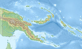
| A country |
|
| Region | Islands |
| Area | Manus |
Content
Geography
The island is part of the Admiralty Islands . The southern coast of the island is washed by the New Guinea Sea , the northern - by the Pacific Ocean . The island is located 274 km northeast of New Guinea and 285 km west of the island of New Hanover [3] . In the immediate vicinity are the islands of Los Negros and Tong (to the east), Low and Baluan (to the southeast) and numerous reefs and small sandy islands. The nearest mainland, Australia , is approximately 1050 km away. The length of the island from west to east is 103 km, the maximum width is 28 km, an area of 1940.2 km². The island is the fifth largest (after New Guinea, New Britain , New Ireland and Bougainville ) the island of Papua New Guinea [3] . The interior of the island is mountainous, overgrown with tropical rainforests. The highest point is Mount Dremsel, 718 m high. Most of the island is surrounded by coral reefs (passages are only on the south side).
Geologically, the island of Manus is of volcanic origin. The thickness of the crust beneath it is 25 km [4] . An island was probably formed in the Miocene , 8-10 million years ago. Volcanic activity persists near the island in the St Andrews Strait ( Baluan and Taluman volcanoes [5] [6] , the last eruption occurred in 1957 ).
The climate of the island is subequatorial [7] . Monthly average temperatures range from 22 - 32 ° С [8] . The flora and fauna of the island is very diverse. There are several endemic species, in particular the most beautiful snail papuina .
History
The island's European discoverer is probably the Spanish navigator Alvaro de Saavedra , who discovered it in 1528 . [9] In 1616, Dutch travelers Willem Schauten and Jacob Lemer sailed past Manus. [10] Then, until 1875, the island was not visited by Europeans. In 1912, the German colony of Lorengau was founded, in 1914 the island came under the jurisdiction of Australia [11] . During World War II , in 1942, Japan established a military base on the island, which was attacked and destroyed by US troops during the February-March 1944 operation. Then, an American military base was built in Ciadler Bay [12] . However, back in 1950-51, the Australian government carried out the sweeping of the island from Japanese criminal elements. In 1971, the island was the base of patrol boats of the Australian Navy [13] .
Population
According to the 2000 census , 32 713 residents in 127 settlements lived on the island [14] . The main city of the island is Lorengau , with a population of 5829 people. The basis of the economy is agriculture and fisheries . It mainly produces copra , cocoa , coffee and other agricultural products, mainly exported . [ten]
Notes
- ↑ Geographic Encyclopedic Dictionary: Geographic Names / Ed. A.F. Treshnikov . - 2nd ed., Ext. - M .: Soviet Encyclopedia , 1989. - S. 302. - 210 000 copies. - ISBN 5-85270-057-6 .
- ↑ United Nations Environment Program, " Islands by land area: Manus ," islands.unep.ch (1988).
- ↑ 1 2 Manus . www.oceandots.com. Date of treatment April 6, 2010.
- ↑ Aprodov, V.A. Volcanoes / Ed. V.E. Khaina, E.K. Markhinina, A.E. Svyatlovsky. - Thought, 1982. - S. 138, 139. - 367 p.
- ↑ Baluan Volcano . John Seach. Date of treatment April 6, 2010. Archived April 22, 2012.
- ↑ Tuluman Volcano . John Seach. Date of treatment April 6, 2010. Archived April 22, 2012.
- ↑ Islands of Papua New Guinea . UN SYSTEM-WIDE EARTHWATCH. Date of treatment April 6, 2010. Archived April 22, 2012.
- ↑ The Beautiful West Coast of Manus - travel-distinations profile (inaccessible link) . ManusIsland.com. Date of treatment April 6, 2010. Archived April 22, 2012.
- ↑ Max Quanchi; John Robson Historical Dictionary of the Discovery and Exploration of the Pacific Islands. - Lanham, Maryland; Toronto; Oxford: The Scarecrow Press, Inc., 2005 .-- P. xiv. - ISBN 0810853957 .
- ↑ 1 2 Manus Island . Encyclopædia Britannica. Date of treatment April 7, 2010. Archived April 22, 2012.
- ↑ Manus Island (English) (inaccessible link) . A&E Television Networks. Date of treatment April 6, 2010. Archived March 8, 2010.
- ↑ Manus Island (English) (inaccessible link) . pacificwrecks.com. Date of treatment April 6, 2010. Archived April 22, 2012.
- ↑ Kovalenko V.A., Ostroumov M.N. Directory of foreign fleets. - M .: Military Publishing , 1971. - S. 28. - 688 p. - 34,000 copies.
- ↑ Admirality Islands (Manus Island ) (inaccessible link) . pacificislandtravel.com. Date of treatment April 6, 2010. Archived April 22, 2012.