Pechegda is a river in the Bolsheselsky and Tutaevsky districts of the Yaroslavl region . Right tributary of the Volga .
| Pechgda | |
|---|---|
 River valley above the bridge on the Yaroslavl-Tutaev road River valley above the bridge on the Yaroslavl-Tutaev road | |
| Characteristic | |
| Length | 46 km |
| Pool | 328 km² |
| Water consumption | 2,50 m³ / s |
| Watercourse | |
| Source | |
| • Location | Waregovo swamp |
| • Height | 128-130 m |
| • Coordinates | |
| Mouth | Gorky reservoir |
| • Location | village Konstantinovsky |
| • Height | 85 m |
| • Coordinates | |
| River slope | 1 m / km |
| Location | |
| Water system | Volga → Caspian Sea |
| A country |
|
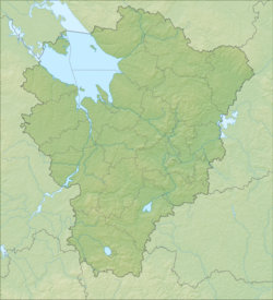
| Region | Yaroslavskaya oblast |
| Areas | Bolsheselsky district , Tutaevsky district |
| HWR code | |
Description
The river is 46 km long, the catchment area is 328 km² [2] . Together with the rivers Mogza , Pakhma , Vondel and Kurbitsa it forms a large hydrographic node of the Ilyinsko-Ramensky heights.
The source in the Varegovo swamp [3] (previously the source was located north of the village of Varegovo , located at the southern edge of the swamp, however, active peat extraction has been carried out in the swamp since the 1930s and is currently covered by a network of drainage channels in which the source of the river is lost) . It flows mainly to the northeast along the territory covered by coniferous and mixed forests, as well as through open and in some places swampy areas of land.
It flows through the village of Chebakovo . It flows into the Gorky reservoir in the village of Konstantinovsky [4] , flowing between residential areas and the Yaroslavl oil refinery . The mouth on the right bank is 2656 km from the mouth of the Volga.
The largest tributaries (left): Talitsa, Tsipinka and Likhovodka.
The basin also contains the settlements of Nikulskoye , Shelshedom , Sudilovo , Kayurovo and others.
The difficult environmental situation and violation of livestock husbandry standards in recent years have led to a depletion of river biocenosis and mass death of fish.
Hydrography
The river system of Pecgda includes 18 rivers. The nature of the food is mixed, with a predominance of snow. The average water flow rate is 2.50 m³ / s. The height of the source is 125 m above sea level.
The width of the river in the middle course is 10-15 meters, in the mouth part it expands to 30-40 meters. The color of the water is buffy, which, in particular, is due to the passage of the channel through loamy moraine deposits. In the area of the village of Chebakovo on the river is one of the 25 hydrological posts of the region.
Water registry data
According to the state water register of Russia, it belongs to the Upper Volga Basin District , the Volga river water sector from the Rybinsk hydroelectric complex to the city of Kostroma , without the Kostroma river from the source to the water gauge near the village of Isady , the river Volga river basin below the Rybinsk reservoir to the Oka River inlet. The river basin - (Upper) Volga to the Kuibyshev reservoir (without the Oka basin) [2] .
The water body code in the state water registry is 08010300212110000010538.
Notes
- ↑ Surface Water Resources of the USSR: Hydrological Understanding. T. 10. Upper Volga region / ed. V.P. Shaban. - L .: Gidrometeoizdat, 1966 .-- 528 p.
- ↑ 1 2 State Water Register . Pechgda . textual.ru . Ministry of Natural Resources of Russia (March 29, 2009). Date of treatment December 20, 2018. Archived March 29, 2009.
- ↑ Map sheet O-37-79 - FSUE GOSGISTSENTR
- ↑ Map sheet O-37-80 - FSUE GOSGISCENTER
Literature
- Atlas of the Yaroslavl region M .: AST-Press "Cartography", 2002.
- Rokhmistrov V. L. Small rivers of the Yaroslavl Volga. - Yaroslavl: VVO REA Edition, 2004.