Sarvanovskiy (also Vulsuol [1] [2] , Wunsuol - Kild. Vunn - Gulf, Suol - island [3] , Berezhnoy [3] , Sorvanovyh [3] [4] .) - island on the Kola Peninsula , Murmansk region , in water areas of Umbozer . The highest point of the island is 198 meters. Area - 2 km² [3]
| Sarvanovsky | |
|---|---|
| Specifications | |
| Square | about 2 km² |
| Highest point | 198 m |
| Population | 0 people (2008) |
| Location | |
| A country |
|
| The subject of the Russian Federation | Murmansk region |

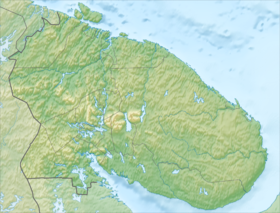
The island is located opposite the central part of the peninsula in the southeastern part of Umbozero, at a distance of only 180 meters from the coast near the mouth of Kitsa . The island has an elongated form from west to east with a length of 4.15 kilometers and a width of 2.3 kilometers in the west to 700 meters in the central part, being the largest island of Umbozero.
The island is hilly in the west ( hills up to 198 meters high) and flat to the east. The rocky beach of the west coast turns into a steep sandy cliff. Rare pine trees .
Sarvanovsky Island is used by the fishing industry. According to the law “On Fisheries and the Conservation of Aquatic Biological Resources” of January 1, 2009, the rest of the lake’s water area is in use by Khibinogorsky Rybak LLC, and Sarvanovskiy Island is in use by the SPK RK “Shoots of Communism” [5] .
You can get to the island by a country road from Kirovsk to the bridge over Kitsu. Previously, from Kirovsk, Umba station in the village of Oktyabrsky could be reached by train, but in 2007 the railway was demolished. The distance from the village of Oktyabrsky to the island along the road is about 24 kilometers.
An interesting fact is the presence on the island of a magnetic anomaly that knocks down the compass - the arrow instead of the north points to the southeast. [6]
History
In 1910, a Swedish ethnographer visited the island in order to obtain Lapar skeletons; for this, the ethnographer secretly dug up the Lapar cemetery on the island [1] [7] .
In the 1920s, the Sorvanov brothers ( Sami [3] ) lived on the island, having their herds of deer [2] .
Notes
- ↑ 1 2 Wiese V. Yu. Lopar Seids // Izv. Arkhangelsk Society for the Study of the Russian North. - 1912. - No. 9. - S.395-401; No. 10. - S. 453-459.
- ↑ 1 2 Fersman A.E. Traveling behind a stone. - M .: Publishing House of the Academy of Sciences of the USSR, 1960.
- ↑ 1 2 3 4 5 Wunsuol // Kola Encyclopedia . In 5 t. T. 1. A - D / Ch. ed. A.A. Kiselev . - SPb. : IP; Apatity: KSC RAS, 2008 .-- S. 437-438.
- ↑ Wunsuol // Geographical Dictionary of the Murmansk Region / ed. V. G. Muzhikov. - Murmansk: Murman. reg. Institute of Development Region. education, continuing education ped. Personnel, 1996. - S. 32. - ISBN 5-86975-023-7 .
- ↑ Virtual reception of the Governor of the Murmansk region - archive for 2009 (Inaccessible link - history ) .
- ↑ Tourism. Ru / The most comprehensive tourism reporting library
- ↑ N. Kharuzin. Russian Lapps, p. 192. (Bulletin of the Society of Lovers of Natural History, Anthropology and Ethnography, vol. LXVI).