Nortbruck is an island located in the southern part of the Franz Josef Land archipelago. The highest point of the island is 344 meters above sea level. This island is one of the most accessible islands of the archipelago.
| Northbrook | |
|---|---|
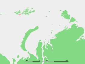 Northbrook Island on Franz Joseph Land Map | |
| Characteristics | |
| Area | 254 km² |
| Highest point | 344 m |
| Population | 0 pax (2010) |
| Location | |
| Archipelago | Franz Josef Land |
| A country |
|
| The subject of the Russian Federation | Arkhangelsk region |


Content
- 1 Island History
- 2 Geography
- 3 Adjacent islands
- 4 See also
- 5 notes
- 6 Topographic maps
Island History
In summer, the shores of the island covered with green moss are almost completely exempted from snow [1] , due to which it was often the main base of polar expeditions of the late 19th – early 20th centuries . Named after Earl of Northbrook , 1st Earl of Northbrook , who was president of the Royal Geographical Society from 1890 to 1893.
In 2006, information appeared that the island was divided into two parts. In 2013, during the expedition of the hydrographic service of the Northern Fleet, it was confirmed: the strait divided the western and eastern parts of the island [2] .
Geography
]
- The extreme northern point of the island is Cape Lagerny .
- The extreme eastern point of the island is the prominent Cape Barents , located in the southeast.
In the northwest of Northbrook, Myers Strait separates Bruce Island and Windward Island. From the east, the island is separated from Eton and the Etheridge Islands by the wide Strait of Bruyne . From the south, the island is washed by the open sea.
Adjacent Islands
- Robertson Island , a small island lying off the east coast of Northbrook Island. Named after Thomas Robertson , captain of the Scotia sailboat during the Scottish Antarctic expedition of 1902-1904 . Less than 1 km in length.
- Yuri Kuchiev Island is the segregated southwestern part of Northbrook Island [3] . It was discovered in 2008 by an expedition to the Yamal icebreaker [3] .
See also
- List of Islands of Franz Josef Land Archipelago
Notes
- ↑ Yandex. Cards
- ↑ "Hydrographs have confirmed the emergence of a new island in the Arctic" - ria.ru
- ↑ 1 2 “The island of Yuri Kuchiev is completely new” - www.prodam-ostrov.ru
Topographic maps
- Map sheet U-39-XXXI, XXXII, XXXIII George Land . Scale: 1: 200,000. 1965 edition.
- Map sheet U-39-XXXIV, XXXV, XXXVI about. Hooker . Scale: 1: 200,000. 1965 edition.
- Map sheet T-39-I, II, III . Scale: 1: 200 000. Status of the area for 1957.
- Map sheet T-39-IV, V, VI m. Barents . Scale: 1: 200 000. Status of the area for 1957.