Valek is a river in the vicinity of Norilsk , right tributary of the Norilsk River. Length - 69 [2] km. The basin area is 410 [2] km².
| Outrigger | |
|---|---|
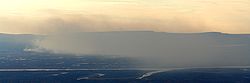 The confluence of Valka in Norilsk The confluence of Valka in Norilsk | |
| Characteristic | |
| Length | 69 km |
| Pool | 420 km² |
| Watercourse | |
| Source | |
| • Location | Valek Range |
| • Height | 760 m |
| • Coordinates | |
| Mouth | Norilsk |
| • Height | 29.1 m |
| • Coordinates | |
| Location | |
| Water system | Norilsk → Pyasino → Pyasina → Kara Sea |
| A country |
|
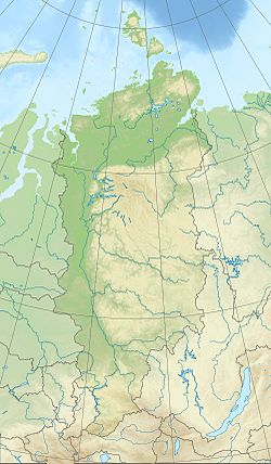
| Region | Krasnoyarsk region |
| HWR Code | |
The river got its name from the expedition of Urvantsev by the name of a new type of fish found in its waters [3] :
In the evenings, people come to us to “guest”, to drink tea with dryers our shepherds. We ask which rivers flow into Norilsk. Kostya told us that, in addition to Listvyanka and Elova, another river flows into it, in which it is caught round like a whale. His fishermen call him a roller ... According to him, the river was named Valek. Now it is against the village Valek .
Content
Basic data
The source of Valka is located in the area of the same name ridge and the first part of the path runs through a mountainous region. At the beginning of the Norilsk valley, Valek merges with the Upper Valek river, and a few kilometers downstream - with the Lower Valk. Next Valek flows through the marshy Norilsk valley, where the channel becomes extremely winding.
In the upper reaches, the river bottom is stony, pebble , and the water is clear. Downstream along the banks of Valka there are constantly crumbling sandy cliffs, therefore in the flat part the bottom is sandy and the water becomes turbid. The flow rate of water in the channel near the mouth of 0.4 m / s (according to official cartographic materials).
The river basin is located north of the Arctic Circle in the tundra and forest- tundra zone, a common permafrost . Mixed river feeding - snow and rain. It freezes at the end of September and opens in June. The opening of the river is floating , the depth of frost penetration is 1 meter and more.
In the area where the Valk flows into Norilsk, there is the Valek airport , the same name of the uninhabited “ village ” and the dispensary that is now closed.
Tourism
Rafting is a traditional tourist route [4] . On Valka they are rafting on kayaks , catamarans , inflatable boats. At the beginning of the route, the speed of the current exceeds 10 km / h, there are Shiver and other obstacles. Characteristic is the presence of "comb" - trunks of trees falling down in the direction of the channel. In the lower part, the flow becomes slow and involves the constant use of oars . All the way to the lower reaches of Valka (or - often - to the road bridge across the Norilsk) takes two days.
Notes
- ↑ Surface water resources of the USSR: Hydrological knowledge. T. 16. Angaro-Yenisei district. Issue 1. Yenisei / ed. G.S. Karabaev. - L .: Gidrometeoizdat, 1967. - 823 p.
- ↑ 1 2 State Water Register . River Valek . textual.ru . Ministry of Environment of Russia (March 29, 2009). The appeal date was December 20, 2018. Archived March 29, 2009.
- ↑ Urvantsev, N. N. Yenisei - the industrial gate of Siberia // Taimyr - my northern region . - M .: Thought, 1978. - p. 26. - 239 p.
- ↑ Gunina S. Without knowing the ford ... (Rus.) // The Polar Truth: Newspaper. - Norilsk, 2008. - № 87 . Archived November 7, 2017.
See also
- Norilka
Links
- Map of the lower reaches of Valka . Archived May 25, 2012.