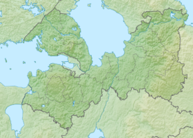
Powerful ( Swede. Lövskär , Fin. Lavansaari , Est. Lavassaar , until 1951 Rus. Lavensari, Lavensaari, Lavansaari ) - an island in the Gulf of Finland , administratively belonging to the Kingisepp district of the Leningrad region . [1] Located south of the Bolshoi Ship Fairway, 130 km west of St. Petersburg . Vyborg is located 90 km north-east of the island, Gogland - 40 km to the west. To the Vigrund rock in the southwest is 25 km: as much as to the Kurgalsky peninsula located in the southeast. The closest to the Powerful island - Small - is located 6 km to the east.
| Powerful | |
|---|---|
| Specifications | |
| Square | |
| Location | |
| Water area | The Gulf of Finland |
| A country |
|
| The subject of the Russian Federation | Leningrad region |

Name Origin
The former name of the island " Lawnsaari " is formed, it is believed, from the Finnish words lavea - "wide, extensive", and saari - "island", because its size in comparison with the size of nearby islands is larger. [one]
Geography

Powerful area is 13.4 km². [2] The island consists of two parts connected by a sand isthmus [1] [2] 0.3 km wide. [2] Both parts are low, heavily indented and overgrown with coniferous forest . The eastern part is much smaller in size than the western one and is called the Intermediate Peninsula. There are five bays near the island: Malmiget-Lahti, Okolnaya, Zarnitsa, Fishery and Protective. Of these, three were found suitable for organizing yacht shelters. Okolnaya Bay is located north of the Isthmus, Zashchitnaya - to the south, Rybachaya - in the north-west of the island, near the now defunct village. Fisherman's Bay has a fairway of complex configuration: three knees. Its shores are low and rocky, except for the east, where the sands of the Kirkovi Spit are located. [1] In the south of the island, 1.6 km from the coast, there is a lake rich in pike , perch and roach . [2]
The island, similar to Gogland and Seskar , is almost uninhabited. The exception is the personnel of a small frontier post with a radio post (radar and visual patrol), a post for lighting the surface and underwater conditions of the Leningrad Naval Base and the family of the forester and lighthouse keeper. The island has a helipad and an old abandoned airfield . [one]
Lighthouses
There are three lighthouses on Moshchny, two of which are the gate . The non-lethal lighthouse is located at the northern end of the island and is a lattice tower painted red. Its focal plane is at a height of 30 m. It gives three white flashes every 10 seconds. Gate lighthouses are located on the southwestern end of the island and on the east - on the Intermediate Peninsula. The first of them consists of two towers: the front stone, 19 m high, and the back trellised - 29 m. Both towers light the light for 1.5 seconds. every 1.5 sec. The second gate lighthouse consists of two lattice towers of 16 (front) and 26 (rear) meters. The front tower quickly blinks in white, the rear tower shines for 2 seconds. after 2 sec. [3]
History
Passed to Russia from Sweden in 1721 under the Nistadt Peace Treaty . In 1742 , during the Russo-Swedish war (1741-1743) , the island’s raids served as the rendezvous point of the Russian fleet. [4] [5] In 1783 , a church was erected, the bell tower was rebuilt in 1910. [6] In January 1808 , during the Russo-Swedish war (1808-1809) , the battle of the battleship Borey took place near the island under the command of Captain 1st Rank Ustin Moore with two British frigates , which prevented the landing of Swedish troops on the island of Kotlin . [7] In 1889 a school was built, [2] [6] burned down in 1895. In 1896 a new one was erected in its place. [6] At the end of January 1900 , thanks to the exchange of messages on the first practical radio line of Alexander Stepanovich Popov , 27 island fishermen were rescued from the ice floe. [eight]
During the First World War , in 1916-1917, the Baltic Fleet equipped the island with coastal artillery , placing a battery of ten-inch guns and a battery of six-inch guns, as well as a railway for its maintenance. [6] In March 1918 , the Finnish detachment occupied the island and at the end of the same month fired upon the icebreaker Ermak , which was going to Helsingfors to deploy a fleet to Kronstadt [9] . In 1920 , the island transferred to Finland under the Tartu Peace Treaty and was demilitarized - the batteries were dismantled. [ten]
In 1923 , the island's population reached a historic maximum, amounting to 1338 [2] people - the island commune was the most densely populated in the entire Vyborg district, to which Lavensaari belonged. Residents were mainly Karelians from Estonia and the Koivisto region. The main fishery was fishing and the provision of transport services. [2] In 1915 , the island's fleet comprised from 75 [6] to 85 [2] ships engaged in trade between Russia, on the one hand, and Finland and Sweden, on the other. After Finland gained independence, traffic fell sharply, which led to a decrease in the number of ships. [2] At the same time, the island became one of the smuggling points from Finland to the RSFSR . [11] In 1933 a hospital was built. [6]
During the Soviet-Finnish War (1939-1940), the island was occupied by two reinforced companies of the Soviet Marine Corps on November 30, 1939. [12] [13] The landing was preceded by artillery preparation from the 17th railway battery located near the Kurgolovo station. [14] Inhabitants of the island took out their personal property ahead of time, in October 1939, when the war began to seem inevitable. [6] The KBF winter defense throughout the war kept a garrison on the island, equipped with a snowy road . In March 1940 the island was conventionally called Moscow. Under the Moscow Peace Treaty of 1940 , the island was transferred to the Soviet Union .
After the start of World War II , when at the end of August 1941 the Wehrmacht broke through the Luga fortified position on the approaches to Leningrad , several stationary batteries were transported to the Lavensaari and Seskar islands. [15] The lack of fuel, water, ammunition and repair facilities on the Gogland and Lavensaari islands in the autumn of that year did not allow the base of patrol ships to be stationed there, which were forced to be based in Kronstadt . [16] After the Baltic Fleet evacuated Hanko’s base on December 2 and Gogland on December 7, 1941, the island turned out to be the westernmost defense point of the RKKF and maneuvered base advanced forward. [17] [18] From here, the submarines were escorted from Kronstadt to dive points and met. [17] The island served as the base for the assault on Gogland and the Big Tyuters : on December 30, 1941, a detachment of Colonel Alexei Barinov formed from the garrisons of Lavensari and Seskar; On January 7 and March 15, 1942 , a few reinforcements departed from here; on the island of March 28 and 29 of the same year, the remnants of the detachment knocked out of Gogland returned. On April 8 and 13, 1942, by order of the Military Council of the Baltic Fleet, two assaults on the Greater Tyuters were fired from the island, which ended in failure. [18]
At the beginning of 1942, the island’s air defense carried out the 2nd separate anti-aircraft artillery division consisting of four batteries of 85 and 76-mm guns and two small-caliber batteries. In the autumn of 1942, an airfield was built at Lavansaari. RUS-2 early warning radar was installed on the island in 1942, and in 1943 the SON-2 gun- guided radar. [nineteen]
In the winter period of 1941–42. and 1943–44 the Shepelevsky lighthouse – Seskar – Lavensari ice road was 71 km long, [20] which was served by fleet engineers. In the winter of 1942–43 there was no ice in the vicinity of the islands of Cescar and Lavensaari. [21] In 1942 , Lawnsaari was included in the Baltic Fleet Island Defense Sector along with the islands of Maly and Seskar. All three islands were significantly strengthened by naval engineers: “ about 200 machine-gun, 20 artillery bunkers, more than 450 shelters for personnel were built, about 70 kilometers of wire fences and over 5 kilometers of anti-personnel minefields were installed. » [21] The main operations of the ships based on Lavensaari in 1942 were the posting of 50 [22] convoys from Kronstadt and back with constant naval and air battles in the main channel and in the area of the Island Defense Sector, 61 [17] submarine wiring in escorts , trawling the eastern part of the Gulf of Finland [23] and serving in sentinel lines. On November 18, 1942, in the island’s harbor, Finnish torpedo boats Syöksy, Vinha and Vihuri sank the Red Banner gunboat . [24] [25]
In the fall of 1943 , the sailors of the Island Sector broke through the Kogsmarine's Moghland mine position, which had 27 barriers in several lines and tiers , making three fairways in it. The island during this operation was subjected to German air and artillery attacks. On September 24, a German battery from the island of Big Tyuters destroyed an ammunition depot on the island. [26] In February 1944 , using pierced fairways, an amphibious assault force landed from the island to the area of the village of Merikyula. [26] [27] In June of that year, island-based minesweepers raided the Vyborg Bay on the eve of the Björk landing operation . [27] After the war, in November 1945 , the island naval base was transferred to Pillau , forming the Pillau naval base on its basis. [28]
Notes
- ↑ 1 2 3 4 5 Powerful Island. // Kingisepp Municipal District. Official site.
- ↑ 1 2 3 4 5 6 7 8 9 Lavansaari.
- ↑ Lighthouses of Russia: Gulf of Finland Islands (Unavailable link) . Date of treatment March 11, 2011. Archived February 9, 2011.
- ↑ Two Pramas built in the St. Petersburg Admiralty by D. Sutherland.
- ↑ Russian sailing ships of the XVIII century.
- ↑ 1 2 3 4 5 6 7 Heikki Kajomeri. Lavansaaren Kuvia.
- ↑ Dictionary of Russian generals.
- ↑ Victor Tsarevsky. GOGLAND Island - the first practical radio link
- ↑ Unprecedented operation.
- ↑ Peace Treaty between the Russian Socialist Federative Soviet Republic and the Republic of Finland.
- ↑ Customs Supervision No. 1. // Ivangorod.
- ↑ Occupation of the islands of Seiskari, Lavansaari, Narvi and Someri. // BATTLE ACTIONS OF THE RED BANNED BALTIC FLEET DURING THE SOVIET-FINNISH WAR (Inaccessible link) . Archived on October 20, 2013.
- ↑ Commencement of hostilities. // Arkhipov K.V. History of the Marine Corps - Baltic Marine Corps in the 30s - 40s of the 20th Century. (inaccessible link) . Archived on October 20, 2013.
- ↑ “Object 500”
- ↑ Melnikov P.E. Volleys from the shore. (inaccessible link - history ) .
- ↑ On the watch lines. // Ladinsky Yu. V. At the fairways of the Baltic
- ↑ 1 2 3 Shoulder to shoulder. // Ladinsky Yu. V. At the fairways of the Baltic
- ↑ 1 2 Leonid Vlasov. The long-suffering island in the Gulf of Finland.
- ↑ Korelsky K.S. Baltic anti-aircraft gunners. - Tallinn: Eesti Raamat, 1981. - S. 129, 131. - 256 p.
- ↑ M. Kazan. ICE ROADS OF LIFE. // Science and life. No. 5, 1985
- ↑ 1 2 L.P. Vasiliev. At the front are fleet engineers. // Engineering troops of the front city. L., 1979.
- ↑ Weapons - experience. // Ladinsky Yu. V. At the fairways of the Baltic
- ↑ Valor of the miners. // Ladinsky Yu. V. At the fairways of the Baltic
- ↑ Torpedo boats (Moottoritorpedovene). // Navy warships.
- ↑ Sänkningen av Krasnoje Znamja. // Veteraanien perintö -Itsenäinen isänmaa. (inaccessible link) . Archived on September 27, 2007.
- ↑ 1 2 Operation to break through the Gogland mine position. // Secrets of sunken ships. Underwater archaeological discoveries, finds of sunken ships, shipwrecks and disasters, naval battles, underwater history museum, aircraft of the Second World War. (inaccessible link) . Date of treatment March 13, 2011. Archived on February 26, 2012.
- ↑ 1 2 Winning courses. Under the red flag. // Ladinsky Yu. V. At the fairways of the Baltic
- ↑ Baltic Naval Base. // Baltiysk.
Topographic maps
- Map sheet P-35-XXXIII, XXXIV .
- Map sheet O-35-IV Kohtla-Järve . Scale: 1: 200,000. 1973 edition.
See also
- The outer islands of the Gulf of Finland