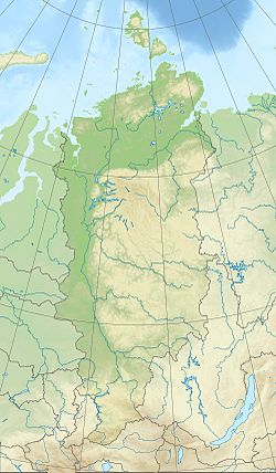
Taseeva is a large river in the west of Eastern Siberia , the left tributary of the Angara , flows through the territory of the Krasnoyarsk Territory of Russia .
| Taseeva | |
|---|---|
| Characteristic | |
| Length | 116 km |
| Pool | 128,000 km² |
| Water consumption | 752 m³ / s (46 km from the mouth) |
| Watercourse | |
| Source | river confluence: Uda and Biryusa |
| • Height | 108 m |
| • Coordinates | |
| Mouth | Hangar |
| • Location | 68 km on the left bank |
| • Height | below 91 m |
| • Coordinates | |
| Location | |
| Water system | Angara → Yenisei → Kara Sea |
| A country |
|
| Region | Krasnoyarsk region |
| HWR code | |

Formed by the confluence of the Chuny and Biryusa rivers, the main left tributary is the Usolka River [2] . The tributaries are the cities of Biryusinsk , Tayshet .
It flows into the Angara 68 km from its mouth, in the lower reaches it is navigable to the village of Mashukovka about 50 km from the mouth [3] [4] [5] .
The name was given by Russian explorers of the XVII century after the Tungus prince Tasey, whose tribe lived on this river [6] .
Content
Geography
The catchment area is 128 thousand km², the length is 116 km or, if the beginning of the Chunya River is taken as the source, the length is 1240 km [7] . The height of the source is 108 m above sea level. In the upper reaches flows in a narrow valley, forming a series of rapids. 15–20 km below the confluence of Chuny (Uda) and Biryusa (Ony) it takes the form of a plain river. In the lower reaches of the Taseev River, it flows almost parallel to the Yenisei River , into which the Angara flows 68 [5] km to the west. It opens from ice in late April - early May, freezes in October - November. Along with the main spring flood, there are summer floods associated with rains and snowmelt in the East Sayan Mountains [7] .
Hydrology
The Taseeva River is the most significant tributary of the Angara below Baikal with an average annual water discharge of 46 km from the mouth of 752 m³ / s [8] (according to other sources - 771 m³ / s, which corresponds to an annual flow of about 24 km³) [9] . The river is characterized by significant changes in the annual runoff, which is expressed in the discrepancy between the mean annual water discharge if it is calculated on the basis of different observation periods [8] [9] . For example, the average water discharge in 1990 was 474 m³ / s , and in 1960 - 1,028 m³ / s , which corresponds to more than a twofold change. For years with significant annual runoff, large spring floods are also characteristic - in May 1966 there was a maximum monthly average discharge equal to 4450 m³ / s . On some days, the inflow of water from Taseeva to the Angara can be no less than the amount of water that the Yenisei carries above the confluence with the Angara [8] .
Notes
- ↑ Surface Water Resources of the USSR: Hydrological Understanding. T. 16. Angara-Yenisei region. Vol. 2. Hangar / ed. T.S. Kirillova, N.N. Korchazhnikova. - L .: Gidrometeoizdat, 1965 .-- 224 p.
- ↑ Great Soviet Encyclopedia : [in 30 vol.] / Ch. ed. A.M. Prokhorov . - 3rd ed. - M .: Soviet Encyclopedia, 1969-1978.
- ↑ Sokolov A.A. Chapter 23. Eastern Siberia // Hydrography of the USSR. - 1954.
- ↑ Angara - shipping and freight transportation , Yenisei Shipping Company
- ↑ 1 2 State Water Register . Taseeva . textual.ru . Ministry of Natural Resources of Russia (March 29, 2009). Date of treatment December 20, 2018. Archived March 29, 2009.
- ↑ Taseeva - an article from the dictionary "Toponymy. Cities and countries "on the site saveplanet.su
- ↑ 1 2 Great Soviet Encyclopedia // B. A. Vvedensky II. - Moscow: Freight One named after Molotova, 04/21/1956 - T. 41 , issue. TARHUN - TASMANIANS . - S. 637 .
- ↑ 1 2 3 4 Taseeva At Mashukovka (English) . R-ArcticNET. Date of treatment January 6, 2018.
- ↑ 1 2 Taseeva at Mashukovka unopened (inaccessible link) . UNESCO: Water resources. Archived March 25, 2016.
Links
- Taseeva - article from the Great Soviet Encyclopedia .