Chico Municipal Airport ( IATA : CIC , ICAO : KCIC , FAA LID : CIC ) is a state civilian airport located six kilometers north of the business center of Chico , Butte County ( California ), USA .
| Chico Municipal Airport Chico Municipal Airport | |||||||||||||
|---|---|---|---|---|---|---|---|---|---|---|---|---|---|
 | |||||||||||||
| IATA : CIC - ICAO : KCIC | |||||||||||||
| Information | |||||||||||||
| Type of | city government | ||||||||||||
| A country | USA | ||||||||||||
| Location | California | ||||||||||||
| NUM height | + 22 m | ||||||||||||
| Runways | |||||||||||||
| |||||||||||||
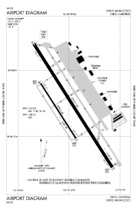
The airport covers an area of 597 hectares , located at an altitude of 22 meters above sea level , operates two runways and one helipad. The airport is mainly used for servicing general aviation flights, the only airline operating regular commercial flights is the regional airline SkyWest Airlines , operating under the United Express brand of the main airline United Airlines .
Airport ground handling, including fueling aircraft, is provided by the commercial company Northgate Aviation.
Content
- 1 History
- 2 Airlines and destinations
- 3 notes
- 4 References
History
At the end of the 30s of the last century, the city of Chico acquired about 65 hectares of land eight kilometers north of the then city line, on which a runway and a small hangar for aircraft were built. Until 1941, the ground-based infrastructure of the facility was leased from a commercial company. In 1941, city government acquired another 405 hectares of land for subsequent lease to the United States government.
During World War II, the entire airport complex was leased to the federal government for one US dollar per year for the construction and further operation of the US Air Force base . The airbase was at the disposal of the 10th Air Force of the United States Air Force Air Force Reserve Command and was one of the largest training centers that trained several thousand pilots for BT-13 Valiant , Lockheed P-38 Lightning , Bell P-39 " Aerocobra ” , Bell P-63“ Kingcobra ” , Boeing B-17“ Flying Fortress ” and B-29“ Superfortress ” . [1] [2] [3]
As an additional runways, the training center of the air base used the following:
- supporting band Orland No. 1;
- Support Band Kirkwood No. 2;
- auxiliary strip Vine No. 3;
- Campbell Support Lane No. 4;
- auxiliary strip Oroville No. 5.
After the war, according to the agreement, the entire infrastructure of the air base, together with all the improvements and modernization of the runways, became the property of the city government. [four]
Airlines and Destinations
| Airline | Destinations |
|---|---|
| United express performed by SkyWest Airlines | San Francisco |
Notes
- ↑ Titan I map (inaccessible link) . California Department of Toxic Substances Control. Date of treatment October 17, 2009. Archived July 21, 2011.
- ↑ Photos of ICBM site in Chico, California (link not available) . Date of treatment October 17, 2009. Archived August 17, 2009.
- ↑ Beale AFB History . Global Security.org.
- ↑ Archived copy (inaccessible link) . Date of treatment October 17, 2009. Archived January 3, 2007.
Links
- Chico Municipal Airport
- FAI CIC Airport Base Data ( Form 5010 PDF )
- FAI Airport Map ( PDF ) as of August 28, 2008