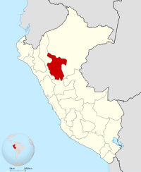
San Martín ( Spanish: San Martín ) is a region in the north of Peru . In the north and east it borders with the region of Loreto , in the south - with the region of Huanuco , in the west - with the regions of La Libertad and Amasonas . The area of the region is 51,253 km². The population is 813.4 thousand people (2017) [1] . The administrative center is the city of Moyobamba , the largest city is Tarapoto .
| region | |||||
| San martin | |||||
|---|---|---|---|---|---|
| Spanish Departamento de san martín | |||||
| |||||
| A country | Peru | ||||
| Includes | 10 provinces and 77 districts | ||||
| Adm. center | Moyobamba | ||||
| Governor | |||||
| History and Geography | |||||
| Area | 51 253.31 km² (4%, 7th place ) | ||||
Height
|
| ||||
| Timezone | UTC -5 | ||||
| Largest cities | Tarapoto , Moyobamba , Juanghui | ||||
| Population | |||||
| Population | 813 381 [1] people ( 2017 ) (2.8%, 15th place ) | ||||
| Density | 15.9 [1] people / km² (18th place) | ||||
| Nationalities | mestizos (84%), as well as Quechua , Afro-Peruvians , etc. | ||||
| Denominations | Catholics, Protestants | ||||
| official languages | spanish , aguaruna , chayahuita , Quechua | ||||
| Digital identifiers | |||||
| ISO 3166-2 Code | PE-SAM | ||||
| Official site | |||||
 | |||||


Content
- 1 Geography
- 2 population
- 3 Economics
- 4 Attractions
- 5 Gallery
- 6 Administrative divisions
- 7 notes
Geography
The region is located on the territory of the Danish Sierras at the eastern slope of the Andes . Almost the entire territory is covered by Amazonian and alpine tropical forests . In the west of the region, the eastern slopes of the Andes rise; here the height reaches 4 kilometers or more, and the mountains are riddled with a large number of canyons. In the northeast - periodically flooded forests of the Amazonian lowlands .
One of the main rivers is the Uallaga . The average annual temperature varies from 18 ° C in the mountains to 29 ° C in the lowlands.
Population
The population of the region is 813,381 people [1] , the population growth is 1.1% per year. Most of the population lives in the north. The population density is 15.9 people / km², in the north - about 30 people / km², in the south - from 4 to 12 people / km². The level of urbanization is 68.1%.
Sexual structure: 51% - men, 49% - women. The proportion of children under 14 years old is 31.9%. Literacy rate is 86%.
National composition: mestizos (83.7%), Quechua (5.3%), Afro-Peruvians (4.9%), whites (4.2%). Confessional composition: Catholics (60.3%), Protestants (22.1%) [2] .
Economics
Economic specialization is the cultivation of oil palm and palm oil production, as well as the cultivation of rice and cassava . Tobacco, cocoa, corn, coffee, cotton, tuber and cereal crops, oranges, coconuts and bananas, coca , tropical vegetables, sacha-inchi ( Spanish sacha inchi - a type of peanut ) are also grown . Livestock is represented by cattle breeding, pig breeding, poultry farming. Deposits of oil, coal, silver, gold, ornamental stones and other minerals. Sawmill, textile, food industry, winemaking.
Attractions
- Rio Abiseo National Park - a UNESCO World Heritage Site. About 30 archaeological sites of the pre-Columbian era. The endemic of this park is the extinct yellow-tailed monkey . The park presents a huge variety of flora and fauna, including a very rare one.
- National Park (translated as “Blue Mountains”) is a mountain range in the middle of the jungle.
- Velo de Plata Waterfall, height - 480 meters
- Hera and Pakcha Waterfalls 21 Kilometers from Moyobamba
- Auashiyyaku Waterfall, near Tarapoto
- Thermal springs San Mateo and Sulfurosos
- Lagoon de venice
- Kainarachi Valley
- Orchid Greenhouses
- The city of is a small noteworthy town called the “People’s capital of the Peruvian Amazon” ( Spanish: La capital folklórica de la Amazonia peruana ). Located in a picturesque area surrounded by waterfalls. The city is rich in cultural traditions of the Quechua people and the indigenous tribes of the Amazon, numerous festivals are held here.
- The city of Rioja, in the vicinity of which you can see many caves
- Urku Center in Tarapoto exploring and popularizing Amazonian culture
Gallery
Administrative Division
The region consists of 10 provinces, which are divided into 77 districts:
| No. | Provinces | Administrative center | Population (2017) |
|---|---|---|---|
| one | Belyavista (Bellavista) | Belyavista (Bellavista) | 55 033 |
| 2 | Lamas | Lamas | 81 521 |
| 3 | Mariscal Cáceres | Juanjuí | 64,626 |
| four | Moyobamba | Moyobamba | 122 365 |
| 5 | Picota | Picota | 40,545 |
| 6 | Rioja | Rioja | 122 544 |
| 7 | San Martín | Tarapoto (Tarapoto) | 193,095 |
| 8 | Tocache (Tocache) | Tocache Nuevo | 69 394 |
| 9 | Huallaga | Saposoa (Saposoa) | 27 506 |
| 10 | El Dorado | San José de Sisa | 36,752 |