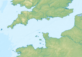
The Normandy Islands ( English Channel Islands , Fr. îles Anglo-Normandes , îles de la Manche , Normand. Îles d'la Manche ) - a group of islands consisting of two large, Jersey and Guernsey , several small and many islands and rocks. The archipelago is located off the coast of Normandy .
| Channel Islands | |
|---|---|
| English Channel Islands , fr. îles Anglo-Normandes, îles de la Manche , nrm les d'la Manche | |
 Guernsey beach | |
| Specifications | |
| Largest island | Jersey |
| total area | 200.5 km² |
| Population | 163 857 people (2012) |
| Population density | 817.24 p / km² |
| Location | |
| Water area | English Channel |
| Country |
|

Content
Geography
The large islands in the coronary possessions of Jersey and Guernsey are under the jurisdiction of the British monarchy , but are not part of the UK and are not part of the EU , but are part of the customs territory of the EU [1] . The southern part of the archipelago - the Szhoze archipelago - is located within the borders of France ( Manche department).
The area of the islands is 200.5 km² : ( Guernsey - 78 km² , Jersey - 116 km² , Shoze - 6.5 km² ).
History
In 933, the Channel Islands became part of the Duchy of Normandy . In 1066, the Duke of Normandy became the English king William I. After 138 years, King John the Landless lost most of the duchy of Normandy, but the Channel Islands remained under English control.
Population
The population of the islands is 163,857 people (2012). The largest city is Saint Helier (French pronunciation is Saint-Elier).
National composition (2008):
- British - 56%
- French - 40%
- Belgians - 2%
- Dutch - 1%
- others - 1%
Economy
On the islands developed cattle and fishing .
See also
- Special territories of the Member States of the European Union
- German occupation of the Channel Islands (1940-1945)