Bahapcha is a river in the Magadan region of Russia , the right tributary of the Kolyma .
| Bahapcha | |
|---|---|
| Characteristic | |
| Length | 291 km |
| Pool | 13 800 km² |
| Water consumption | 123.8 m³ / s (5.4 km from the mouth) |
| Watercourse | |
| Source | Solar |
| • Location | Tenkinsky district |
| • Height | 753 m |
| • Coordinates | |
| Mouth | Kolyma |
| • Location | 1839 km on the right bank, Yagodninsky district |
| • Coordinates | |
| Location | |
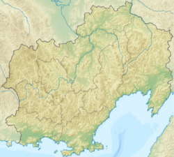
| Water system | Kolyma → East Siberian Sea |
| A country |
|
| Region | Magadan Region |
| HWR code | |

Content
General Information
Length - 291 km [2] , catchment area - 13.8 thousand km² [3] . It originates from Lake Solnechny at an altitude of 753 m above sea level. It flows within the boundaries of the Tenkinsky and Yagodninsky regions along mountainous terrain, crossing the Verkhnekolymskoye plateau , in the lower rapids. Freeze from October to May. It flows into Kolyma in 1839 km from its mouth, below the village of Sinegorye .
Hydrology
The average annual flow rate of 5.4 km from the mouth is 123.84 m³ / s, the largest in June and the smallest in March. Monthly average water discharges (observational data from 1934 to 1998) [4] :
Water registry data
According to the state water registry of Russia and the geographic information system of water management zoning of the territory of the Russian Federation, prepared by the Federal Agency for Water Resources [3] :
- Basin District - Anadyro-Kolymsky
- River basin - Kolyma
- River sub-basin - Kolyma before the confluence of Omolon
- Water sector - Kolyma from the Kolyma hydroelectric station to the confluence of the Seymchan River
- The code of the water body is 19010100212119000008981
Major tributaries
(distance from the mouth)
- 46 km - Nerega river (pr)
- 122 km - Multan River (ave)
Notes
- ↑ Surface Water Resources of the USSR: Hydrological Understanding. T. 19. Northeast / ed. Yu. N. Komarnitskaya. - L .: Gidrometeoizdat, 1966 .-- 602 p.
- ↑ According to the water registry, the length of the river is 212 km.
- ↑ 1 2 State Water Register . Bohapcha . textual.ru . Ministry of Natural Resources of Russia (March 29, 2009). Date of treatment December 20, 2018. Archived March 29, 2009.
- ↑ 1 2 Bohapcha 5.4 km from the mouth . Statistics on the R-ArcticNET website . Date of treatment January 24, 2013. Archived February 2, 2013.
Literature
- Bahabcha // Encyclopedic Dictionary of Brockhaus and Efron : in 86 volumes (82 volumes and 4 additional). - SPb. , 1890-1907.
Links
- Bahapcha // Great Soviet Encyclopedia : [in 30 vol.] / Ch. ed. A.M. Prokhorov . - 3rd ed. - M .: Soviet Encyclopedia, 1969-1978.
- Institute of Geography RAS