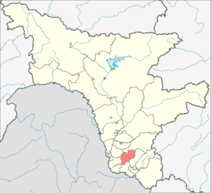
The Oktyabrsky District is an administrative-territorial unit ( district ) and a municipality ( municipal district ) in the Amur Region of Russia .
| Municipal District | |||||
| Oktyabrsky District | |||||
|---|---|---|---|---|---|
| |||||
| A country | |||||
| Included in | Amur Region | ||||
| Includes | 15 municipalities | ||||
| Adm. center | village Ekaterinoslavka | ||||
| The head of administration | Dementiev Sergey Leonidovich | ||||
| History and Geography | |||||
| Date of formation | 1935 | ||||
| Area | 3381.46 [1] km² | ||||
| Timezone | MSK + 6 ( UTC + 9 ) | ||||
| Population | |||||
| Population | ↗ 18,284 [2] people ( 2018 ) (2.31%) | ||||
| Density | 5.41 people / km² | ||||
| Digital identifiers | |||||
| Telephone code | 41652 | ||||
| Official site | |||||
 | |||||


The administrative center is the village of Yekaterinoslavka .
Content
- 1 Geography
- 2 History
- 3 population
- 4 Municipal territorial structure
- 4.1 Settlements
- 5 Economics
- 6 Transport
- 7 notes
- 8 References
Geography
Oktyabrsky district is located in the southwest of the Amur region. In the north it borders with Romnensky, in the east and southeast - with Zavitinsky, in the south - with Mikhailovsky, in the west - with the Tambov and Ivanovsky districts of the region. The area is 3.4 thousand km².
History
On January 25, 1935, the Yekaterinoslavsky District was formed as part of the Amur Region of the Far Eastern Territory (from April 1, 1935 - the Kaganovichsky District ). On May 26, 1941, part of the village councils of the Kaganovichsky district (Verkhne-Belsky, Znamensky, Kuzmichyovsky, Lyubimovsky, Novo-Rossiysky and Svyatorusovsky) were transferred to the newly formed Soviet district (the center is the village of Romny ). On August 10, 1957, the Kaganovichi district was renamed Oktyabrsky .
On December 1, 2005, by the decision of the Oktyabrsky District Council of People's Deputies, the emblem of the district was approved.
From January 1, 2006, in accordance with the Law of the Amur Region dated March 17, 2005 No. 457-OZ [3] , 15 municipalities (rural settlements) were formed in the district.
Population
| Population size | |||||||
|---|---|---|---|---|---|---|---|
| 1959 [4] | 1970 [5] | 1979 [6] | 1989 [7] | 2002 [8] | 2009 [9] | 2010 [10] | 2011 [11] |
| 21,442 | ↗ 22 591 | ↘ 22 520 | ↗ 23 127 | ↘ 22 761 | ↗ 23 015 | ↘ 19 679 | ↘ 19 563 |
| 2012 [12] | 2013 [13] | 2014 [14] | 2015 [15] | 2016 [16] | 2017 [17] | 2018 [2] | |
| ↘ 19 208 | ↘ 19 118 | ↘ 18 865 | ↘ 18 673 | ↘ 18 375 | ↘ 18 273 | ↗ 18 284 | |
Municipal Territory
The Oktyabrsky district includes 14 municipalities with the status of rural settlements [18] :
| No. | Rural settlement | Administrative center | amount populated points | Population (people) | Area (km²) |
|---|---|---|---|---|---|
| one | Borisoglebsky Village Council | Borisoglebka village | 2 | ↘ 381 [2] | 214.63 [1] |
| 2 | Barbarian Village Council | Varvarovka village | one | ↘ 2529 [2] | 110.07 [1] |
| 3 | Eastern Village Council | Vostochny village | 2 | ↘ 1378 [2] | 157.53 [1] |
| four | Yekaterinoslav Village Council | village Ekaterinoslavka | 3 | ↗ 9595 [2] | 265.11 [1] |
| 5 | Korolinsky Village Council | village of Kings | 6 | ↘ 398 [2] | 155.09 [1] |
| 6 | Maksimovsky Village Council | Maksimovka village | 2 | ↘ 379 [2] | 194.82 [1] |
| 7 | Mukhinsky Village Council | Mukhinsky village | 2 | ↗ 686 [2] | 246.18 [1] |
| 8 | Nikolo-Aleksandrovsky Village Council | the village of Nikolo-Aleksandrovka | 2 | ↘ 638 [2] | 253.72 [1] |
| 9 | Novomikhailovsky Village Council | village Novomikhaylovka | four | ↘ 561 [2] | 394.26 [1] |
| 10 | Paninsky Village Council | Panino village | 2 | ↘ 286 [2] | 188.77 [1] |
| eleven | Pereyaslovsky Village Council | Pereyaslovka village | 2 | ↘ 161 [2] | 188.23 [1] |
| 12 | Peschanoozersky Village Council | Peschanozerka village | one | ↘ 462 [2] | 134.03 [1] |
| 13 | Romanovsky Village Council | Romanovka village | 3 | ↘ 592 [2] | 425.92 [1] |
| fourteen | Labor Village Council | labor village | 3 | ↘ 238 [2] | 199.84 [1] |
The Law of the Amur Region dated May 7, 2015 No. 535-OZ [19] abolished the Smelovsky Village Council , poured into the Korolinsky Village Council .
Settlements
There are 35 settlements in the Oktyabrsky district.
| List of settlements of the district | ||||
|---|---|---|---|---|
| No. | Locality | Type of | Population | Municipality |
| one | Belyakovka | village | → 11 [20] | Korolinsky Village Council |
| 2 | Borisovo | village | → 1 [20] | Romanovsky Village Council |
| 3 | Borisoglebka | village | ↘ 197 [20] | Borisoglebsky Village Council |
| four | Barbarian | village | ↘ 2529 [20] | Barbarian Village Council |
| 5 | Oriental | village | ↘ 1289 [20] | Eastern Village Council |
| 6 | Georgievka | village | → 38 [20] | Korolinsky Village Council |
| 7 | Ekaterinoslavka | village | ↗ 9562 [20] | Yekaterinoslav Village Council |
| 8 | Zaozerny | village | → 63 [20] | Labor Village Council |
| 9 | Zorino | village | → 0 [20] | Yekaterinoslav Village Council |
| 10 | Ilyinovka | village | ↗ 184 [20] | Borisoglebsky Village Council |
| eleven | Kings | village | ↘ 207 [20] | Korolinsky Village Council |
| 12 | Kutilovo | village | ↘ 47 [20] | Maksimovsky Village Council |
| 13 | Maksimovka | village | ↘ 332 [20] | Maksimovsky Village Council |
| fourteen | Maryanovka | village | ↘ 164 [20] | Romanovsky Village Council |
| fifteen | Mukhinsky | village | ↗ 572 [20] | Mukhinsky Village Council |
| 16 | Upland | village | ↘ 33 [20] | Yekaterinoslav Village Council |
| 17 | Nikolo-Aleksandrovka | village | ↘ 503 [20] | Nikolo-Aleksandrovsky Village Council |
| eighteen | Novomikhaylovka | village | ↗ 416 [20] | Novomikhailovsky Village Council |
| 19 | Panino | village | ↘ 202 [20] | Paninsky Village Council |
| twenty | Transfer | village | ↘ 57 [20] | Pereyaslovsky Village Council |
| 21 | Sandpiper | village | ↘ 462 [20] | Peschanoozersky Village Council |
| 22 | Pokrovka | village | → 135 [20] | Nikolo-Aleksandrovsky Village Council |
| 23 | Transfiguration | village | ↘ 104 [20] | Pereyaslovsky Village Council |
| 24 | Coastal | village | ↘ 89 [20] | Eastern Village Council |
| 25 | Romanovka | village | ↘ 427 [20] | Romanovsky Village Council |
| 26 | Sergey-Fedorovka | village | ↘ 119 [20] | Novomikhailovsky Village Council |
| 27 | Bold | village | ↗ 128 [20] | Korolinsky Village Council |
| 28 | Smirnovka | village | ↘ 12 [20] | Korolinsky Village Council |
| 29th | Triplet | railroad station | ↘ 24 [20] | Novomikhailovsky Village Council |
| thirty | Labor | village | ↘ 105 [20] | Labor Village Council |
| 31 | Oval | village | ↘ 70 [20] | Labor Village Council |
| 32 | Kharkov | village | → 2 [20] | Novomikhailovsky Village Council |
| 33 | Cheryomushki | village | ↘ 114 [20] | Mukhinsky Village Council |
| 34 | South | village | ↘ 84 [20] | Paninsky Village Council |
| 35 | Yasnaya Polyana | village | ↘ 2 [20] | Korolinsky Village Council |
- Abolished settlements
The village of Volny , the village of Stepanovka .
Economics
Transport
The area has a favorable geographical position in two main transport directions: the Trans-Siberian Railway and the Chita-Khabarovsk highway , connecting the Far East and the regions of the European part of Russia.
Interdistrict and intraregional automobile communication is developed.
Notes
- ↑ 1 2 3 4 5 6 7 8 9 10 11 12 13 14 15 Amur Region. The total land area of the municipality
- ↑ 1 2 3 4 5 6 7 8 9 10 11 12 13 14 15 16 The population of the Russian Federation by municipalities as of January 1, 2018 . Date of treatment July 25, 2018. Archived July 26, 2018.
- ↑ Law of the Amur Region dated March 17, 2005 No. 457-OZ (as amended on December 14, 2005) “On the Establishment of Borders and the Allocation of Appropriate Status to the Municipal Formation of the Oktyabrsky District and Municipal Units in It” Archived on August 8, 2014.
- ↑ 1959 All-Union Census of the Population . Date of treatment October 10, 2013. Archived October 10, 2013.
- ↑ 1970 All-Union Census. The current population of cities, urban-type settlements, districts, and regional centers of the USSR according to the census as of January 15, 1970, in the republics, territories, and regions . Date of treatment October 14, 2013. Archived October 14, 2013.
- ↑ All-Union Census of 1979
- ↑ All-Union Population Census of 1989 . Archived August 23, 2011.
- ↑ 2002 All-Russian Population Census. Tom. 1, table 4. The population of Russia, federal districts, constituent entities of the Russian Federation, regions, urban settlements, rural settlements - district centers and rural settlements with a population of 3 thousand or more . Archived February 3, 2012.
- ↑ The number of permanent population of the Russian Federation by cities, urban-type settlements and regions as of January 1, 2009 . Date of treatment January 2, 2014. Archived January 2, 2014.
- ↑ 2010 All-Russian Population Census. The population of urban districts, municipalities, urban and rural settlements, urban settlements, rural settlements
- ↑ Amur region. Estimated resident population as of January 1, 2009-2014
- ↑ Population of the Russian Federation by municipalities. Table 35. Estimated resident population as of January 1, 2012 . Date of treatment May 31, 2014. Archived May 31, 2014.
- ↑ The population of the Russian Federation by municipalities as of January 1, 2013. - M.: Federal State Statistics Service of Rosstat, 2013. - 528 p. (Table 33. The population of urban districts, municipalities, urban and rural settlements, urban settlements, rural settlements) . Date of treatment November 16, 2013. Archived November 16, 2013.
- ↑ Table 33. The population of the Russian Federation by municipalities as of January 1, 2014 . Date of treatment August 2, 2014. Archived on August 2, 2014.
- ↑ The population of the Russian Federation by municipalities as of January 1, 2015 . Date of treatment August 6, 2015. Archived on August 6, 2015.
- ↑ Population of the Russian Federation by municipalities as of January 1, 2016
- ↑ The population of the Russian Federation by municipalities as of January 1, 2017 (July 31, 2017). Date of treatment July 31, 2017. Archived July 31, 2017.
- ↑ Law of the Amur Region of March 17, 2005 N 457-OZ “On the Establishment of Borders and the Allocation of Appropriate Status to the Municipal Formation of the Oktyabrsky District and Municipal Units in Its Composition”
- ↑ Law of the Amur Region dated 05.05.2015 No. 535-OZ “On the Unification of the Korolinsky and Smelovsky Village Councils in the Oktyabrsky District and Amendments to the Law of the Amur Region“ On the Establishment of Borders and Granting the appropriate Status to the Municipal Formation of the Oktyabrsky District and Municipal Units in It ”“
- ↑ 1 2 3 4 5 6 7 8 9 10 11 12 13 14 15 16 17 18 19 20 21 22 23 24 25 26 27 28 29 30 31 32 33 34 35 Estimation of the resident population of the Amur Region by city and region (March 14, 2018). Archived March 18, 2018.