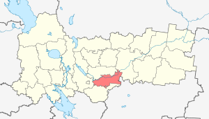
The Mezhdurechensky District is an administrative-territorial unit ( district ) and a municipality ( municipal district ) in the south of the Vologda Oblast .
| metropolitan area | |||||
| Mezhdurechensky district | |||||
|---|---|---|---|---|---|
| |||||
| A country | |||||
| Enters into | Vologda region | ||||
| Adm Centre | Shuya | ||||
| Chapter | Kiselev Sergey Nikolaevich | ||||
| History and geography | |||||
| Date of education | 1929 | ||||
| Square | 3624 km² | ||||
| Timezone | MSK ( UTC + 3 ) | ||||
| Population | |||||
| Population | ↘ 5533 [1] people ( 2017 ) | ||||
 | |||||


District center - the village Shuiskoe .
Content
Geography
The area is 3624 km². The district is bordered by the Vologda, Sokol, Totemsky, Gryazovetsky districts and the Kostroma region.
The main river is the Sukhona , from its major tributaries, the Shuya and Ichalitsa can be noted.
The most developed and populated part of the region is the Avnegsky Upland in the western half, where most of the villages are located. The north of the region lies in the Prisukhonsky lowland , forests dominate here, often swampy. In the northeastern part there are several large open bogs.
The largest settlements are the village of Shuiskoe (the regional center) and the village of Turovets (the center of the timber industry). They account for about half of the population of the area.
History
The Shuya District was formed in 1929 as part of the Vologda District of the Northern Territory of the RSFSR , on January 6, 1931, in accordance with a resolution of the All-Russian Central Executive Committee Presidium of November 20, 1930, it was renamed Mezhdurechensky [2] .
Symbols
- Flag of Mezhdurechensky municipal district
- Coat of arms of the Mezhdurechensky municipal district
Population
| Population | ||||||
|---|---|---|---|---|---|---|
| 2002 [3] | 2009 [4] | 2010 [5] | 2011 [5] | 2012 [6] | 2013 [7] | 2014 [8] |
| 7641 | ↘ 7136 | ↘ 7054 | ↘ 6057 | ↘ 5973 | ↘ 5902 | ↘ 5826 |
| 2015 [9] | 2016 [10] | 2017 [1] | ||||
| ↘ 5716 | ↘ 5625 | ↘ 5533 | ||||
Administrative division
The boundaries of the Mezhdurechensky District are determined by the Law of the Vologda Region No. 1118-ОЗ “On the Establishment of the Boundaries of the Mezhdurechensky Municipal District, the Boundaries and the Status of the Municipal Formations that Are Part of It” dated December 6, 2004 [11] with subsequent changes: July 2, 2008 [12] April 8, 2009 [13] and June 4, 2010 [14] . The center of the district is the village of Shuiskoe .
On January 1, 2006, 8 rural settlements were created within the district [11] .
By the law of the Vologda region of April 8, 2009 No. 1987-OZ [15] , they were transformed by combining them:
- the rural settlements of Botanovskoye and Khozhaevskoye - to the rural settlement of Botanovskoye with the administrative center in the village of Igumnitsevo ;
- the rural settlements of Staroselskoye and Nozemskoye - to the rural settlement of Staroselskoye with the administrative center in the village of Staroye ;
- rural settlements Sukhonskoe and Vragovskoye - to the rural settlement Sukhonskoe with the administrative center in the village of Shuiskoe .
By the law of the Vologda region of May 3, 2017 No. 4136-OZ [16] , the rural settlements of Sukhonskoye and Sheybukhtovskoye were transformed, by their unification, into a rural settlement of Sukhonskoye with the administrative center in the village of Shuiskoe .
| Settlement | Administrative center | Composition by OKATO structure |
|---|---|---|
| rural settlement Botanovskoye | Igumnnichevo | Botanovsky, Khozhaevsky village councils |
| rural settlement Staroselskoe | Old | Nozemsky, Staroselsky village councils |
| rural settlement Sukhonskoe | Shuya | Vragovskiy, Sukhonsky and Sheybukhtovsky Village Councils |
| rural settlement Turovets | Turovets | Turovets Village Council |
- Newly populated areas
In 2014, the village of Verkhny Pochinok was formed [17]
Economy
The enterprise "Mezhdurechieles", the collective farm "Noviy Zavet", the agricultural cooperative "Shuiskoe", the production site "Mezhdurecheraygaz", the district section of power supply "Vologdaoblkommunenergo".
Transportation
A dead-end road “Ilekino — Svyatogorye — Shuiskoe” passes through the area, connecting with the M8 “Kholmogory” highway, which connects the district center with Vologda . The nearby railway station is Tufanovo , 56 km from Shuisky.
The two largest settlements, Shuiskoe and Turovets, are far from each other (about 75 km along Sukhona), but they are not connected by a road. By car from one to another, you can only drive through Vologda and several areas of the region (about 250 km) or in winter along the Sukhona coast and ice. During summer navigation through Sukhona between Shuisky and Turovts there is a regular passenger service on the boat "Mezhdurechie".
Culture
Attractions
Manor of Gryazev in the village of Botanovo , manor of landowner N. Poroshina - “Svyatogorsky Park” with a system of reservoirs; the house of N. Ye. Vvedensky and the grave of a scientist in the village of Ivanishchevo ; the picturesque hill of Avnig .
Monuments of nature : a park in the village of Svyatogorye and the “Dubnya” tract at the mouth of the Vologda River.
Holy spring on Dyakonovskoy glade in Dyakonov .
People associated with the area
Natives
- Vvedensky, Nikolay Evgenievich - physiologist ;
- Korkin, Alexander Nikolaevich - a mathematician .
- Lyuskova, Alexandra Evgenievna - Head of the pig farm “Budenovets” collective farm, Hero of Socialist Labor
- Petrov, Nikolai Alekseevich - Soviet and Russian military leader .
- Tyapkina, Evdokia Vasilyevna - Milkmaid of the Shuiskoe State Farm, Hero of Socialist Labor
Sources
- ↑ 1 2 The population of the Russian Federation by municipalities as of January 1, 2017 (July 31, 2017). The date of circulation is July 31, 2017. Archived July 31, 2017.
- ↑ History of the administrative-territorial division of the Arkhangelsk region and the province in the XVIII — XX centuries. \\ State Archive of the Arkhangelsk region
- ↑ All-Russian census of 2002. Tom. 1, table 4. The population of Russia, federal districts, constituent entities of the Russian Federation, districts, urban settlements, rural settlements — regional centers and rural settlements with a population of 3,000 or more . Archived on February 3, 2012.
- ↑ The resident population of the Russian Federation by cities, urban-type settlements and districts as of January 1, 2009 . The date of circulation is January 2, 2014. Archived January 2, 2014.
- ↑ 1 2 Vologda region. Estimate of the number of resident population on January 1, 2009-2016
- Population of the Russian Federation by municipalities. Table 35. Estimated number of resident population on January 1, 2012 . The date of circulation is May 31, 2014. Archived May 31, 2014.
- ↑ Population of the Russian Federation by municipalities as of January 1, 2013. - M .: Federal State Statistics Service Rosstat, 2013. - 528 p. (Table 33. Population of urban districts, municipal districts, urban and rural settlements, urban settlements, rural settlements) . The appeal date is November 16, 2013. Archived November 16, 2013.
- ↑ Table 33. The population of the Russian Federation by municipalities as of January 1, 2014 . Circulation date August 2, 2014. Archived August 2, 2014.
- ↑ Population of the Russian Federation by municipalities as of January 1, 2015 . Circulation date August 6, 2015. Archived August 6, 2015.
- Population of the Russian Federation by municipalities as of January 1, 2016
- ↑ 1 2 Law of the Vologda Oblast No. 1118-ОЗ “On the Establishment of the Boundaries of the Mezhdurechensky Municipal District, the Boundaries and the Status of the Municipal Formations That Are Its Part” dated December 6, 2004
- ↑ Law of the Vologda Oblast No. 1816-ОЗ “On Amendments to Certain Laws of the Region Establishing the Borders and Statuses of the Municipal Formations of the Region” dated July 2, 2008
- Law of the Vologda region No. 1987-OZ “On the transformation of certain municipal units of the Mezhdurechensky municipal district of the Vologda region” dated April 8, 2009
- ↑ Law of the Vologda Oblast No. 2315-ОЗ “On Amendments to the Law of the Region“ On Establishing the Borders of the Mezhdurechensky Municipal District, Borders and Status of the Municipal Formations That Are Part of It ”" dated June 4, 2010
- ↑ The Law of the Vologda Oblast of 08.04.2009 No. 1987-OZ “On the Transformation of Certain Municipalities of the Mezhdurechensky Municipal District of the Vologda Region”
- ↑ The Law of the Vologda Oblast of 03.05.2017 No. 4136-OZ “On the Transformation of Certain Municipal Units of the Mezhdurechensky Municipal District, on Amendments to the Law of the Region“ On the Establishment of the Boundaries of the Mezhdurechensky Municipal District, the Boundaries and the Status of the Municipal Formations Included in Its Structure ”and Annex to the law of the region "On some issues of the organization and activities of local governments in the Vologda region"
- ↑ Law of the Vologda region of December 23, 2014 No. 3537-OZ “On Amendments to Certain Regional Laws Establishing the Boundaries and Status of Municipalities of the Region”