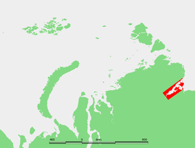
The Khatanga Bay [1] (the Khatang Bay ) is a bay in the Laptev Sea , formed at the confluence of the Khatanga River. The length of the bay is more than 200 kilometers, the greatest width is more than 50 kilometers.
| Khatanga Bay | |
|---|---|
| Yakut. Khatanga өrүs | |
 Bay location | |
| Specifications | |
| Average tide | 1.4 m |
| Deepest | 29 m |
| Flowing rivers | Khatanga , Popigay , Big Balakhna |
| Location | |
| Upstream waters | Laptev Sea , Arctic Ocean |
| A country |
|
| Subjects of the Russian Federation | Krasnoyarsk region , Yakutia |
| Area | Taimyr Dolgan-Nenets District |
Big Begichev Island divides the bay into two straits : Northern (13 km wide) and East (8 km wide). The greatest depth is 29 meters. The shores are high, steep, rugged. The height of the tides is about 1.4 meters. In the western part of the bay is Kozhevnikova Bay . Most of the year the bay is covered with ice [2] . Most of the bay belongs to the Krasnoyarsk Territory , less to Yakutia .
Many large rivers flow into the bay: Khatanga, Bolshaya Balakhnya [3] , Tikyan-Yuryakh [4] , Semieriskyai [4] , Sanga-Yuryakh [4] , Novaya [5] , Podkamennaya [5] and others.
In the shelf part of the gulf, large oil reserves were discovered, which are part of the East-Taimyr oil field [6] .
Notes
- ↑ Khatanga Bay // Dictionary of names of hydrographic objects of Russia and other CIS countries / ed. G. I. Donidze. - M .: Kartgeocenter - Geodesizdat, 1999. - P. 323. - ISBN 5-86066-017-0 .
- ↑ Khatanga Bay // The Great Soviet Encyclopedia : [in 30 t.] / Ch. ed. A. M. Prokhorov . - 3rd ed. - M .: Soviet Encyclopedia, 1969-1978.
- ↑ Map sheet S-48-B, D. Scale: 1: 500 000. Indicate the date of issue / state of the area .
- ↑ 1 2 3 Map sheet S-49-B, G. Scale: 1: 500 000. Indicate the date of issue / state of the area .
- ↑ 1 2 Sheet Card S-49-A, B. Scale: 1: 500 000. Indicate the date of issue / state of the area .
- ↑ Vedomosti, 2015 . www.vedomosti.ru . The appeal date is June 3, 2019.
