Verkkosaari [1] (Verkosari [2] , Verkko-saari [3] , Verkko-sari [4] , Verkkosari [5] ; Fin. Verkkosaari [6] - “ Island of Networks ”) is a small island in Lake Ladoga . The territory belongs to the Lahdenpohsky region of the Republic of Karelia , Russia .
| Werkkosaari | |
|---|---|
| fin. Verkkosaari | |
| Specifications | |
| Highest point | 16.2 m |
| Population | 0 pax |
| Location | |
| Water area | Ladoga lake |
| A country |
|
| The subject of the Russian Federation | Republic of Karelia |
| Area | Lahdenpoh district |

Geography
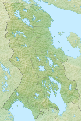
The island of Verkkosaari is located in the northwestern part of Lake Ladoga, in a group of islands located at some distance from the shore of the Lahdenpohsky region and referred to as the Western Archipelago. Verkkosaari is the southernmost of the islands of the archipelago. The distance to the group of Heinäsenänmaa islands (to the north) is from 5 (to the small island of Munatsuluoto ) to 5.7 (to the main island of Heinäsenmaa ) km. 13 km northeast is the large island of Vossinansaari . The distance to the nearest coast ( Storozhevoye village, Priozersky district of the Leningrad region ) is about 18 km to the south-west. The distance to the Karelian coast is 19 km to the north-west.
The island stretched from west to east for 1.1 km, width up to 0.5 km. The landscape is a mid-taiga eastern European lowland plain [7] . The western part of the island, more elevated (heights over 16 m), is covered with forests. The eastern part of the island, on the contrary, is lower (elevations up to 10.7 m), significant vegetation is absent. The eastern tip of Verkkosaari is rocks, the southern and western shores are steep. Above the cliff on the southwestern cape of the island is a lighthouse [5] .
History
According to the data of the 19th - early 20th century historian Peter Theodor Schvindt , who was engaged in ethnographic and archaeological research on the Karelian Isthmus , the treasury of the medieval Russian city of Korela was hidden on the island of Verkkosaari (Schvindt calls it in Finnish - Käkisalmi ). A record of the place of burial of treasures was contained in the monastery books of the Roitsan monastery - this name probably should be understood as the Orthodox Trinity Haymarket, which existed on the island of Heinäsenmaa in the 15th – 17th centuries (which is translated as “hay land” in Russian). Roytsan here - the word “ Trinity ”, “Trinity” modified in Finnish. It is not possible to find the treasure, since the monastery burned down, and with it the whole of his book [8] . The loss of books should be attributed either to the fall of 1580, when, during the final stage of the Livonian War, the Swedish troops captured Korela and Korel uyezd and probably ruined the monastery, or to 1611, when it was renewed in 1592 (that is, before the Tyavzinsky treaty of 1595 years, returning Korela to the Russian kingdom ) the monastery was most likely re-captured by the Swedes, together with Korela (during the Time of Troubles ) [9] .
On topographic maps of the mid-19th century, Verkkosaari was designated as the island of Serka [10] [11] . However, the Finnish name - Werkkosaari - was also used [12] . Verkkosaari was translated from Finnish as “island of networks” [8] . By 1940, the island was covered with forest and, apparently, uninhabited [13] .
At the beginning of World War II, Verkkosaari was one of the points of defense of Soviet troops on the islands of Lake Ladoga. The central defense hub was Rahmansari Island, and up to 60 defenders were stationed on Verkkosaari and Heinäsenmaaa. On September 7-10, 1941, as a result of fierce battles, despite the transfer of reinforcements from Heinäsenmaa, Verkkosaari and Valaam to the forces of the Ladoga military flotilla , Rakhmansari was captured by the Finnish landing [14] . As of January 1944, there was a pier on the island of Verkkosaari, not far from which the Finnish barge DORIS was thrown onto the rocks (until recently, its remains were still preserved on the island) [15] .
After the war, on Verkkosaari, as well as on several other islands of the Western archipelago, military facilities were located, the ruins of which are still found on the island (observation post, trenches, rifle cells and gun courtyards, concrete bunkers) [15] . Due to the fact that radioactive tests were conducted on the islands of the neighboring Heinäsenänmaa archipelago, Verkkosaari is also sometimes referred to as the radioactive contamination zone of Lake Ladoga islands, there are allegations that explosive military radioactive substances (BRV) were produced on Verkkosaari [16] . However, measurements of the background radiation show that the island of Verkkosaari has bypassed pollution [17] .
Reserve
Since February 27, 1996, the island of Verkkosaari belongs to the territory of the Western Archipelago State Complex Natural Reserve of Regional Importance, according to Decree No. 160 of the Chairman of the Government of the Republic of Karelia V. N. Stepanov “On the Creation of the Western Archipelago State Complex Natural Reserve of Regional Importance on Lake Ladoga” in the Lahdenpoh district of the Republic of Karelia ” [18] . Werkkosaari is, today, one of the 5 sites of the reserve. The boundaries of the protected area include both the island itself, belonging to the Oppolsky forestry of the Lakhdenpohsk forestry, and the adjacent strip of Lake Ladoga water area 2 km wide [19] .
According to the nature management regime, visiting Verkkosaari, as well as the Yalayansari island, also part of the reserve, is prohibited from April 25 to July 1, during the breeding season of waterfowl and water birds [18] . The species composition of the birds of the island is specific for Werkkosaari both within the reserve and within the entire Lake Ladoga:
- silver gull (typical of Lake Ladoga);
- gray gull (typical of Lake Ladoga);
- klusha (typical of Lake Ladoga);
- Arctic tern (unusual for fresh water) [19] .
Notes
- ↑ Register of names of geographical objects on the territory of the Leningrad Region as of January 20, 2017
- ↑ The Great World Table Atlas of A.F. Marx, 1909, edited by Yu. M. Shokalsky and E. Yu. Petri , 2nd edition.
- ↑ Map of the management of military topographers of the Red Army . Scale: 1 cm 2 km. 1932.
- ↑ Map of the General Staff of the Red Army, Eastern Europe and the European part of the Soviet Union. Scale 1: 1,000,000, 1940.
- ↑ 1 2 Topographic map of P-36-97-A, B. Scale 1: 50,000. Terrain status in 1987. 1989 edition.
- ↑ Viipurin lääni. Scale 1: 400000. Helsinki, 1923.
- ↑ Protected areas of Russia. Western archipelago. Landscapes
- ↑ 1 2 Theodore Schwindt. Folk traditions of the northwestern Ladoga collected in the summer of 1879. Helsinki, 1883. Translation by M. I. Petrov, 2001. Chapter “Treasures and Lena Books”
- ↑ A.A. Gulyaev and A.P. Dmitriev. Trinity Haymarket XV-XVII centuries. - younger brother of Balaam and Konevets
- ↑ Special map of the Western part of the Russian Empire by F.F. Schubert , Petersburg and surrounding provinces, 1844.
- ↑ Special Map of European Russia by I.A. Strelbitsky , St. Petersburg Province, 1865.
- ↑ Map of the donation lands of the Vyborg province , 1873.
- ↑ Finnish map of the Karelian Isthmus and southern Karelia. Scale 1: 100000, 1940.
- ↑ War on Ladoga 1941-1944
- ↑ 1 2 Ladoga, islands of the western archipelago // Historical background on the islands and capes of Ladoga and places of parking
- ↑ Victor Tereshkin. Radioactive secrets of the Ladoga Islands. Index, 2000, No. 12
- ↑ Sergey Severin. Involuntarily testers: combat radiation near St. Petersburg // IA Military. RF ”, March 29, 2016
- ↑ 1 2 Ladoga Chronicle. State Archipelago State Nature Reserve established
- ↑ 1 2 Protected Areas of Russia. Western archipelago