The Yenisei is a river in Siberia , one of the longest and deepest rivers of the world and Russia . It falls into the Kara Sea of the Arctic Ocean . The length is 3487 km, the catchment area is 2,580,000 km² (the second largest in Russia), and the annual runoff is 624.41 km³ (the deepest river in Russia ).
| Yenisei | |
|---|---|
 The merger of the Big Yenisei (left) and the Small Yenisei near the city of Kyzyl The merger of the Big Yenisei (left) and the Small Yenisei near the city of Kyzyl | |
| Characteristic | |
| Length | 3487 km |
| Pool | 2,580,000 km² |
| Water flow | 19 800 m³ / s |
| Watercourse | |
| Source | confluence of the rivers: the Big Yenisei and the Small Yenisei |
| • Height | 619.5 m |
| • Coordinates | |
| Mouth | Yenisei Bay |
| • Height | 0 m |
| • Coordinates | |
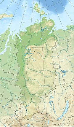
| Location | |
| Water system | Kara Sea |
| A country |
|
| Regions | Tyva , Krasnoyarsk Territory , Khakassia |
| HWR Code | |
Content
Title
The name comes from ancient . Enesy (modern Enzya-yam ' ) [2] , which in turn goes back to the “big water” [3] [4] . In the 17th century, the northern toponym Yenisei for some time competed in documents with the South Siberian name of this river - Kem , ultimately displacing it.
Siberians often call the river the epithet "Yenisei-Father" [4] [5] [6] [7] [8] [9] [10] .
Geography
One of the largest rivers in the world : the length of the river from the confluence of the Big Yenisei and the Small Yenisei - 3487 km (with the Small Yenisei - 4287 [11] km, from the sources of the Large Yenisei - 4092 (4123) [12] km). The length of the waterway: Ider - Selenga - Lake Baikal - Angara - Yenisei is 5550 km [13] . In terms of the basin area (2580 thousand km²), the Yenisei takes the 2nd place among the rivers of Russia and Eurasia (after the Ob ) and the 7th place among the rivers of the world . A sharp asymmetry is characteristic of the Yenisei basin: its right bank part is 5.6 times larger than the left bank.
Yenisei - the natural boundary between Western and Eastern Siberia . The left bank of the Yenisei ends the great West Siberian Plain , and the right bank represents the kingdom of mountain taiga . From the Sayans to the Arctic Ocean, the Yenisei passes through all climatic zones of Siberia . Camels live in its upper reaches, and polar bears in the lower reaches.
Actually the Yenisei starts from the city of Kyzyl , where the Big Yenisei and the Small Yenisei merge. The height of the source is 619.5 [14] m above sea level. For the first 188 km, the Yenisei flows under the name Upper Yenisei (Ulug-Khem) , within the northern edge of the Tuva Basin in the west [ clarify ] the river is divided into sleeves, the bed is replete with shoals, the width varies from 100 to 650 m; the depths in the reaches are 4–12 m, in the shallows no more than 1 m. From the Shagonar begins the Sayano-Shushenskoe reservoir formed by the dam of the Sayano-Shushenskaya hydroelectric station . Having taken the Khemchik river to the left, the Yenisei turns north and for 290 km it breaks through the mountains of the Western Sayan and the Minusinsk hollow . Below the dam of the Sayano-Shushenskaya hydroelectric power station begins a small Mainsky reservoir, ending with the Mainsky hydroelectric station . After the confluence of the left tributary - the Abakan River - the Krasnoyarsk Reservoir begins (360 km long) formed by the dam of the Krasnoyarsk Hydroelectric Power Plant , located near the town of Divnogorsk , at the crossing point of the Yenisei spurs of the Eastern Sayan . The width of the valley here is 5 km, the channel is more than 500 m. Between Krasnoyarsk and the Angara mouth, the Yenisei valley widens again, the river loses its mountain character, but there are still submarine ridges in the riverbed, a continuation of the spurs of the Yenisei ridge . Below the confluence of the Angara, the character of the valley and the bed of the Yenisei changes dramatically. The right bank remains mountainous, the left becomes low, floodplain. The width of the Yenisei valley at the mouth of the Lower Tunguska is about 40 km, at Dudinka and Ust-Port it is up to 150 km, the channel is 2.5—5 km; the minimum depths of the entire lower Yenisei range from 5 to 8.5 m. Below Dudinka, the prevailing depths are 20–25 m, the channel is broken into arms, the islands reach a length of 20 km.
From the mouth of the river Kureika , where tidal fluctuations of the level are already felt, the mouth of the Yenisei riverbed begins. The channel loses its normal appearance at the confluence of the Yenisei River into the Yenisei Gulf at the section passing through the mouth of the Funtusov channel (point with coordinates 69 ° 36′40 ″ N, 84 ° 32′40 ″ V. [15] [16 ] ) and Cape Krestovsky [17] . The expansion of the Yenisei Bay with the floodplain (left) and island (right) multi-arm begins below this alignment: below the village of Ust-Port is the Yenisei delta itself, which advanced into the bay in the form of a combination of sleeves and a canal with small tides and floodplain arrays up to the 71st parallel where the bay width increases to 44 km [17] . In the delta is also marked leaching mode. The Yenisei Bay is divided by the Brehovsky Islands into a number of channels, of which four main branches are distinguished: the Okhotsk Yenisei , the Kamenny Yenisei , the Big Yenisei and the Small Yenisei ; The total width of the bay here is 50 km. Downstream the Eniseysky Bay of the Kara Sea takes the form of an estuary .
Hydrology
Yenisei refers to the type of rivers of mixed nutrition with a predominance of snow. The share of the latter is slightly less than 50%, rainwater 36–38%, underground in the upper reaches up to 16%, to the lower reaches it decreases. The freezing of the Yenisei begins in the lower reaches (early October). For the Yenisei characterized by intensive formation of intra-ice, autumnal drift. Ice accumulation in the lower reaches from the end of October, in the middle of November in the middle reaches of Krasnoyarsk and in the end of November - December in the mountainous part. In some areas in the stream there are powerful frost. For the most part of the Yenisei, extended spring floods and summer floods are characteristic, in winter there is a sharp reduction in runoff (but levels fall slowly due to the development of zazhora ). For the upper reaches is characterized by a stretched spring-summer flood. The flood on the Yenisei begins in May, sometimes in April, on the average Yenisei a little earlier than on the upper, on the lower in the middle of May - early June. Spring break-up is accompanied by congestion. The range of fluctuations of the Yenisei level in the upper reaches is 5–7 m in expansions and 15–16 m in narrowings, it is greater in the lower reaches (28 m at Kureika ), decreases to the mouth (11.7 m at Ust-Port ).
The water flow rate at the beginning of the Yenisei River, at Kyzyl, is 1009 m³ / s [18] , in the Sayanogorsk area 1,484 m³ / s [19] , in the Krasnoyarsk Hydroelectric Power Station 2,723 m³ / s [20] , in the Krasnoyarsk region 2864 m³ / s [21] , near Yeniseisk 7724 m³ / s [22] , after the confluence of the Podkamennaya Tunguska tributary 10768 m³ / s [23] , Igarka has 18395 m³ / s [24] .
In terms of runoff (624 km³), the Yenisei ranks first among the rivers of Russia. The average annual water discharge at the mouth is 19,800 m³ / s, the maximum flow from Igarka is 154,000 m³ / s.
Tributaries
The list of the most significant tributaries of the Yenisei includes the following rivers: on the left - Khemchik , Kantegir , Abakan , Kem , Kas , Sym , Dubches , Yelogui , Turukhan , Malaya Kheta , Bolshaya Kheta , Gryaznukha ; on the right - Us , Kebezh , Tuba , Syda , Sisim , Mana , Kan , Angara , Bolshoy Pete , Podkamennaya Tunguska , Bakhta , Lower Tunguska , Kureika , Khantayk , Dudinka . In total, about 500 more or less significant rivers flow into the Yenisei, and their total length is more than 300 thousand kilometers [25] .
The right tributaries of the Yenisei dominate over the left by the amount of brought water and the catchment area. The main tributary is the Angara , but about one year out of ten years another large tributary, the Lower Tunguska , surpasses it in annual runoff [26] [27] .
Controversy: Yenisei or Angara
The Yenisei is considered the main river due to the more ancient geological structure of its river valley and by virtue of its historically established tradition. .
There are several reasons why the modern Yenisei below the merger with Angara could be considered Angara:
- at the confluence with the Yenisei, the Angara carries much more water - near the village of Arrow the average annual water consumption in the Yenisei is 3350 m³ / s or ≈104 km³ per year, and at the mouth of the Angara - 4530 m³ / s or ≈143 km³ per year [26] [28 ] ] [29] ;
- the basin of the upper part of the Yenisei is less than 400 thousand km² , that is, significantly less than the catchment area of the Angara - 1040 thousand km² [26] [22] ;
Locations
Cities (location downstream): Kyzyl , Shagonar , Sayanogorsk , Minusinsk , Abakan , Divnogorsk , Krasnoyarsk , Sosnovoborsk , Zheleznogorsk , Lesosibirsk , Yeniseisk , Igarka , Dudinka .
Other localities: Cheryomushki , Main , Shushenskoye , Ust-Abakan , Novoselovo , Berezovka , Atamanovo , Kazachinskoe , Pityosovo , Turukhansk , Kureika , Ust-Port , Karaul , Peschanka.
Bridges
From source to mouth:
- Kyzyl City Bridge
- The transport bridge in Kyzyl - the bypass road of the M54 "Yenisei"
- Pedestrian-road bridge in Cheryomushki
- Bratsk bridge near the village of Green Bor
- Railway-automobile bridge near the village of Green Bor
- Road bridge near the town of Divnogorsk
- Nikolaevsky bridge
- Railroad bridge
- Communal bridge
- October Bridge
- Korkinsky bridge
- The bridge over the Yenisei on the Krasnoyarsk bypass - the bypass of the federal highway M53 "Baikal"
Economic Use
Yenisei - the most important waterway of the Krasnoyarsk Territory . Regular shipping - from Sayanogorsk to the mouth (3013 km). The main cargo flows go from Krasnoyarsk to Dudinka . Main ports and wharves: Abakan , Krasnoyarsk , Strelka , Maklakovo , Yeniseisk , Turukhansk , Igarka , Ust-Port . To Igarka rise ships. A unique ship lift was built to escort vessels from the downstream of the Krasnoyarsk Hydroelectric Station to the upper one. In the Republic of Tuva on the Yenisey local shipping (the main pier Kyzyl ).
Hydroelectric power plants (downstream location): Sayano-Shushenskaya HPP , Mainskaya HPP , Krasnoyarskaya HPP .
According to the Yenisei, wood is floated in rafts.
At the end of the XIX century the Ob-Yenisei Canal was built, connecting the Ob with the Yenisei. The channel is currently unused and abandoned.
Environmental and social issues
After the construction of the Krasnoyarsk and Sayano-Shushenskaya HPPs, serious environmental consequences ensued [30] .
The Yenisei near Krasnoyarsk, Divnogorsk, Sayanogorsk stopped freezing, in particular, the extended non-freezing polynya below Krasnoyarsk can have a length of up to five hundred kilometers. The official site of RusHydro connects the formation of such an extended polynya “not so much with the work of hydroelectric power stations, as with discharges of warm wastewater in Krasnoyarsk” [31] . The climate became softer and the air more humid, thanks to the huge amount of water that accumulates in the Krasnoyarsk reservoir [31] .
In addition, the cascade of the Yenisei Hydroelectric Power Station flooded large areas of valuable land, led to the destruction of archaeological sites, biocenoses, fish resources, and the forced relocation of a significant number of the population [31] [32] . In 2001, a memorial cross was erected on a mountain in the place where the water hid the village Byskar at the bottom of the Krasnoyarsk reservoir [33] .
After the mining chemical complex was built in Krasnoyarsk-26 in the 1950s, two direct-flow nuclear reactors were commissioned to produce weapons-grade plutonium (plutonium-239). The reactors had a direct-flow type cooling, that is, after the water was taken and the reactor cooled, the water without purification was discharged back to the Yenisei - which led to radiation pollution of the Yenisei [34] .
Attractions
From source to mouth:
- The confluence of the Big and Small Yenisei near the city of Kyzyl is the geographical center of Asia . To commemorate this, an obelisk is installed at the memorial site.
- The annual international festival of ethnic music and crafts "The World of Siberia " (until 2012 the festival was called the "Sayan Ring") [35] and the Historical and Ethnographic Museum-Reserve under the open sky in the village of Shushenskoye .
- Preserve Stolby , as well as a ski complex - Fanpark " Bobrovy Log " near Krasnoyarsk.
See also
- History of shipping on the Yenisey
- Yenisey River Shipping Company
- Kazachinsky threshold
Notes
- ↑ Surface water resources of the USSR: Hydrological knowledge. T. 16. Angaro-Yenisei district. Issue 1. Yenisei / ed. G.S. Karabaev. - L .: Gidrometeoizdat, 1967. - 823 p.
- ↑ Khelimsky E. A. The factor of the Mangazeya sea course in ethnonymy and toponymy . www.philology.ru . The date of circulation is March 15, 2019. // Khelimsky Ye.A. Comparativistics, uristics. Lectures and articles. IM. 2000. p. 351-352.
- ↑ Yenisei // Dictionary of modern place names / Rus. geogr. oh Mosk. Centre; Under total ed. Acad. V.M. Kotlyakov . Institute of Geography RAS . - Yekaterinburg: U-Factory, 2006.
- ↑ 1 2 “People call this river“ Enisey-father ”out of respect for its size and power. The Evenks called it “Ioenesi”, which means “High Water” ”- M. Zunts. Great construction sites on the rivers of Siberia . - M .: State. publishing house watered. lit-ry , 1956. - p. 39. - 76 p.
- ↑- L. Eliasov. Russian Folklore of Eastern Siberia. Part 3: Local songs . - Ulan-Ude: Buryat book publishing house , 1973. - p. 211.
"And there is no one to bless me
Bless me a stranger father
Father alien, irrepressible.
Oh, my river, Yenisei-father, Calm you me, daughter darling, Daughter darling from the steep bank. " - ↑ Astafyevsky Yenisei quite often is not just a river, but precisely “Yenisei-Father”. - The image of the river in the prose of the late V. Astaf'eva // Russian literature at the present stage: materials in the International Conference. - M .: RIC MGOPU named after MA Sholokhov , 2006. - T. 2. - p. 43-44. - 498 s.
- ↑ Cruises (inaccessible link) . UN Member States Portal. The appeal date is June 9, 2012. Archived July 4, 2012.
- ↑ Pecherskaya T. F. Summaries of reading lesson, 1st grade . Festival of pedagogical ideas "Open lesson" . Publishing House "The First of September". The appeal date is June 9, 2012. Archived July 4, 2012.
- ↑ Dolgopolova M. Our amazing handsome Yenisei (Inaccessible link) . Information tourist portal of the Krasnoyarsk Territory. The appeal date is June 9, 2012. Archived July 4, 2012.
- ↑ Kuznetsov N. There is real life! or How to swim to the Arctic Ocean . The newspaper "Orenburg University" (May 31, 2006). The appeal date is June 9, 2012. Archived July 4, 2012.
- ↑ Wanderer. Server for tourists and travelers. Archived August 23, 2011.
- ↑ Industrial statements. The true origins of Lena and the Yenisei are discovered. Archived August 23, 2011.
- ↑ A. S. Bestuzheva Hydroecology [Text]: a course of lectures: in 2 parts / H. 2: Environmental protection structures of river hydraulic engineering . books.google.com . The appeal date is March 15, 2019 .. - 2017. - 193, [2] p. : il., tab., p. 101
- ↑ Map sheet M-46-9 Kyzyl . Scale: 1: 100 000. The state of the area in 1975. 1985 edition
- ↑ Order of the Ministry of Natural Resources of the Russian Federation of 11.10.2007, No. 265 “On approval of the boundaries of basin districts”: Section 2 of the annex to the order, coordinates of the reference point of the Yenisei Basin District No. 605 . www.consultant.ru . The date of circulation is March 15, 2019. - “The confluence point Yenisei to the Yenisei Bay of the Kara Sea (01/17/00) "
- ↑ Sheet 8 Maps of basin districts approved by the Ministry of Environment of the Russian Federation. Link for downloading the map on the portal of the Ministry of Natural Resources of the Russian Federation . www.mnr.gov.ru. The appeal date is March 15, 2019.
- ↑ 1 2 Kolobovsky E. Yu. , Klimanova O. A. Geoinformation mapping of the land borders of the peninsulas (on the example of Yamal and Gydansky) . istina.msu.ru . The date of circulation is March 15, 2019. // Geodesy and Cartography. - 2018. - T.79 - № 11 - P. 34-46 . geocartography.ru . The appeal date is March 15, 2019 .. DOI: 10.22389 / 0016-7126-2018-941-11-34-46
- ↑ Yenisey at Kyizyil Neopr . www.r-arcticnet.sr.unh.edu . The appeal date is March 15, 2019.
- ↑ Yenisey at Nikitino Undeclared . www.r-arcticnet.sr.unh.edu . The appeal date is March 15, 2019.
- ↑ Yenisey at Krysnoyarskaya GES . www.r-arcticnet.sr.unh.edu . The appeal date is March 15, 2019.
- ↑ Yenisey at Bazaikha Neopr . www.r-arcticnet.sr.unh.edu . The appeal date is March 15, 2019.
- ↑ 1 2 Yenisey At Yeniseysk Neopr . www.r-arcticnet.sr.unh.edu . The appeal date is March 15, 2019.
- ↑ Yenisey at Podkamennaya Tunguska . www.r-arcticnet.sr.unh.edu . The appeal date is March 15, 2019.
- ↑ 1 2 Yenisey At Igarka (English) . The date of circulation is March 29, 2013. Archived April 3, 2013.
- ↑ Great rivers of Russia . moflat.ru . The appeal date is March 15, 2019.
- ↑ 1 2 3 Angara At Tatarka Neopr . www.r-arcticnet.sr.unh.edu . The appeal date is March 15, 2019. , R-Arcticnet V4.0
- ↑ Nizhnyaya Tunguska at Fakt`Bolshoy Porog Undefeated (inaccessible link) . UNESCO: Water resources. Archived November 24, 2009.
- ↑ Journey to the Yenisei on the ship “V. Chkalov ” (Inaccessible link) . www.infoflotforum.ru . The appeal date is March 15, 2019. Archived October 27, 2010.
- ↑ A. A. Sokolov. Chapter 23. Eastern Siberia // Hydrography of the USSR. - 1954
- ↑ Bryzgalov V.I. From the experience of the creation and development of the Krasnoyarsk and Sayano-Shushenskaya hydropower stations - a production publication. - Krasnoyarsk: Siberian Publishing House "Surikov", 1999. - 560 p. - ISBN 5-7867-0019-7 (err.) .
- ↑ 1 2 3 Вопросы и ответы о возобновляемых источниках энергии (недоступная ссылка) . Архивировано 19 марта 2012 года.
- ↑ Фонд «Археологическое наследие» — Информационные документы . www.archaeology-russia.org . The appeal date is March 15, 2019.
- ↑ Крест над Енисеем (недоступная ссылка) . Дата обращения 17 июля 2014. Архивировано 26 июля 2014 года. / Абакан. — 2014. — 5 июня.
- ↑ Радиационное загрязнение Енисея . www.tipazheleznogorsk.narod.ru . The appeal date is March 15, 2019.
- ↑ Этнофестиваль «Саянское кольцо» изменит название . Красноярская ГТРК (28 мая 2012). Дата обращения 17 июня 2012. Архивировано 22 июня 2012 года.
Literature
- Бурыкин А. А. Енисей и Ангара. К истории и этимологии названий гидронимов и изучению перспектив формирования географических представлений о бассейнах рек Южной Сибири . www.tuva.asia . Дата обращения 15 марта 2019. // Новые исследования Тувы. — 2011. — № 2-3.
- Вышегородцев А. А. Рыбы Енисея: Справочник . — Новосибирск, 2000.
- Кублицкий Г. И. Енисей, река сибирская (недоступная ссылка — история ) . . — Красноярск, 2015.
- Latkin N.V. Yenisei // Brockhaus and Efron Encyclopedic Dictionary : 86 t. (82 t. And 4 add.). - SPb. , 1890-1907.
Links
- Yenisei // Great Soviet Encyclopedia : [in 30 t.] / Ch. ed. A. M. Prokhorov . - 3rd ed. - M .: Soviet Encyclopedia, 1969-1978.
- Enisey // Dictionary of modern geographical names / Rus. geogr. about of . Mosk. Centre; Under total ed. Acad. V.M. Kotlyakov . Institute of Geography RAS . - Yekaterinburg: U-Factory, 2006.
- Lotsia r. Yenisei (Vorogovo section - Igarka 10.1 Mb) . turuhansk-region.ru . The appeal date is March 15, 2019.