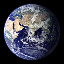
Eurasia is the largest of the six continents on Earth . Area - 53.6 million km² [3] , which is 36% of the land area . The population is 5.132 billion. (July 1, 2015) [1] , which makes up more than 70% of the planet’s population [4] .
| Eurasia | |
|---|---|
 Eurasia | |
| Territory | 53.6 million km² |
| Population | 5.132 billion (as of July 1, 2015) [1] people. |
| Density | 93.72 people / km² |
| Names of residents | Eurasians, Eurasian, Eurasian |
| Includes | 94 states |
| Unrecognized regions | eight |
| Languages | Languages of Eurasia |
| Time Zones | UTC ± 0 to UTC + 12 |
| Largest cities | Shanghai , Tokyo [2] , Moscow , London [2] , Istanbul , Jakarta [2] , Delhi , Mumbai , Tehran , Calcutta , Osaka [2] , Seoul , Beijing , Tianjin , Manila [2] and Karachi |


Name Origin
Initially, the largest continent of the world was given various names. Alexander Humboldt used the name "Asia" for the whole of Eurasia. Karl Gustav Reuschle in 1858 in the book "Handbuch der Geographie" used the term "Doppelerdtheil Asien-Europa". The term “Eurasia” was first used by geologist Edward Suess in the 1880s [5] .
Geographical position
The continent is located in the Northern Hemisphere between approximately 9 ° C. d. and 169 ° z. etc., while part of the islands of Eurasia is located in the southern hemisphere . Most of continental Eurasia lies in the Eastern Hemisphere , although the extreme western and eastern extremities of the mainland are in the Western Hemisphere .
The continent contains two parts of the world : Europe and Asia . The border line between Europe and Asia is most often drawn along the eastern slopes of the Ural Mountains , the Ural River , Emba River , the northwestern coast of the Caspian Sea , the Kuma River, the Kumo-Manych Depression , the Manych River, the eastern Black Sea coast , the southern Black Sea coast, and the strait Bosphorus , Sea of Marmara, Dardanelles , Aegean and Mediterranean Seas. This conditional division has developed historically, as a result of which there is a variation in the definition of the borders of Europe and Asia, including the inclusion in Europe of the entire basin of the Caspian Sea , Asia Minor , the Levant , as well as southern Iran , the territories of the Tigris and Euphrates , Arabia and Sinai rivers, that the latter for political reasons may be included in Africa [6] . Naturally, there is no sharp border between Europe and Asia. The continent is united by land continuity (Eurasia is also connected by land to Africa, the Suez Canal is the artificial line of separation of the continents), which has formed at the moment with tectonic consolidation and the unity of numerous climatic processes.
This is the only continent on Earth washed by four oceans: in the south - Indian , in the north - Arctic , in the west - Atlantic , in the east - Pacific .
Eurasia stretches from west to east for 18 thousand km, from north to south - for 8 thousand km, with an area of ≈ 54 million km². This is more than a third of the total land area of the planet. The area of the islands of Eurasia is about 3.45 million km² [7] .
Extreme Points of Eurasia
- Mainland points
- Cape Chelyuskin ( Russia ), 77 ° 43 's. w. - extreme northern continental point.
- Cape Piai ( Malaysia ) 1 ° 16 's. w. - The extreme southern mainland point.
- Cape Roca ( Portugal ), 9 ° 31 'C. e. - the extreme western continental point.
- Cape Dezhneva ( Russia ), 169 ° 42 's. D. - the extreme eastern continental point.
The geographical center of Eurasia is located 40 km west of Semey (formerly Semipalatinsk), Kazakhstan.
- Island points
- Cape Fligeli ( Russia ), 81 ° 51'13 "N - the extreme northern island point (However, according to the topographic map of Rudolph Island [8] , the coastal stretch in the latitudinal direction west of Cape Fligeli lies several hundred meters north of the cape in coordinates ).
- South Island ( Cocos Islands ) 12 ° 4 'S w. - extreme southern island point.
- Monchik rock ( Azores ) 31 ° 16 'C. D. - the extreme western island point.
- Ratmanova Island ( Russia ) 169 ° 0 's. d. - the extreme eastern island point.
Largest Peninsulas
- Kola Peninsula
- Yamal Peninsula
- peninsula Taimyr
- Chukotka Peninsula
- Kamchatka Peninsula
- peninsula korea
- peninsula indochina
- peninsula malacca
- Hindustan Peninsula
- Arabian Peninsula
- peninsula of Asia Minor
- Crimean peninsula (Crimea peninsula)
- Balkan Peninsula
- Apennine Peninsula
- The Iberian Peninsula
- Scandinavian peninsula
Geological characteristics
Structure
The geological structure of Eurasia is qualitatively different from the structures of other continents. Eurasia is composed of several platforms and plates . The continent was formed in the Mesozoic and Cenozoic eras and is the youngest in geological terms. This distinguishes it from other continents, representing the heights of ancient platforms, formed billions of years ago.
The northern part of Eurasia is a series of plates and platforms formed during the periods of Archean , Proterozoic and Paleozoic : the East European platform with the Baltic and Ukrainian shields, the Siberian platform with the Aldan shield , the West Siberian plate . The eastern part of the mainland includes two platforms (Sino-Korean and South China), some plates and areas of Mesozoic and Alpine folding. The southeastern part of the mainland is a region of Mesozoic and Cenozoic folding. The southern regions of the mainland are represented by the Indian and Arabian platforms, the Iranian plate , as well as areas of alpine and Mesozoic folding, which prevail in southern Europe. The territory of Western Europe includes zones of predominantly Hercynian folding and plates of Paleozoic platforms . Central areas of the continent include Paleozoic folding zones and Paleozoic platform plates.
In Eurasia, there are many large faults and cracks that are found in Siberia (West and Lake Baikal ), Tibet and some other areas.
History
Main article - History of Eurasia
The period of the formation of the mainland covers a huge period of time and continues today. The beginning of the process of formation of the ancient platforms that make up the continent of Eurasia occurred in the Precambrian era. Then three ancient platforms were formed: Chinese , Siberian and East European , separated by ancient seas and oceans [9] . At the end of the Proterozoic and in the Paleozoic , the processes of closure of the oceans separating land masses occurred. At this time, there was a process of land growth around these and other platforms and their grouping, which ultimately led to the formation of the Pangea supercontinent by the beginning of the Mesozoic era [9] .
In the Proterozoic, the formation of ancient platforms of Eurasia of Siberia, China and East Europe took place. At the end of the era, land increased south of the Siberian platform [9] . In Siluria, extensive mountain building occurred as a result of the connection of the European and North American platforms , which formed the large North Atlantic continent . In the east, the Siberian platform and a number of mountain systems merged to form the new mainland - Angarida . At this time, the process of formation of ore deposits [9] .
A new tectonic cycle began in the Carboniferous period [9] . Intense movements led to the formation of mountainous areas connecting Siberia and Europe. Similar mountainous regions formed on the territory of the southern regions of modern Eurasia. Before the beginning of the Triassic period, all the ancient platforms grouped and formed the mainland Pangea. This cycle was long and divided into phases. In the initial phase, mountain building took place in the southern territories of present western Europe and in the regions of central Asia [9] . In the Permian period , new large mountain-forming processes took place, in parallel with the general raising of land. As a result, by the end of the period, the Eurasian part of Pangea was a region with large folding. At this time, the process of destruction of the old mountains and the formation of powerful sedimentary deposits took place. In the Triassic period, geological activity was weak, but in this period the Tethys Ocean gradually opened in the east of Pangea, later in the Jurassic divided Pangea into two parts Laurasia and Gondwana. In the Jurassic period, the process of orogenesis begins, the peak of which, however, occurred in the Cenozoic era [9] .
The next stage in the formation of the continent began in the Cretaceous , when the Atlantic Ocean began to open. Finally, the continent of Laurasia was divided in the Cenozoic.
At the beginning of the Cenozoic era, northern Eurasia represented a huge land mass that composed ancient platforms interconnected by areas of the Baikal, Hercynian, and Caledonian foldings. In the east and southeast, Mesozoic folding regions joined this massif. In the west, Eurasia from North America was already separated by a wide Atlantic Ocean [9] . From the south, this enormous mass was supported by the shrinking Tethys Ocean. In the Cenozoic, there was a reduction in the area of the Tethys Ocean and intensive mountain building in the south of the continent. By the end of the Tertiary period, the continent took its modern shape.
Physical Characteristics
Relief
The relief of Eurasia is extremely diverse, it contains some of the largest plains and mountain systems in the world, the East European Plain , the West Siberian Plain , the Tibet Plateau . Eurasia is the highest continent on Earth, its average height is about 830 meters (the average height of Antarctica is higher due to the ice sheet, but if you take the height of the bedrock as its height, the continent will be the lowest). In Eurasia, there are the highest mountains on Earth - the Himalayas (ind. Abode of snows), and the Eurasian mountain systems of the Himalayas, Tibet , Hindu Kush , Pamir , Tien Shan and others form the largest mountain region on Earth. [ten]
The modern relief of the continent is due to intense tectonic movements during the Neogene and Anthropogenic periods. The greatest mobility is characterized by the East Asian and Alpine-Himalayan geosynclinal belts . Powerful neotectonic movements are characterized by a wide strip of structures of different ages from Gissar-Alai to Chukotka . High seismicity is inherent in many areas of Central , Central and East Asia , the Malay archipelago . The active volcanoes of Eurasia are located in Kamchatka , the islands of East and Southeast Asia , in Iceland and in the Mediterranean .
The average height of the continent is 830 m, mountains and plateaus occupy about 65% of its territory [11] .
The main mountain systems of Eurasia:
|
|
|
The main plains and lowlands of Eurasia:
|
|
|
The relief of the northern and several mountainous regions of the continent was affected by ancient glaciation. Modern glaciers are preserved on the islands of the Arctic , in Iceland and in the highlands. About 11 million km² (mainly in Siberia ) is occupied by permafrost.
Mainland geographic records
In Eurasia, there is the highest mountain of the Earth - Chomolungma (Everest), the largest ( Caspian Sea ) and the deepest ( Baikal ) lakes, the largest mountain system in area - Tibet , the largest peninsula - Arabian , the largest geographical area - Siberia , the largest low point of land - Depression of the Dead Sea . On the continent there is also a cold pole of the northern hemisphere - Oymyakon .
Historical and geographical zoning
Eurasia is the birthplace of the most ancient civilizations of Sumerian and Chinese, and the place where almost all the ancient civilizations of the Earth were formed. Eurasia is conditionally divided into two parts of the world - Europe and Asia . The latter, by virtue of its size, is divided into smaller regions - Siberia , the Far East , Amur Region , Primorye, Manchuria , China, India, Tibet , Uyguria (East Turkestan, now Xinjiang as part of China), Central Asia , the Middle East , the Caucasus , Persia , Indochina , Arabia and some others.
Climate
In Eurasia, all climatic zones and climatic zones are represented. In the north, the Arctic and subarctic climatic zones predominate, then the temperate zone crosses a wide strip of Eurasia, followed by the subtropical zone. The tropical belt in Eurasia is interrupted, stretching across the continent from the Mediterranean and Red Seas to India. The subequatorial belt extends to the north, covering India and Indochina, as well as the extreme south of China, and the equatorial belt covers mainly the islands of southeast Asia. Climatic zones of the marine climate are mainly in the west of the continent in Europe, as well as islands. Monsoon zones prevail in the eastern and southern regions. With a deepening inland, the continentality of the climate grows, this is especially noticeable in the temperate zone when moving from west to east. Zones of the most continental climate are in Eastern Siberia (see Dramatically continental climate ).
Nature
Natural areas
| Arctic desert Tundra Taiga Mixed forest Steppe and forest-steppe Subtropical forest Mediterranean climate Monsoon forest Arid desert | Semi desert Arid steppe Semi-arid desert Grassy savannah Wood savannah Dry rainforest Tropical rainforest Alpine tundra Mountain forest |
In Eurasia, all natural areas are represented. This is due to the large size of the mainland and the length from north to south.
The northern islands and high mountains are partially covered by glaciers. The polar desert zone extends mainly along the northern coast and a significant part of the Taimyr Peninsula. Next is a wide belt of tundra and forest-tundra, occupying the most extensive areas in Eastern Siberia ( Yakutia ) and the Far East .
Almost all of Siberia, a significant part of the Far East and Europe (northern and northeastern), is covered by coniferous forest - taiga . Mixed forests are located in the south of Western Siberia and on the Russian Plain (central and western parts), as well as in Scandinavia and Scotland. Plots of such forests are available in the Far East, in Manchuria , Primorye, Northern China, Korea and the Japanese islands. Deciduous forests predominate mainly in the west of the mainland in Europe. Small areas of these forests are found in East Asia (China). In the south-east of Eurasia, there are massifs of moist equatorial forests .
The central and southwestern regions are predominantly occupied by semi-deserts and deserts . On Hindustan and Southeast Asia, there are areas of light forests and variable-humid and monsoon forests. Subtropical and tropical monsoon-type forests also prevail in eastern China, and their moderate counterparts in Manchuria, Amur and Primorye . In the south of the western part of the continent (mainly the Mediterranean and the Black Sea coast) there are zones of hard-leaved evergreen forests and shrubs (forests of the Mediterranean type). Large areas are occupied by steppes and forest-steppes, occupying the southern part of the Russian Plain and the south of Western Siberia. Steppes and forest-steppes are also found in Transbaikalia , Amur Region, their vast areas are in Mongolia , as well as in northern and northeastern China and Manchuria.
In Eurasia, areas of altitudinal zonation are widespread.
Fauna
The Hindustan and Indochina peninsulas enter the Indo-Malay Region, along with the adjacent part of the mainland, the islands of Taiwan, the Philippines and Sunda, and the south of Arabia, together with most of Africa, enter the Ethiopian region. Some southeastern islands of the Malay archipelago, the majority of zoogeographers belong to the Australian zoogeographic region. This division reflects the features of the development of the Eurasian fauna in the process of changing environmental conditions during the late Mesozoic and the entire Cenozoic, as well as communication with other continents. The ancient extinct fauna, known only in the fossil state, the fauna that disappeared in historical time as a result of human activity, and the modern fauna are of interest to characterize modern natural conditions.
At the end of the Mesozoic, a diverse fauna was formed on the territory of Eurasia, consisting of monotreme and marsupial mammals, snakes, turtles, etc. With the advent of placental mammals, especially predators, lower mammals retreated to the south, to Africa and Australia. They were replaced by proboscis, camels, horses, rhinos, which inhabited most of Eurasia in the Cenozoic. The cooling of the climate at the end of the Cenozoic led to the extinction of many of them or a retreat to the south. Proboscis, rhinos, etc. in the north of Eurasia are known only in fossil state, and now they live only in South and Southeast Asia. Camels and wild horses, until recently, were widespread in the inner arid parts of Eurasia.
The cooling of the climate led to the settlement of Eurasia with animals adapted to harsh climatic conditions (mammoth, tour, etc.). This northern fauna, the center of formation of which was located in the Bering Sea and was common with North America, gradually pushed south the heat-loving fauna. Many representatives of it died out, some survived as part of the modern fauna of the tundra and taiga forests. The drying of the climate of the interior of the continent was accompanied by the spread of steppe and desert fauna, which was preserved mainly in the steppes and deserts of Asia, and partially died out in Europe.
In the eastern part of Asia, where climatic conditions did not undergo significant changes during the Cenozoic, many preglacial animals found refuge. In addition, through East Asia there was an exchange of animals between the Holarctic and Indo-Malay regions. Within its limits, tropical forms such as tiger, Japanese macaque, etc. penetrate far north.
The distribution of modern wildlife across the territory of Eurasia reflects both the history of its development, as well as the features of natural conditions and the results of human activities.
On the northern islands and in the far north of the continent, the composition of the fauna almost does not change from west to east. The fauna of the tundra and taiga forests has insignificant internal differences. The farther south, the wider the latitude differences within the Holarctic. The fauna of the extreme south of Eurasia is already so specific and so different from the tropical fauna of Africa and even Arabia that they are assigned to different zoogeographic areas.
The tundra fauna is especially monotonous throughout Eurasia (as well as North America).
The most common large mammal of the tundra is the reindeer (Rangifer tarandus). It is almost never found in Europe in the wild; This is the most common and valuable pet in northern Eurasia. The tundra is characterized by arctic fox, lemmming and white hare.
Ecology
Eurasian countries
The list below includes not only the states located on the continent of Eurasia, but also the states located on the islands that belong to Europe or Asia (Japan is an example). The total number of states in Eurasia is 99 (world record), with 50 of them European. Italicized states with fuzzy legal status (see unrecognized and partially recognized states ).
|
|
|
|
Inland waters
The mainland is rich in surface and groundwater. From its territories, the largest rivers flow into all the oceans except the South. Lakes of the continent stand out in size and depth. The distribution of rivers on the mainland is determined by the relief and climate, the most dense river network on its outskirts. Inland waters of Eurasia are unevenly distributed.
Low-water areas, remote and isolated from the oceans, occupy a significant area. Inland runoff basins comprise about one second of the mainland. Large reserves of groundwater are found under the West Siberian Plain. Near the high mountains adjacent to the basins, in arid areas, groundwater emerges in the form of keys. In such places in Central and Central Asia, oases have formed. The mainland ice stores many fresh waters (coverslips on the Arctic islands, mountainous in the glaciers). The rivers of the Arctic Ocean (Pechora, Ob, Yenisei, Lena, etc.) have a mixed diet with a predominance of snow and freeze for a long time. Many rivers flowing into the Atlantic Ocean do not freeze, their food is mainly rainwater, in the mountains - glacial, they are full of water all year round. The largest rivers of this basin are the Danube, the Rhine, the Elbe, the Neman, and others. The rivers of the Pacific Ocean basin have mixed feeding, in which the rains brought by the summer monsoons from the ocean play a significant role. Here the largest river of Eurasia flows - the Yangtze and such rivers as the Amur, Yellow River, Mekong. The Ganges with the Brahmaputra, Indus, Tiger, Ganges and Euphrates carry their waters into the Indian Ocean. The first three of them begin in the Himalayas, then flow along the plains, irrigating them. The river regime is associated with melting ice and snow in the mountains with monsoons.
Notes
- ↑ 1 2 United Nations, Department of Economic and Social Affairs, Population Division (2015). World Population Prospects: The 2015 Revision, DVD Edition. File POP / 1-1: Total population (both sexes combined) by major area, region and country, annually for 1950-2100 (thousands). Estimates, 1950 - 2015. POP / DB / WPP / Rev.2015 / POP / F01-1 .
- ↑ 1 2 3 4 5 Located on an island belonging to the continent
- ↑ Eurasia // Great Russian Encyclopedia : [in 35 vols.] / Ch. ed. Yu.S. Osipov . - M .: Great Russian Encyclopedia, 2004—2017.
- ↑ Eurasia
- ↑ Stefan Wiedehouselkekehr. II. Zwischen den Beiden Weltkiegen: Die Eurasier in der Emigration // Die Eurasische Bewegung: Wissenschaft und Politik in der russischen Emigration der Zwischenkriegszeit und im postsowjetischen Russland . - Böhlau Verlag Köln Weimar, 2007 .-- T. 39. - P. 36. - 398 p. - (Beiträge zur Geschichte Osteuropas). - ISBN 9783412339050 . (German)
- ↑ Peel, MC; BL Finlayson and TA McMahon. Updated world map of the Köppen-Geiger climate classification (Eng.) // Hydrology and Earth System Sciences: journal. - 2007. - Vol. 11 . - P. 1633-1644 . - DOI : 10.5194 / hess-11-1633-2007 . - .
- ↑ I.M. Itenberg, L.N. Kolosova. Atlas of the World. - Main Directorate of Geodesy and Cartography. The Ministry of Geology and Mineral Resources of the USSR., 1962. - P. 51, 84. - 165 p. - (I-850). - 250,000 copies.
- ↑ Topographic map of Rudolph Island
- ↑ 1 2 3 4 5 6 7 8 BASIC STAGES OF FORMING THE NATURE OF EURASIA
- ↑ Eurasia (inaccessible link) . Date of treatment February 20, 2011. Archived on May 1, 2011.
- ↑ Geography. Modern illustrated encyclopedia. - M.: Rosman. Edited by prof. A.P. Gorkin. 2006. Article “Eurasia” .
- ↑ 1 2 3 4 5 6 7 8 9 State with fuzzy legal status. See unrecognized and partially recognized states .
- ↑ In the process of formation .
Literature
- History of World Civilizations 2006
- Physical Geography 2005
- Dimov, G. Middle-Age the Balkans in the context of the Eurasian space. Dichotomyata on the Balkans of the earth kato periphery or center on ideas and culture for Eurasia. - Q: History, year. XXI, Prince 3, 2012, 207-218.
Links
- Eurasia help
- Great Soviet Encyclopedia - Eurasia
- Mainland Eurasia - Overview
- Eurasia (inaccessible link) . Date of treatment December 28, 2010. Archived on September 5, 2011.
- Eurasia Regions
- Eurasia - geological structures
- Climate of Eurasia
- Eurasia tectonics
- Plitotectonic development and formation of oil and gas basins in Northern Eurasia
- Eurasia - relief