Basia ( Belorussian Basya ) is a river in the Mogilev region of Belarus , the right tributary of the Prony . The length of the river is 104 km. The area of its river basin is 955 km². The average slope of the water surface is 0.68 ‰. [one]
| Basia | |
|---|---|
| Belor. Basia | |
| Characteristic | |
| Length | 104 km |
| Swimming pool | 955 km² |
| Watercourse | |
| Source | |
| • Location | Smolensk Upland |
| • Coordinates | |
| Mouth | Pronya |
| • Coordinates | |
| River slope | 0.68 m / km |
| Location | |
| Water system | Pronya → Sozh → Dnepr → Black Sea |
| A country |
|
| Regions | Mogilev region , Vitebsk region |
| Areas | Dubrovensky district , Goretsky district , Shklovsky district , Dribinsky district , Chausky district |
Name Origin
Bas- Root is a modification of an ancient hydronymic base with the meaning "water", "river". A related name for Basya is, for example, the hydronym Veseya, Veseyka in the Pripyat basin [2] . Also, the name of the river is associated with the Indo-Iranian ( Scythian ) basach - “big” [3] .
According to V.N. Toporov , the name of the Basia river is of Baltic origin - from * Bas- . The hydronym corresponds with such correspondences as lt. Basi, Basites , dr.-Prussian. Bosin [4] .
Description
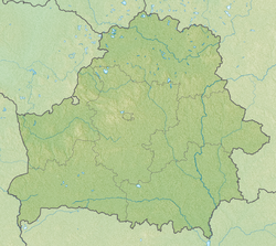
The source of the river is located on the Smolensk Upland , in the south-west of the Dubrovensky district of the Vitebsk region near the village of Antipenki . The river flows along the Orsha-Mogilev plain through the territory of the Goretsky , Shklovsky , Dribinsky and Chausky regions, after which it flows into Pronya . The density of the river network is 0.48 km / km². Loamy soils prevail. Forest cover 20%. The valley is box-shaped, 300-500 m wide. The slopes are steep, 4-10 m high. The floodplain is bilateral, cut by elders and tributary valleys, 150-300 m wide. It is flooded to a depth of 0.3-1 m, in places down to 1.5 -2 m. The channel is moderately winding, slightly branched, in the middle course, canalized, in some areas cleared, the width in the middle and lower reaches of 10-15 m. The banks are steep. The spring period accounts for 68% of the annual runoff. The highest level of high water at the end of March, the average height above the low-water level of 2.5 m. It freezes in early December, with an icebreaker in the 3rd decade of March. Spring ice drift 5-11 days. The average annual water flow at the mouth is 6.3 m³ / s. Basia is used as a water intake of reclamation systems. [5]
The main tributaries are Limna , Avchesa , Ruza (on the right), Golubin , Kasinka , Polna , and Bilberry (on the left).
Three kilometers from the mouth is the town of Chausy .
The river is famous for the battle of 1660 during the Russo-Polish war . [6]
Notes
- ↑ Blackboard of Belarus: Etsiklapedyya / redkal: N. A. Dzisko i insh. - Minsk: BelEn , 1994 .-- 415 p. - 10,000 copies. - ISBN 5-85700-133-1 . (belor.)
- ↑ Rogaleў A.F. Names of the Fatherland of Belarus (Tapanіmіya Belarusі). - Gomel: Bark, 2008 .-- S. 196.
- ↑ Entsiklapedy gіstoryya Belarusі. At 6th t. / Redkal .: B. І. Sachanka (gal. Red.) І інш .. - Мn: BelEn, 1994. - T. 2. - P. 528.
- ↑ V.N. Axes. "Baltica" near Moscow. - Balto-Slavic studies. - 1972. - S. 256.
- ↑ Enceclapedia progeny of Belarus / Redkal .: І. P. Shamyakin (gal. Red.) І інш. - Mn. : BelSE , 1983. - T. 1. Aality - Gassts. - S. 249. - 575 p. (belor.)
- ↑ Malov A.V. Russo-Polish War of 1654-1667 Moscow, Tseikhkhauz, 2006. ISBN 5-94038-111-1 .