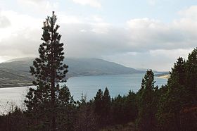
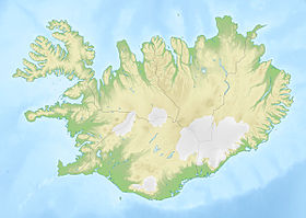
Skorradalsvatn ( Isl. Skorradalsvatn ) - a lake in the west of Iceland , is located in a narrow valley between the Hvalfjord fjord and the small town of Reykholt . Its length is about 15 km, width 1 km and has a total area of 14.7 km ². Maximum depth 48 m.
| Lake | |
| Skorradalsvatn | |
|---|---|
| fig. Skorradalsvatn | |
 | |
| Morphometry | |
| Dimensions | 15 × 1 km |
| Square | 14.7 km² |
| Deepest | 48 m |
| Location | |
| A country |
|
There are several high mountains around the lake. In the north of the lake is Mount Skorradalshauls , 450 meters high, and in the south there are higher mountains, such as Skardsheidi , 1053 meters high.
Previously, the road to the lake ran along the Tingvetlir Valley. This is an old trail that crosses the southeast mountains towards the Kaldidalur valley, which is still sometimes used for trekking .
The shores of the lake are forested. This is the result of a government program to reforest Iceland. In view of this, the valley resembles valleys in the Alps, for example, in the vicinity of Salzburg ( Austria ).
The lake is also used as a reservoir, for which its level has been artificially raised.
On the shores of the lake there is not a single settlement, but many summer houses.
See also
- Photo
- Ellidavatn