Kishma (Vorsma) - a river in the Nizhny Novgorod region , the right tributary of the Oka .
| Kishma | |
|---|---|
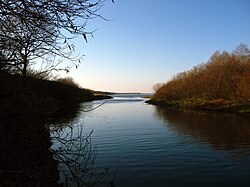 Mouth of Kishma Mouth of Kishma | |
| Characteristic | |
| Length | 71 km |
| Swimming pool | 795 km² |
| Watercourse | |
| Source | |
| • Location | at the village of Babkino |
| • Height | > 140 m |
| • Coordinates | |
| Mouth | Oka |
| • Location | near the village of Okulovo |
| • Height | 68 m |
| • Coordinates | |
| River slope | 1.58 m / km |
| Location | |
| Water system | Oka → Volga → Caspian Sea |
| A country |
|
| Region | Nizhny Novgorod Region |
| Areas | Vachsky district , Sosnovsky district , Pavlovsky district |
| HWR code | |

The length of the river is 71 km, the catchment area is 795 km² [2] . The height of the source is more than 140 m above sea level [3] . The height of the mouth is 68 m above sea level [4] .
It flows through the territory of Vachsky , Sosnovsky and Pavlovsky districts.
The source is located in the tract Kolpenka on the border of the Vachsky and Sosnovsky districts near the bell tower of an inactive church 3 km southwest of the village of Babkino . From the source to the north to the village of Matyushevo , then north to Komarov and Gomzov , the last 10 km flows west. It flows into the Oka River near the village of Okulovo .
The river strongly meanders, flows through a treeless failure ( karst ) area. From the village of Bogdanovo to Davydkov, the flow is variable. Within the city limits, Vorsma flows through Lake Vorsma , located in a large karst basin .
Content
Channel Formation History
According to the research of Professor V.P. Amalitsky, participant of the Nizhny Novgorod geological and soil expedition V.V. Dokuchaev, the Kishma River initially flowed into Lake Toscanka (Vorsmansky), ending its watercourse. The modern lower reaches of Kishma after the village of Gomzovo was part of the Paleo-Kudmy river, which at that time flowed not into the Volga, but into the Oka in the region of the current village of Okulovo.
Subsequently, as a result of river interceptions that occurred due to neotectonic movements of the earth's crust and the development of erosion on the watersheds, the pattern of the river network of the region changed as follows:
- the wide but flat watershed between Lake Vorsmensky and Paleo-Kudma was blurred, and the waters of Kishma rushed north, merging with the lower reaches of the Paleo-Kudmy;
- positive vertical tectonic movements on the Ubezhitsky anticlinal uplift and erosion on the watershed with the Volga turned the Paleo-Kudmy eastward, leaving the Bogorodskaya “dead valley” that has survived to our time in its former place.
It is noteworthy that, until the beginning of the 20th century, local residents considered parts of Kishma on either side of Lake Vorsma to be two different rivers: the river above the lake was called Kishma, and below it was called Vorsma (translated from Mordovian - “forest river”).
Tributaries
- Lubyanka
- Iverka
- Rattlesnake
- Stanko
- Moody
- Valgma (lv)
- Surin
- Black
Settlements
The settlements are located on the banks of the river:
- Bogdanovo village
- Elizarovo village
- village of Big Martovo
- Davydkovo village
- city of Worsma
- Komarovo village
- Gomzovo village
- Rybino village
- village of Vorvan
Bridges
Automobile bridges are thrown across the Kishma River near Elizarov, Bolovin, Davydkov, Rybin, Vorsma and Gomzov. There is a railway bridge (near the village of Gomzovo near Vorsma station).
Dam near the city of Vorsma .
Water registry data
According to the state water register of Russia, it belongs to the Oka Basin District , the water sector of the river is the Oka from the city of Murom to the city of Gorbatov , without the Klyazma and Tesha rivers, the river sub-basin is the basins of the Oka tributaries from Moksha until it flows into the Volga. The river basin of the river is the Oka [2] .
The code of the object in the state water register is 09010301212110000031124 [2] .
Notes
- ↑ Surface Water Resources of the USSR: Hydrological Understanding. T. 10. Upper Volga region / ed. V.P. Shaban. - L .: Gidrometeoizdat, 1966 .-- 528 p.
- ↑ 1 2 3 State Water Register . Kishma . textual.ru . Ministry of Natural Resources of Russia (March 29, 2009). Date of treatment December 20, 2018. Archived March 29, 2009.
- ↑ Map sheet N-38-2 Vacha . Scale: 1: 100,000. State of the terrain for 1983. 1989 Edition
- ↑ Map sheet O-38-32 - FSUE GOSGISCENTER