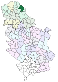
Kikinda ( Serb. Kikinda ) is a community in Serbia , part of the North Banat District of the Autonomous Region of Vojvodina . The community is located in the historical and geographical area of Banat .
| community | |||
| Kikinda | |||
|---|---|---|---|
| Kikinda | |||
| |||
| A country | Serbia | ||
| Included in | North Banat District Autonomous Region of Vojvodina | ||
| Includes | 10 settlements | ||
| Adm. center | Kikinda | ||
| History and Geography | |||
| Area | 782 km² | ||
| Timezone | CET ( UTC + 1 , summer UTC + 2 ) | ||
| Population | |||
| Population | 63 324 people ( 2007 year ) | ||
| Density | 81 people / km² | ||
| Digital identifiers | |||
| Auto Code numbers | Ki | ||
 | |||
 | |||

The population of the community is 63 324 [1] people (2007), the population density is 81 people / km² [1] . The occupied area is 782 km² [1] , of which 89.1% [1] is used for industrial purposes.
The administrative center of the community is the city of Kikinda . The Kikinda community consists of 10 settlements [1] , the average area of a settlement is 78.2 km² [1] .
Content
- 1 Community statistics
- 2 Settlements
- 3 Education
- 4 notes
- 5 Links
Community Population Statistics
| Year | Population [2] |
|---|---|
| 1991 | 67 582 |
| 2001 | 67,378 |
| 2002 | 66 781 |
| 2003 | 66 168 |
| 2004 | 65,532 |
| 2005 | 64 842 |
| 2006 | 64 119 |
| 2007 | 63 324 |
Settlements
- Banatska Topola
- Banatsko-Veliko-Selo
- Bashaid
- Ijös
- Kikinda
- Mokrin
- Nakovo
- Novi Kozartsi
- Rusko-Selo
- Sayan
Education
There are 15 primary and 4 secondary schools in the community.
Notes
- ↑ 1 2 3 4 5 6 Publish and stamp - Republik factory for statistics Srbi Сe ( ISSN 1450-9075, January 2009) - Section "General Data", pages No. 15-19
- ↑ Publishing and stamping - Republikki plant for statistics of Srbiјe (ISSN 1450-9075, January 2009) - Section "Population", pages 108–111