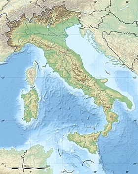
The Gulf of Trieste ( Italian: Golfo di Trieste , Sloven . Tržaški zaliv ) is a shallow bay in the Adriatic Sea , at the northernmost point of the Mediterranean Sea . Trieste Bay is part of the Gulf of Venice . The waters are divided between Italy , Slovenia and Croatia . From the south, the bay is bordered by Istria , the largest peninsula of the Adriatic Sea, divided between Croatia and Slovenia.
| Trieste Bay | |
|---|---|
| ital Golfo di Trieste , word. Tržaški zaliv | |
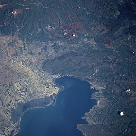 Photo of the gulf from space | |
| Location | |
| Upstream water area | Adriatic Sea |
| Country |
|
The boundary of the bay is an imaginary line connecting Punta Tagliamento ( Italian. Punta Tagliamento ) on the Italian coast with Savudrija ( Croatian Savudrija ) in the Croatian. The bay area is about 550 km², the average depth is 16, and the maximum is 37 m. A number of small islands lie at the entrance to Laguna di Grado ( Italian: Laguna di Grado ). The east coast, on which Trieste and the Slovenian coast is located, is distinguished by steeper relief.
Water in the bay flows counterclockwise at an average speed of 0.8 knots . Waves in the Gulf are larger than elsewhere in the Adriatic, but usually do not exceed sixty cm . The average salinity is usually 37-38 ‰ , but in summer it drops to 35.
The most important parts are:
- Panzano Bay ( Italian. Panzano ) in Italy;
- Gulf of Muggia ( Italian. Muggia ) in Italy;
- Koper Bay ( Italian: Capodistria ) in Slovenia;
- Piran Bay ( Croatian Piranski zaljev , Italian. Baia di Pirano , Sloven. Piranski zaliv ), which has been the subject of territorial disputes between Slovenia and Croatia since 1991.
The entire coast of Slovenia is located in this bay. The coastline is 46.6 km [1] . The cities on the coast (from east to west) are Koper , Izola and Piran .
See also
- Free Territory of Trieste
Notes
- ↑ The World Factbook by CIA (Eng.) . The appeal date is June 5, 2009.