Despite their small size and considerable remoteness, the Faroe Islands have a developed system of public and private transport.
Content
History
The history of the Faroe Islands transportation system can be divided into four main periods:
XIX century and earlier
During this period, stretching from the feudal era to the beginning of the 20th century, transport links on the islands were carried out mainly by boat, foot and, in some places, horse-drawn transport.
End of XIX - beginning of XX century
In the second period, which began at the end of the 19th century , the first ferry crossings appeared. At first, ferries were private, but gradually acquired the role of public transport . A special impetus to the development of ferry services was the emergence of road public transport between the world wars. After the Second World War, it became possible to reach most of the islands using a combination of ferries - bus or taxi .
Mid 20th Century
The third period includes the modernization of ferry services, the emergence of car ferries, making it possible to reach any part of the islands by private car. During World War II, the first airport on the islands of Vagar was built , which in 1963 was reconstructed into a civil international airport.
During this period, the road network was significantly expanded, tunnels were built to connect remote valleys and gorges, such as Hwalba , Sandvik and Norddepil .
From the end of the 20th century to the present
The fourth period began with new developments. In 1973, the first bridges appeared between the villages of Nordskali on the island of Estura and the village of Nesvik on Streymoye . In 1976, a new tunnel was opened between Northrend and the rest of the island of Estura. Together with the bridge, this system connected the two largest islands of the archipelago into what is now called "Meginlandið" - "Mainland".
In 1975, a dam bridge was built between the islands of Vida and Borda , in 1986 a similar system connected the islands of Borda and Kun , and by 1992 a first-class road was built connecting the capital Faroe Torshavn with the northern regions of the archipelago.
The latest development of the Faroese transport network are tunnels under the seabed. In 2002 , a tunnel was opened between the islands of Stremoy and Vagar, the latter is the only Faroese airport. In 2006, the Norðoyatunnilin tunnel connected the islands of Estura and Bordeaux. Travel through these two tunnels is paid, the rest remain free. Thus, at present, about 85% of the Faroe Islands can be reached by car.
The Faroe Islands currently have a developed transport system based on roads, ferries and helicopters . International communication is carried out both by air and by sea.
Roads
Total: 458 km (1995)
- paved: 450 km
- unpaved: 8 km
Bus Service
Roads have become the most important transport arteries of the Faroe Archipelago. The islands have a developed bus network - with red-colored Bussleiðin buses serving Torshavn and blue Bygdaleiðir connecting the rest of the islands. Most of the buses are modern, built by Volvo .
Railways
Due to the mountainous terrain, small population and relatively small distances, there are no railways on the islands.
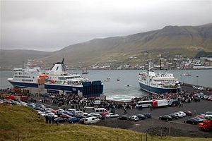
Ports and Harbors
- Torshavn
- Klaksvik
- Turoyri
- Runavik
- Fouglafjörur
Merchant Fleet
Total: 6 ships (with a displacement of 1000 register tons or more), total 22 853 RT / 13 481 metric tons (1999)
- ships of the type: Cargo ships 2, gas tanker 1, refrigerated vessel 1, Rolker 1, passenger 1.
Airports
On the islands there is only one Vagar airport.
Links
Sources
- CIA World Factbook , 2000.