New Ireland ( eng. New Ireland ) or Latangai is an island in the Bismarck archipelago of Papua New Guinea . The area of the island is 7,404.5 km² [1] , with 118,350 [2] people. The island is part of the eponymous province of the Islands , the administrative center is the city of Kavieng .
| New Ireland | |
|---|---|
| English New ireland | |
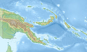
 Island Map | |
| Specifications | |
| Square | 7404.5 km² |
| Highest point | 2379 m |
| Population | 118 350 people (2002) |
| Population density | 15.98 people / km² |
| Location | |
| Archipelago | Bismarck Archipelago |
| Water area | Pacific Ocean |
| A country |
|
| Region | Islands |
| Area | New Ireland |
Geography

New Ireland is the second largest island of the Bismarck archipelago after New Britain . The archipelago itself is located northeast of New Guinea . New Ireland is located in the eastern part of the archipelago between the second and third degrees of southern latitude and extends for 400 km from northwest to southeast. The island has a very thin shape and only in the extreme south-east it is wider than 10 km. New Ireland is covered with rainforest and very mountainous. The peak Taron in the mountains of Hans Meier is the highest point of the island (2379 m). New Ireland is located between the Bismarck Sea and the Pacific Ocean . In the southeast, it is separated by the St George’s Strait from New Britain, and the Duke of York Islands are located in the strait. The administrative center of the province of New Ireland, the city of Kavieng is located in the north.
History
Evidence of human settlement in New Ireland can be traced back to more than 30 thousand years ago.
In 1616, Dutch navigators Jacob Lemer and Willem Cornelis Schouten were the first Europeans to land on the island. Subsequently, the southern edge of New Ireland became a popular stop for Spanish and Dutch ships in order to replenish drinking water supplies . However, the fact that New Ireland and New Britain are two different islands was discovered only in 1767 by Philip Carteret . It was he who gave the island the name Nova Hibernia , which in Latin meant New Ireland.
In the 1870s , New Ireland became the target of invasions by merchants who took indigenous people to slave labor on sugar cane plantations in Australia and Samoa . In 1879, New Ireland became the scene of a major deception of the Marquis de Rai, an adventurer. He lured the island with false promises of white colonists, selling them hundreds of hectares of useless land. Many died of malaria and starvation before the rest of the colonists were saved and evacuated to Australia. The Marquis himself died later in the house of the insane in France .
From 1885 to 1899, New Ireland was part of a German protectorate ( German New Guinea Company ), and from 1899 to 1914 a part of the colony German New Guinea . During this period, the island was called " New Mecklenburg " ( it. Neumecklenburg ). Since the days of German rule in New Ireland, along the northeast coast, there is a 250 km long road made of crushed coral , connecting Samo , Namatanai , Kanam , Malom , Logia and Mangai with the capital Kavieng. The reason for the construction of the road was the need to access German-based copra plans, which turned out to be very profitable. Since 1975, the road has been called Boluminski Highway in honor of the then governor of the island.
During World War II, New Ireland was occupied by the Japanese army . On September 18, 1945, the Japanese units that occupied New Ireland signed an act of surrender aboard the American ship HMS Swan .
Language
The name of the island in the Papuan lingua franca tok-pisin is also Niu Ailan . In New Ireland, 19 languages are used, of which all but one is Austronesian and are related to each other.
Notes
- ↑ United Nations Environment Program, " Islands by land area: New Ireland ," islands.unep.ch (1988).
- ↑ New Ireland Province (not available link) . The appeal date is July 17, 2013. Archived August 8, 2017.
Links
- Wikimedia Commons has media related to New Ireland