Habomai ( 歯 舞 群島 Habomai-gunto:, “Flat Islands” [2] [3] ) is the Japanese [4] name for the group of islands in the north-west of the Pacific Ocean , together with the Shikotan island in the Soviet [5] [6] [ 7] [8] and Russian [9] cartography [4] included in the Small Kuril Ridge [4] . The Habomai group includes the islands of Polonsky , Shards , Zelyony , Demina , Yuri , Anuchin , Tanfilyev and a number of small ones. Separated by the Soviet Strait from Hokkaido Island. The total area of the archipelago is 99.94 km², of which 59% is Green Island. The archipelago is dominated by a relatively mild oceanic climate .
| Habomai Archipelago | |
|---|---|
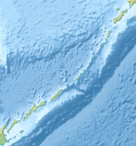
 Islands of the Habomai Archipelago, view from space | |
| Characteristics | |
| Largest island | Green |
| total area | 99.94 km² |
| Location | |
| Archipelago | Kurile Islands |
| Water area | Pacific Ocean |
| A country |
|

The group of islands administratively, according to the federal structure of Russia, is included in the Sakhalin Region as part of the South Kuril region as part of the administrative and territorial structure of the region and as part of the South Kuril urban district as part of the municipal structure in the region . Their affiliation is disputed by Japan .
Etymology and use of the name
The unifying Japanese name for the group of islands is derived from the previous administrative-territorial division of Japan [4] : until April 1, 1959, the Habomai County formally existed.
In the last [ specify ] the years in Russian society there is a discussion about the appropriateness of using the name "Habomai" in Russian . Thus, in a resolution of the Sakhalin Regional Duma of February 18, 1999, it was noted that the name Khabomai was used in a number of Russian-Japanese agreements of 1998, which led to the widespread use of this name in the Russian media . The decision drew attention to the letter of the Interdepartmental Commission on Geographical Names of the Russian Federation (MVK N 2257 of October 1, 1997), as well as the requirements of Art. 8, 11 of the Federal Law "On the names of geographical objects" N 152-ФЗ dated December 18, 1997. Based on these documents, the Sakhalin Regional Duma
- demanded that the use of this kind of Japanese geographical names in Russian official documents and the media be considered unacceptable;
- suggested amending the 1998 Russian-Japanese treaties [10] .
Responding to this kind of criticism, Russian Foreign Minister Igor Ivanov explained that the name “Khabomai” was used “... in the Joint Declaration of the USSR and Japan of October 19, 1956, which was ratified by the Supreme Soviet of the USSR and is a valid international treaty . Since international treaties take precedence over domestic law, the name “Khabomai” was subsequently used repeatedly in official Russian-Japanese documents ” [11] .
In the summer of 2006, Sakh.com reported on a situation where the use of the name “Khabomai” on a website was recognized as an administrative offense for which a fine of 30 minimum wages (3,000 rubles) was charged from the site’s leader [12] .
Description
The islands are stretched in a line parallel to the Greater Kuril ridge , 48 km south of the latter. The straits between the islands are shallow, filled with reefs and underwater cliffs. Strong tidal currents and persistent thick fogs make the straits extremely dangerous for swimming.
Most of the islands are low. Desert, rocky, meadow landscapes; there are no forests; there are shrubbery and swamps. This group of islands is characterized by a humid marine climate with cool summers and mild winters. Judging by observations of the breeding period of some rodents , which lasts until November, the climate of Khabomaev is even milder than in Kunashir [13] .
There are no civilians on the islands - only Russian border guards [14] .
The Habomai archipelago, along with the islands of Kunashir , Iturup and Shikotan , is the subject of a territorial dispute between Russia and Japan [15] [16] [17] .
List of Islands
- Polonsky Island ( 多 楽 島 taraku something: doc. "Island of Great Fun")
- Rock gull
- Shattered Islands
- Cliff of kira
- Rock Cave ( Kanakuso ) - on the rock rookery of Steller Sea Lion .
- Fox Islands ( Todo )
- Rock Sail ( Hokoki )
- Cones Islands ( Kabuto )
- Rock Candle ( Rosoku )
- Green Island ( 志 発 島 sibotsu something:, before the "island of Aspirations")
- Dyomin Islands ( 春 苅 島 harukari something:, referred to as "Spring Harvest Island")
- Yuri Island ( Japanese 勇 留 島 Yu: ri:)
- Anuchin Island ( Japanese 秋 勇 留 島 Akiyu: rio:, doc. “Autumn Yuri Island”)
- Rock Amazing ( Hanare )
- Tanfiliev Island ( Japanese 水晶 島 Suisyo: -jima , apt . “Crystal Island”)
- Bank Dangerous
- Watchdog Island ( 萌 茂 尻 島 hoemosiri )
- Reef Island ( オ ド ケ 島 odoke-shima )
- Signal Island ( 貝殻 島 kaigara jima )
Climate
The archipelago has a rather mild oceanic climate with a long cold spring; cool in summer; warm, clear and dry in the fall and rather mild in the winter. The sum of active temperatures (> + 10 ° С) here reaches an average of 1,563 ° С per year. As a result, the rodent breeding season continues until November [13] , and the climate is quite suitable for the acclimatization of rabbits . Winters are snowy, but fogs and strong winds do not allow the formation of a stable snow cover in winter, which is favorable for cattle breeding. The average January temperature in the archipelago is 5.2 ° C. Even in the coldest months (January and February), temperatures rarely drop below −6 ° C. The record minimum is -18 ° C. The sea around the island does not freeze, but in severe winters from February to April it can be filled with floating ice from the Sea of Okhotsk. In the summer there is a lot of rain. The average August temperature is + 16.1 ° C, which, given the high humidity , this figure is quite comfortable for humans. The maximum recorded temperature over the observation history was +28 ° С. The islands are characterized by sufficient moisture: the average annual rainfall here is 1000-1020 mm, which is significantly less than on the even more moistened Shikotan - 1240 mm / year.
Flora and Fauna
The islands are covered with grassy vegetation (sedge-grass-motley meadows). There are no forests, although modern archaeological excavations have revealed that previously on the large islands of the archipelago, Glen spruce was widespread, and there were also small areas of birch forests [18] . Recent studies have shown that meadow communities on the island have spread since the Middle Holocene [19] .
In the archipelago in the entire history of ornithological observations, 140 species of birds have been recorded, including about 40 species of nesting birds. The remaining species are rare or vagrant [20] . In the 21st century, after many years of absence, sea otters returned to the archipelago: in 2001 , 33 individuals were recorded here (mainly on the islands of Demin) [21] . The straits between the islands are shallow (2-8 m), rich in biological resources ( cod , kelp , etc.).
Geology
The Tanfiliev Island , on which the border post of the Russian Federation is located, is well researched by geologists and oceanologists, who, analyzing its sections, attempted to restore the chronological geology of the Lesser Ridge, as well as neighboring Kunashir and Hokkaido . The islands are entirely composed of Upper Cretaceous formations [22] . On one of the beaches of the island, washed out by the sea, the remains of a petrified Cretaceous tree over 60 million years old have come to the surface, although there are currently no forests on the island. In the middle Pleistocene, about 170-180 thousand years ago, the climate of the islands was warmer and oysters flourished here. 125 thousand years ago, during the last interglacial period, the ocean flooded Habomai . Located below sea level, they turned into shallow banks. Then the sea smoothed them, and the islands became almost flat. About 35 thousand years ago in Hokkaido there was a severe eruption of the Kuttiyaro volcano, which covered with ash 1.5 m thick all the islands of the Lesser Kuril Ridge, including the southern part of Fr. Shikotan [23] . Traces of ash from other volcanoes of Iturup and Kunashir were also found [24] . A layer of gray-blue clay was formed from this ash, over which lies a peat layer, which reaches a thickness of 2 m in the central part of the local Tanfilev swamp. Traces of tsunamigenic sands were found in old layers of peat. During the last large ice age (18–20 thousand years ago.), The ocean level decreased by 100–130 m. At this time, Khabomai and Kunashir merged with the islands of Hokkaido and Sakhalin into a single land bridge covered by boreal and subboreal vegetation from sparse larch forests and the tundra. In the XVII-XVIII centuries, the climate of the islands was colder than the modern one, and the ocean level was lower. In this “small ice age”, a layer of young peat was actively formed on the large islands of the ridge.
Population
The indigenous inhabitants of the archipelago - the Ainu - were mainly deported or assimilated by the Japanese after the establishment of the Japanese administration (1855). In the Japanese period (1855-1945), the archipelago, including the small islands, was densely populated by the families of Japanese fishermen, who also raised cattle here. In the Soviet period, these lands were mainly declared reserved and / or border. In the 21st century, there is no permanent civilian population, but Russian border guards with families live year-round on Tanfiliev Island , as well as in the rotation regime, up to several dozen seasonal workers [25] [26] of the Zorkaya fishing base, which produces maquaria using the labor of hired workers from the CIS countries, regularly arrive [27] . It is dried and sent for export to Japan. In Soviet times, she was sent to Shikotan and canned.
Notes
- ↑ The Habomai Islands are the subject of a territorial dispute between Russia , the ruling island, and Japan . In accordance with the Constitution of the Russian Federation, the islands are part of the territory of the Russian Federation , according to the administrative-territorial division of Japan - they are part of the Nemuro District of Hokkaido Prefecture in Japan .
- ↑ Ponomarev S. A. What is the “Northern Territory”? . // Internet newspaper "Century", 11/7/2007. Date of appeal September 21, 2015.
- ↑ Adashova T.A. South Kuril Islands - the geopolitical space of Russia . // Electronic version of the newspaper "Geography". Date of appeal September 27, 2015.
- ↑ 1 2 3 4 Ponomarev S. A. The Soviet-Japanese Declaration of 1956 and the Problems of National Security of the Russian Federation (Russian) : Journal. - // Provincial Gazette (Yuzhno-Sakhalinsk), 2001. - September 19 ( No. 176 ).
In fact, Habomai is, firstly, the name of the village on the island of Hokkaido - the center of the county of the same name, and secondly, uniting the Japanese name of the group of small islands, derived from the previous administrative division of Japan. In Russian cartography, these islands are part of the Lesser Kuril Ridge, where they enter together with the larger island of Shikotan.
[...]
Behind the seemingly alien-dubbed name Habomai, being crushed into national identity, there are about 20 islands and rocks that have their own Russian names. - ↑ Atlas of the USSR / General Directorate of Geodesy and Cartography under the Council of Ministers of the USSR. - M. , 1990 .-- S. 76.
- ↑ Bogatikov O. A. Ocean magmatism: evolution, geological correlation / Institute of Geology of Ore Deposits, Petrography, Mineralogy, and Geochemistry, USSR Academy of Sciences, USSR Academy of Sciences. Petrographic Committee .. - M .: Nauka, 1986. - S. 186.
- ↑ Barkalov V. Yu., Kharkevich S. S. Plant world of high-mountain ecosystems of the USSR: collection of scientific works / Biological and Soil Institute (USSR Academy of Sciences), All-Union Botanical Society, Scientific Council on the problem “Biological foundations of rational use, transformation and protection of plant Peace ”(USSR Academy of Sciences). Far Eastern Branch .. - Vladivostok , 1986. - 159 p.
- ↑ Mikhailov N.N. My Russia. - M .: Soviet Russia , 1971. - S. 232.
- ↑ Japan (inaccessible link) . Archived on May 18, 2007.
Regarding the problem of border delimitation, official Tokyo, formally abandoning the once-pursued policy of “linking” the development of bilateral relations with the solution of the territorial problem, nevertheless does not miss the chance to emphasize that “building a strategic partnership with Russia based on genuine trust is only possible while advancing towards the solution of the tvros question ”, of course, on the basis of the well-known Japanese position (Russia's recognition of Japanese sovereignty over the South Kuril islands of Kunashir and turup and Lesser Kuril ridge - on Shikotan and the Habomai group of islands)..
- ↑ “On the Use of Russian Names of Geographical Objects on the Kuril Islands” (Unavailable link) . Resolution of the Sakhalin Regional Duma (February 18, 1999 No. 16/4 / 52-2). Date of treatment September 14, 2011. Archived March 31, 2012.
- ↑ Ivanov I.S. Russia must be active in the Asia-Pacific . // Independent newspaper (February 23, 1999). Date of appeal September 15, 2011.
- ↑ Krapivina N. Erase Habomai - 2 . // Sakhalin.info, IA Sakh.com (June 7, 2006). Date of appeal September 15, 2011.
- ↑ 1 2 Grigoriev E. M. Small mammals of the South Kuril Islands // Abstract of dissertation for the degree of candidate of biological sciences. - Vladivostok, 2008.
- ↑ Country Studies: Southern Kuril Islands or Northern Territories? // Newsru.com
- ↑ Soviet - Japanese Declaration of 1956
At the same time, the Union of Soviet Socialist Republics, meeting the wishes of Japan and taking into account the interests of the Japanese state, agrees to the transfer of the Habomai Islands and Sikotan Islands to Japan, however, that the actual transfer of these islands to Japan will be made after the conclusion of the Peace Treaty between the Union of Soviet Socialist Republics and Japan .
- ↑ Tokyo Declaration on Russian-Japanese Relations (Inaccessible link - history ) .
The President of the Russian Federation and the Prime Minister of Japan, adhering to a common understanding about the need to overcome the difficult legacy of the past in bilateral relations, held serious negotiations on the issue of the ownership of the islands of Iturup, Kunashir, Shikotan and Habomai. The parties agree that negotiations should be continued with a view to concluding a peace treaty as soon as possible by resolving this issue, based on historical and legal facts, and on the basis of documents developed by agreement between the two countries, as well as the principles of legality and justice, and thus fully normalize bilateral relations.
- ↑ Irkutsk statement of the President of the Russian Federation and the Prime Minister of Japan on further continuation of negotiations on the peace treaty
... on this basis, they agreed to expedite further negotiations with a view to concluding a peace treaty by resolving the issue of the ownership of the Iturup, Kunashir, Shikotan and Habomai islands and thus achieve full normalization of bilateral relations based on the 1993 Tokyo Declaration.
- ↑ http://naukarus.com/pervye-dannye-o-razvitii-landshaftov-na-yuge-kurilskih-ostrovov-na-rubezhe-pleystotsena-golotsena
- ↑ http://www.izdatgeo.ru/pdf/gipr/2011-3/96.pdf
- ↑ Kunashir Island and the Small Kuril Ridge / Volume 5 / Wetlands of Russia
- ↑ https://cyberleninka.ru/article/v/sovremennoe-sostoyanie-populyatsiy-kalana-enhydra-lutris-lv-rossiyskoy-chasti-areala
- ↑ Kurilsky Nature Reserve: General Information
- ↑ https://scientificrussia.ru/articles/kuril-ancient-cataclysms
- ↑ http://www.izdatgeo.ru/pdf/gipr/2013-2/125.pdf
- ↑ Three people died in the Kuril Islands, possibly from methyl alcohol poisoning (January 3, 2011). Date of treatment August 7, 2015.
- ↑ Mass poisoning on about. Tanfilieva of the Lesser Kuril Ridge . // Investigative Department of the Investigative Committee of the Russian Federation in the Sakhalin Region (January 3, 2011). Date of treatment September 6, 2011. Archived on April 27, 2012.
- ↑ Obozova T. The Island of the Cooked Cuckoo (Inaccessible link - history ) . // Geo . Date of treatment August 7, 2015.